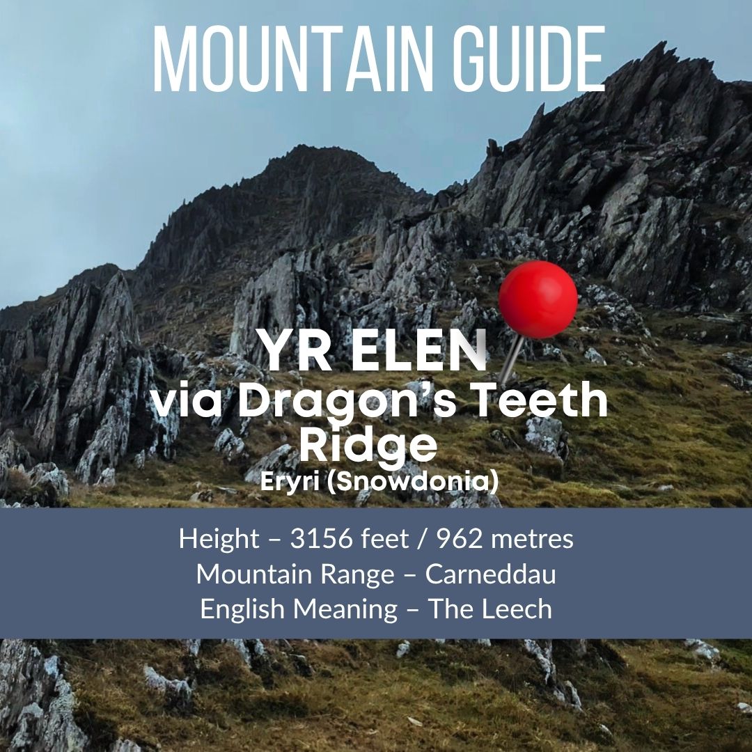
Yr Elen via Cwm Caseg Circular Route Overview
This 12km route up Yr Elen via Cwm Caseg starts in Bethesda with a lovely walk up the valley heading towards the biggest of the Carneddau mountain range. You’ll spot the central summit of Yr Elen immediately as you start walking from Gerlan.
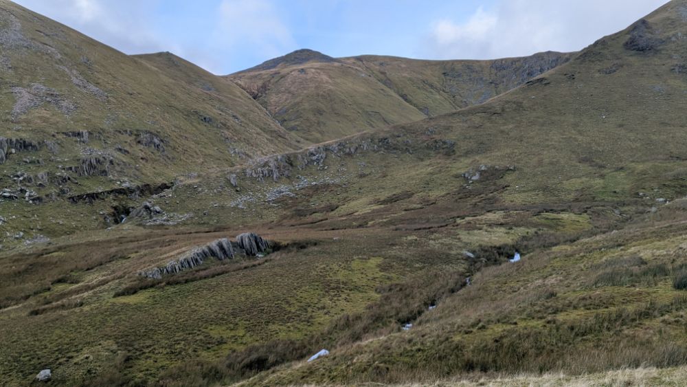
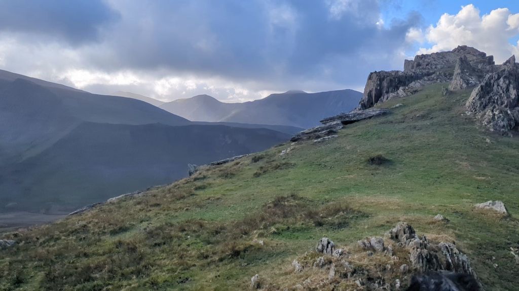
However, once you have walked the length of the valley, the scramble up the truly dramatic North East Ridge begins. This Dragon’s Tooth ridge is tucked right into Cwm Caseg as the route sweeps around the reverse side of Yr Elen.

How High is Yr Elen?
How Long Does the Yr Elen Walk Take?
Is the North Ridge / Dragon’s Teeth Ridge Hard?
Where to Park in Bethesda for the Yr Elen Route?
GPX Route and OS Maps Route
Yr Elen via Cwm Caseg Circular Detailed Route Description
If you’d like to skip straight to the detailed route description and maps – click here
What does Yr Elen mean in English?
Yr Elen is said to mean ‘The Leech’ possibly because of it being attached to Carnedd Llewellyn, alternatively it maybe named after Eleanor de Montfort, who was the wife of Llywelyn ap Gruffudd which also makes sense given it’s location.
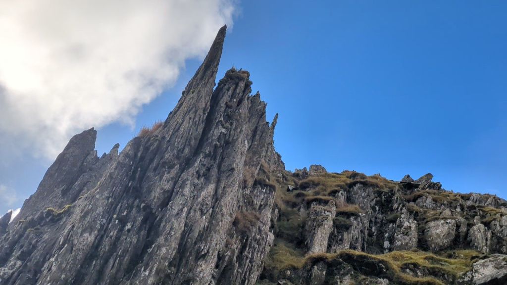

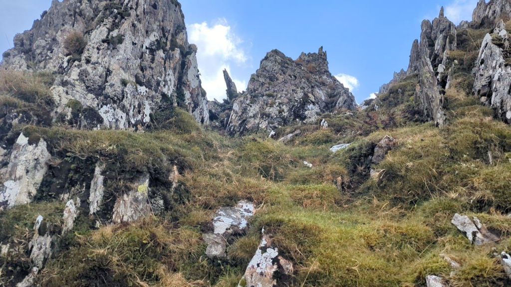
The Dragons Teeth Ridge (aka The North East Ridge of Yr Elen)
I’m not 100% sure where the epithet ‘Dragon’s Teeth Ridge’ first originated but it’s the perfect name for the North East Ridge of Yr Elen with it’s spiky rock formations.

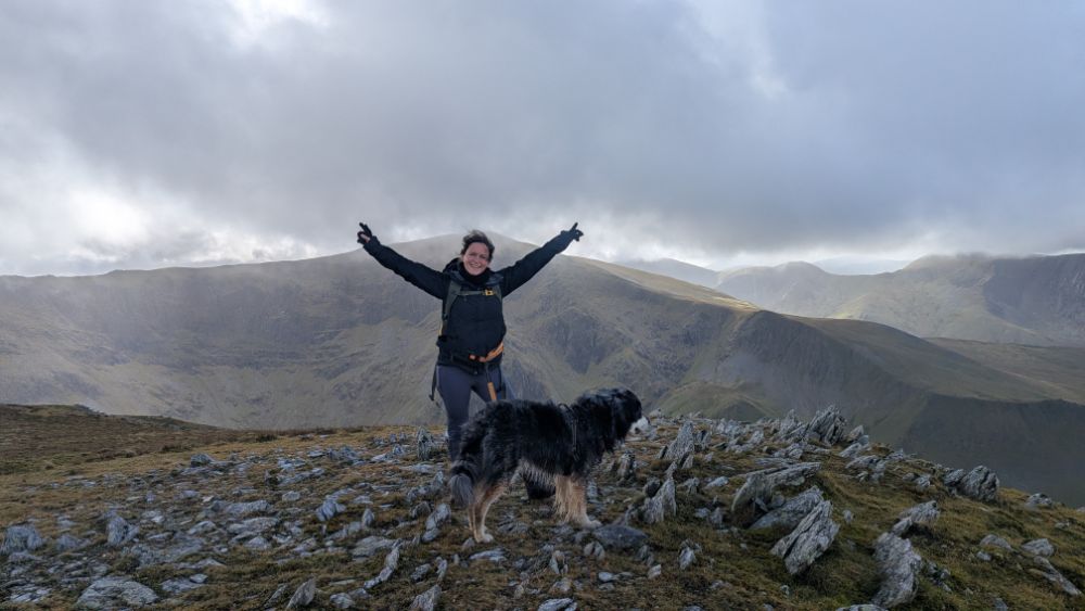
The first mention of the name I have seen is in one of my favourite books on Eryri, the 1951 book ‘Hill Walking in Snowdonia’ the author, E.G. Rowland says he ‘bags’ Yr Elen from Carnedd Llewellyn (along the ridge shown in the photo below), and goes on to say…
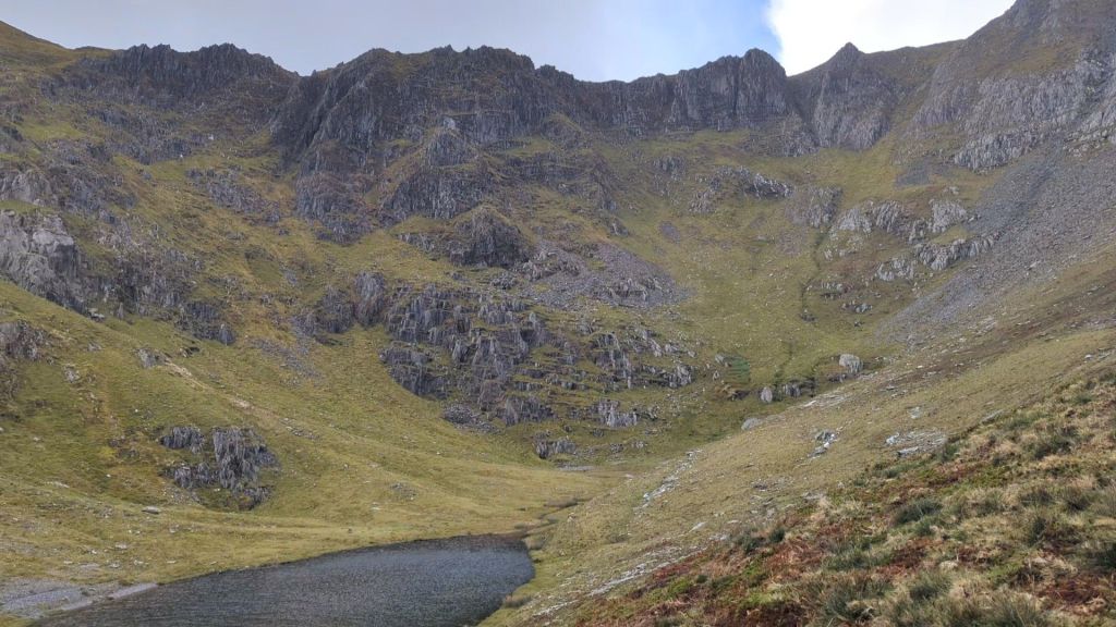
“Near the edge the sharp edge (R) juts out from the grassy slopes (L) like dragon’s teeth. The tiny tarn at the bottom of the cliffs adds to their grimness.”

Is Ffynnon Caseg the Breeding Place of Carneddau Ponies?
It’s so good to understand the meaning of Welsh place names, they usually add more depth to your days spent walking in Eryri. I was delighted when I discovered that Caseg means mare and this valley is full of wild Carneddau ponies, so Afon Caseg is Mare’s River, Cwm Caseg is Mare’s Valley. I did see lots of ponies, but most were at a good distance away.
In his book, Rowland also mentions that the breeding place of the ‘small wild ponies’ is near the tiny tarn under Yr Elen. Ffynnon Caseg means Mare’s Well in welsh. I thought this was particularly special.

How Hard is the North East Ridge of Yr Elen Scramble?
A big chunk of the height of Yr Elen is gained up this spiky section which looks like a scramble, but it’s actually just picking your way up a few steep rock steps and grassy paths.
As long as you have a reasonable head for heights and you’re fairly fit then this route poses no real problems. I would avoid it in high winds and low visability. Whilst there’s nothing technical about the ridge and no exposure it is fairly narrow and parts of it are exceptionally steep.

When I’m planning a walk I do as much homework as I can on the route, I need to be sure it will be safe for both me and Ziggy (my hiking buddy, a Collie-Retriever cross). My goal in writing these guides is simple: to consolidate all the essential information I’d personally want to know, giving you the clarity and confidence to make your own decision about taking the route.
I hope my video guide gives you a close-to-first-person experience of the route up Yr Elen and that summit scramble.
How high is Yr Elen?
Yr Elen is the 9th highest mountain in Wales at 962 metres high (3152 ft). From the start of this route you’re already at 757 ft

How long does it take to walk up Yr Elen from Bethesda?
The route is 12km, the OS Maps calculation says 4 and a half hours, it took me just under 7hrs. However, I had a detour from my planned route as I wanted to see if I could return by crossing Afon Caseg, there’s a green path on the map that crosses it. Annoyingly I missed the path and ended up tracking back to my original route as I couldn’t find a crossing and didn’t want to walk to far back up the river as it was a bog fest.
Ignoring my detour it would be more like 6hrs which I think is the minimum you should allow unless you’re a fell runner or it’s really dry. The going in winter was very boggy and that both zaps energy and slows you down.
Where do you park in Bethesda for the route up Yr Elen?

Park in the small village/community of Gerlan on the outskirts of Bethesda. The closest road to the start of this walk up Yr Elen is Upper Hill St – LL57 3TE. I managed to get a parking spot on this road right next to the start of the footpath. You may need to hunt around, but lots of the streets nearby have free roadside parking. Alternatively use the Pay and Display car park on Bethesda High Street.
Yr Elen OS Map Link

Yr Elen via Cwm Caseg Circular Detailed Route Description
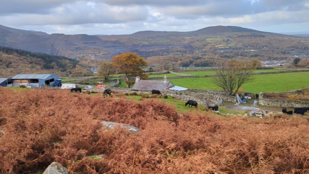
Starting the Walk: Bethesda to Cwm Caseg Valley
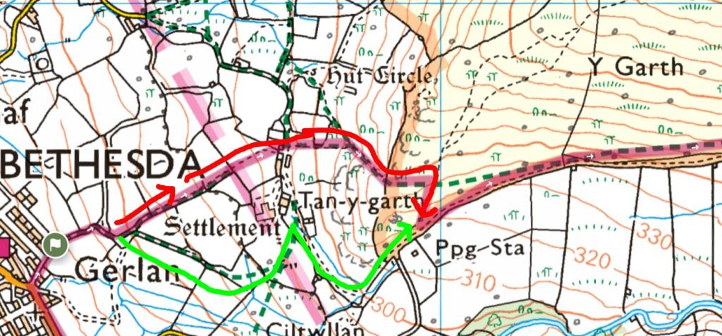
The start of the route takes you up an obvious path which splits and skirts either to the right or the left of the farm called Tan y Garth. I chose the path I have shown in red below which took me through a cow field and up to a stile on a fence line, the height wasn’t really necessary as I had to lose it all going back down to the track. So if I did it again i would choose the green line. (If you were heading on the higher Carneddau Horseshoe route then the red path makes more sense)
Walking the length of the valley
For the next hour or so, you get to enjoy some truly lovely, straightforward walking. It’s a clear wide path used by the farmers on their quad bikes. There are a few gates to go through along the fence line before you go through a lovely big iron gate and cross into completely open access land.

You’ll be staring at Yr Elen trying to work out what the ridge will be like, but remember until you get right around the far side of it you won’t see the North East Ridge.

Nevermind the Dragon’s… Beware of the Bog
I highly recommend this route but I caveat this recommendation – if you are bog phobic then leave this route until a dry summer day. The valley gets very squelchy and because this isn’t a well trodden route even the paths shown on the map tend to take you through very boggy terrain.
The Approach to Cwm Caseg
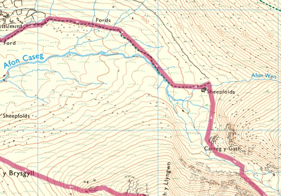
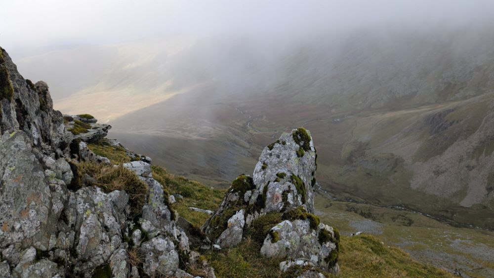
When you’ve nearly reached the end of this valley, you need to start heading right to the river. Your target should be the sheepfolds beneath Foel Grach. I crossed over the Afon Wen at this point, it wasn’t too wide and I made it across without getting my feet wet.

TOP TIP: Walking poles are a great help for steadying yourself on slippy stones when crossing streams.
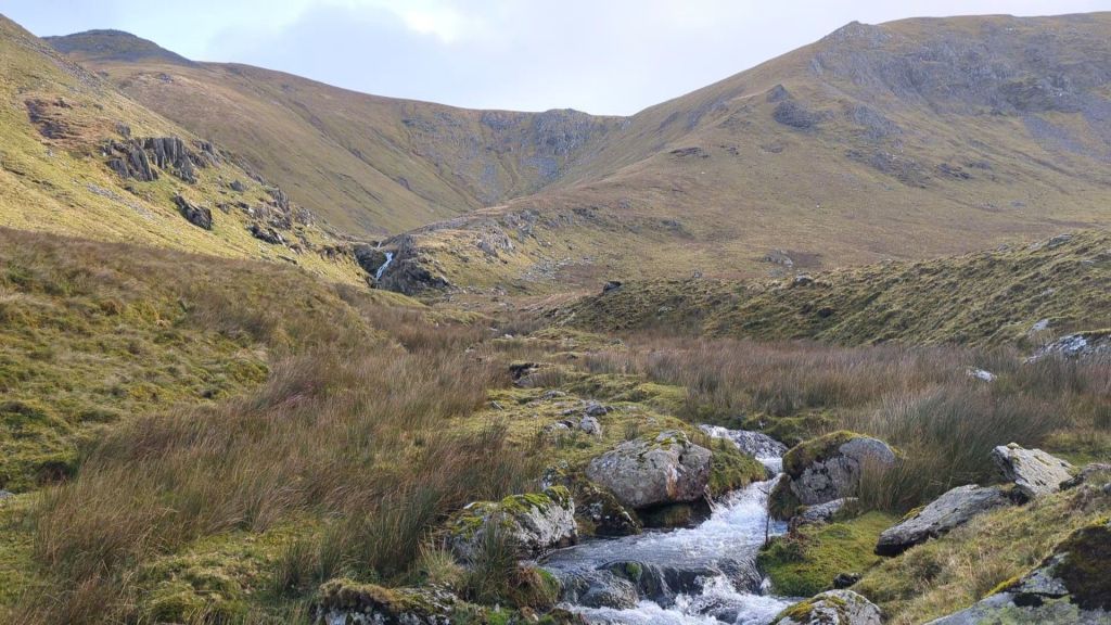
There is a visible path that hugs the side of Carreg y Gath. The valley narrows and Yr Elen is now directly on your right.

Keep walking following this path that’s just visible on the ground, mainly thanks to farmers quad bikes coming in to round up the livestock.
You don’t have to cross the stream at this pont but I did as I wasn’t too sure what lay ahead and I found a good crossing point taking me over to the right side of the lake for summiting Yr Elen.


The ascent up the North Ridge of Yr Elen begins!

I was quite high above the lake and was ready to start up to the Dragon’s Teeth Ridge but Ziggy was desperate for a swim. Unless you’re deperate for a swim yourself (it’s weirdly shallow) I’d maintain the height you have gained and start your ascent up onto the North East Ridge, up to those Dragon’s Teeth.

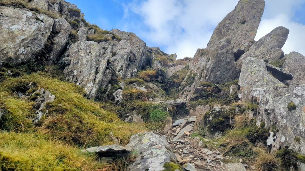
If starting from Ffynnon Caseg, don’t go towards the scree up to the left, instead walk up to the right via grassy slopes, purely because it’s much easier walking. I zigged and zagged as it is a steep climb up from Ffynnon Caseg but it’s not long before you reach the ridge line and the wonderful Dragon’s Teeth are on show ahead of you.
No nerves are needed as really it’s just a walk, but it’s a fun walk full of spiky rocks and it’s incredibly steep. You may need or want to hold onto a few of the rocks as you go, but there isn’t any exposure – just marvellous views.


It isn’t long before you are on the top – if you have good weather the views are amazing and you can also decide if you want to head over to Carnedd llewellyn, the second highest mountain in the Carneddau.

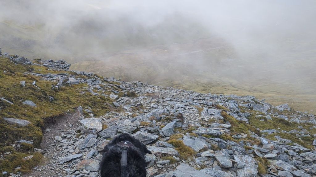
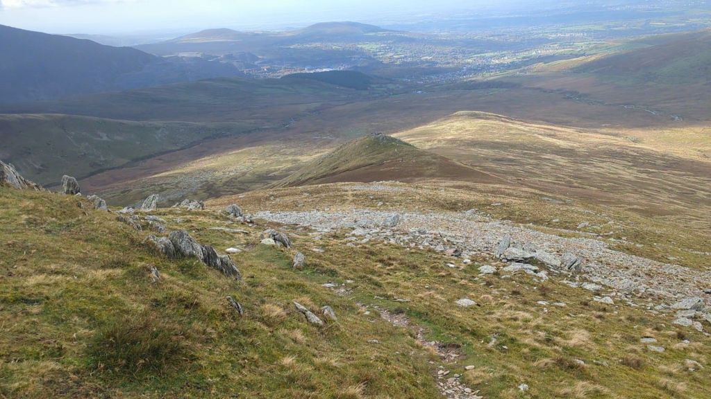
Starting the descent
The path down is a much broader shoulder which you will have been looking at most of the way into the valley. There is a fairly obvious zig zagging path through scree that heads towards Foel Ganol. It’s then a case of just heading back towards Bethesda.


The final section through the farm
Head directly towards Gwaun y Gwiail – look for a gate – here’s a map showing where it is. It looks like there should be a gate further up too but there isn’t! That green path that cuts through this map is the route I thought I’d follow to see if I could cross Afon Caseg – as mentioned earlier i couldn’t find a crossing place so I ended up tracking back along that fence – trying desperately not to be swallowed up into the bog, it was more ‘pond’ in places – I might suggest OS have another symbol for ‘really, REALLY boggy’. Lesson learned, just stick to the route you planned.
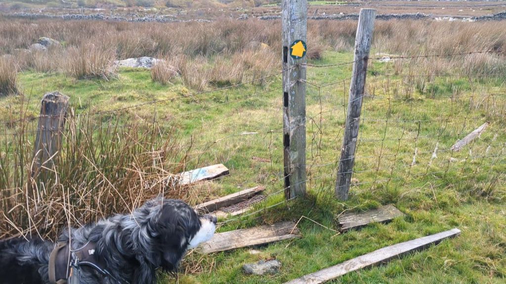
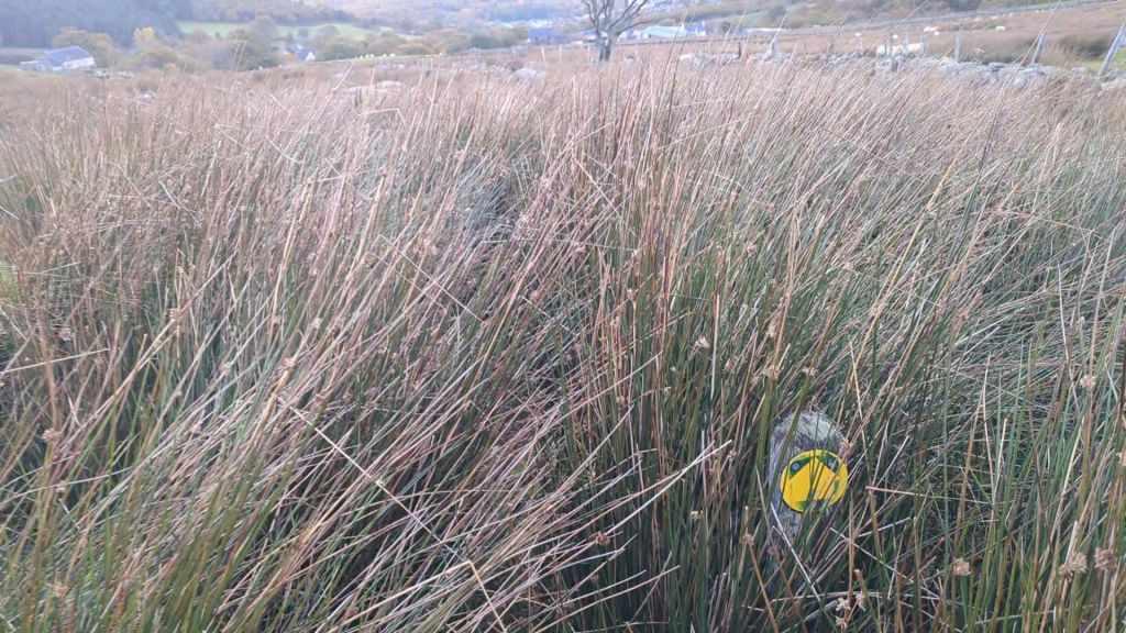
After you get out of the access land (yellow on map) you need to make sure you are following the path. You’ll find a stile in the left hand corner of the next field and then hug the fence. One of the stiles has collapsed, one of the markers should have an associated prize for spotting it and there’s just a bit of general confusion that always seem to come when you’re on quiet paths through farmland. Stay strong and you’ll make it through!

The final part of the walk takes you through a 5 bar gate into a farm yard, then immediately to the left of the farm house and down towards the river.
There was a friendly young chap working in the farm who reassured me I was on the right path as I entered the farm yard with mild trepidation – even though I was 100% positive I was on the green right of way, I still feel nervous walking through farms – and that’s why there aren’t pictures. You’ll then find yourself on a lovely little road back to Gerlan. There’s a bridge crossing the Afon Caseg and some lovely waterfalls to finish the walk off beautifully.
Say Hello and Leave a Comment!
Thanks for reading, I hope you enjoy the route guide and the video, please leave me a comment if you have questions or if you have done this route, let me know how you got on. You can also follow me on Facebook and Instagram if you’d like to keep up with more of my walks, I also send a newsletter occasionally with my new walks, so do sign up for that too.
Leave a Reply