
Click here to jump straight to the best 3 weather resources for planning a walk in the mountains.
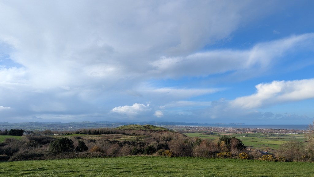
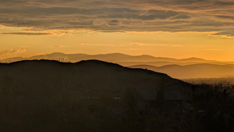
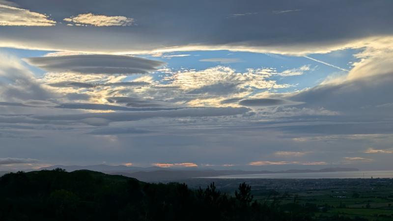
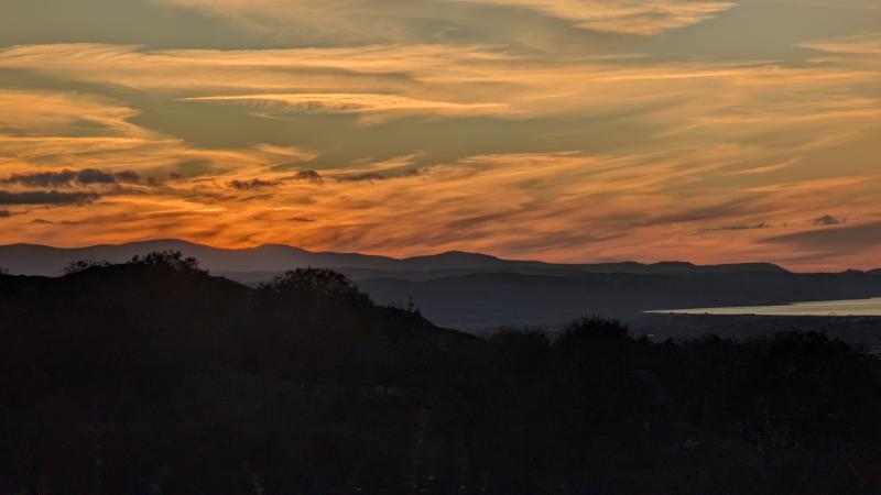
I grew up on a hill in the northern Clwydian Range overlooking the North Wales coast, with the full panorama of Northern Eryri (Snowdonia) and predominantly the Carneddau, laid out before me. On clear days I’ve always been able to pick out Yr Wyddfa on the skyline tucked in behind the first layer of mountains and when it’s really clear you can just make out Tryfan’s spiky summit. It’s an everchanging picture depending on the clouds and the haze.
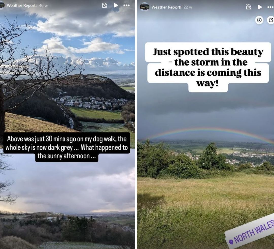
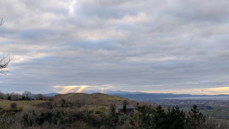
From the kitchen window, we can see storm fronts gathering over the Irish Sea, or watch the cloud base lift and fall across the Carneddau. Quite often it disappears completely. You’ll regularly see the view in my Insta stories… it’s a different picture everyday!
This stunning perspective has taught me a fundamental truth about hiking in Eryri: the weather changes in minutes, and what is happening on the coast or at the foot of the mountain is rarely what is happening on the summits.


You might leave the sunny microclimate of a North Wales coastal town like Prestatyn or Llandudno, thinking the day is set fair. But in Eryri, you’re hiking a maritime climate where the Irish Sea is the engine of the weather.
What is Oragraphic Enhancement? (and why is it responsible for Eryri being so wet!?)
This is the process where prevailing westerly winds continuously carry warm, moisture-laden air inland. When that air hits the mountains, it is forced to rise, cool, and rapidly condense. This significantly enhances the amount and intensity of rain and wind on the mountain slopes of Eryri. As a result, you can often see a storm ‘heading over’ the mountains while the coastal valley remains clear.
While the wettest part of Eryri (Snowdonia) can receive over 180 inches of rain annually, the North Wales coast and the Vale of Clwyd typically receive less than 30 inches (based on met office data). This is because they are in the rain shadow caused by the mountains – no wonder there are so many holidaymakers on the North Wales coast!

The valleys may be dry, but the summits are collecting all the water and wind. Relying on a standard phone app only tells you what the coastal valley is experiencing. Your safety, comfort, and enjoyment, however, depend on knowing the specific wind speed, freezing level, and cloud base on the exposed mountain you are climbing.
Don’t underestimate the wind speeds on Eryri…
The Funnel Effect is what makes the wind speed change so dramatically as you gain height in Eryri (Snowdonia). It’s basically when the huge flow of air, which is already strong, gets rammed into a tight space, squeezed between the mountainsides and the ceiling of the atmosphere way up high.

This is why famous exposed places like the summit of Yr Wyddfa, the skinny ridge of Crib Goch, or those dips between peaks (the bwlchs) get absolutely blasted. This means the wind forecast you read on your BBC weather app might be completely misleading; the speed up high can be multiplied dramatically and can genuinely feel strong enough to knock you clean off a narrow path. Critically, this intensified wind will make the air feel seriously, dangerously cold, the wind chill drops like a stone, putting you at a much higher risk of getting dangerously cold (hypothermia) if you haven’t layered up with proper windproof gear
As someone who has seen this changeable weather my whole life, I rely on a three-pronged system so I can avoid dangerous or unpleasant weather conditions. Here are the three essential resources every North Wales hiker should be using to plan their route.
Beware of Shadows and Ice

One more little tip before we move onto the 3 best weather forecasting resources: think about the route you are walking or scrambling and whether or not it will have had any sun on it. I have made the mistake of thinking I’m in for a gorgeous, blue sky, ice-free, winter scramble only to find that the entire route was in shadow all morning and therefore it was drastically colder than I had expected and a thick layer of overnight ice was still clinging onto every rock.
NB. Using a standard phone app to check the weather before a North Wales hike is the #1 mistake you can make and could end in a miserable or even a down right disastrous trip!
Three essential resources every North Wales hiker should be using to plan their route
1. Mountain Weather Information Service (MWIS)
Use MWIS for your 48-hour outlook for weather in Snowdonia National Park (Eryri). It’s the first source you should check when planning 2-3 days in advance. It does not cover the lower hills in the Clwydian Range.

The Mountain Weather Information Service (MWIS) is an absolute must-use if you’re heading into Eryri, primarily because its forecasts are written by meteorologists specifically for mountaineers. That means real people that will actually care if the wrong information is shared.
It’s funded by Sports Scotland and other sponsorship that enables the Wales and England forecasts. It’s not a computer model output like other apps, it’s real people interpreting the raw data for you. You could learn to interpret this raw data for yourself, but these guys are the experts and it’s their job!
You can follow them on YouTube too – you’ll probably learn alot about the weather.
You’ll need to look for the “Snowdonia National Park (Eryri)“ forecast.
What to Look for on MWIS:
| MWIS Section | Key Point: Meaning & Impact for Planning |
|---|---|
| Viewing Forecast For / Date / Last updated | Check Date/Time: Confirms the forecast is current and relevant to your location and day. |
| Summary for all mountain areas | Broad Context: Gives the overall weather pattern affecting all mountain areas to understand general conditions. |
| Headline for Eryri / Snowdonia National Park | Immediate Risk: Flags the most critical or dangerous weather factor for a swift safety check. |
| How windy? (On the summits) | Speed vs. Safety: Determines if wind speeds are high enough (>35 mph) to make exposed routes dangerous. |
| Effect of the wind on you? | Physical Challenge: Tells you how much the wind will impede walking, balance, and physical comfort. |
| How Wet? | Gear & Flood Risk: Informs waterproof gear selection and warns of potential dangers from swollen streams/flooding. |
| Cloud on the hills? | Navigation Need: Indicates if low cloud will obscure views, making map and compass skills absolutely mandatory. |
| Chance of cloud free summits? | Visibility Probability: Gives a percentage chance of good views versus a navigationally risky whiteout. |
| Sunshine and air clarity? | Visual Quality: Predicts how well you will be able to see landmarks and hazards when not in cloud or rain. |
| How Cold? (at 900m) | Layering & Hypothermia: Crucially provides the Wind Chill factor to determine required protective clothing. |
| Freezing Level | Ice Gear Decision: Indicates the altitude where ice will form, dictating if you must carry and use crampons and an axe. |
| Planning Outlook | Future Trend: Gives the 7-10 day trend to help plan for multi-day trips or walks later in the week. |
2: The Met Office Mountain Forecast

Use the Met Office Mountain Forecast for hour-by-hour specifics. Use this to finalise your plans the day before or the morning of the hike in Eryri.
While MWIS gives you the overall story, the Met Office provides the finely-tuned, location-specific data you need. They now have dedicated mountain forecast pages where you can search for the exact summit, not just the nearest village.
For example: Search “Yr Wyddfa / Snowdon Summit” instead of “Llanberis.” You will see a massive difference in the forecast.
What to Look for on The Met Office:
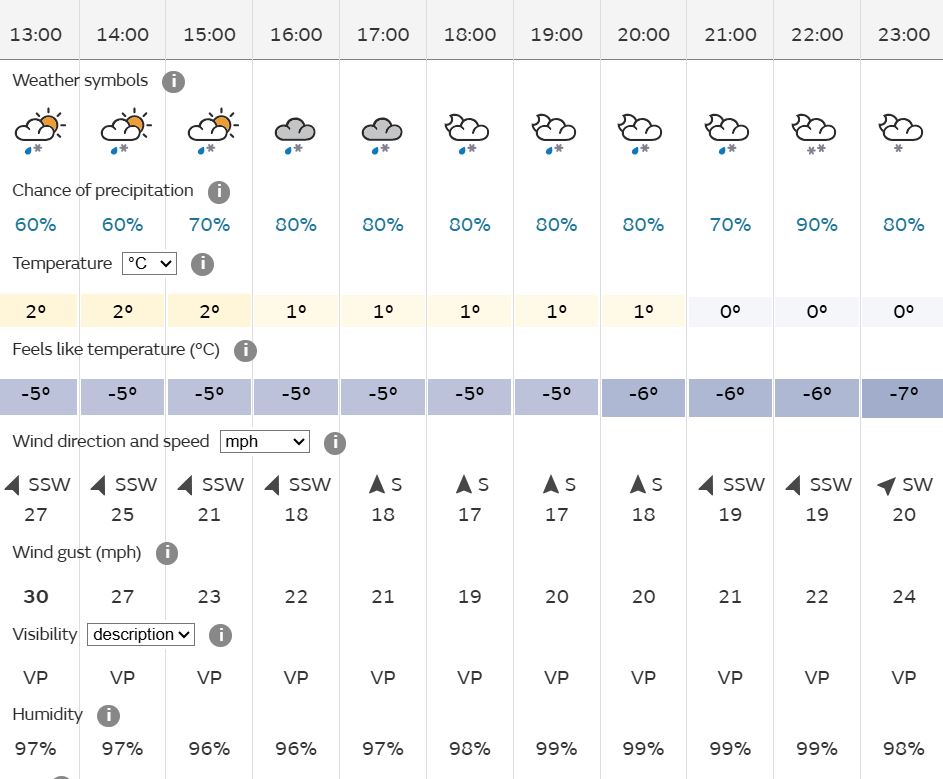
- Summit-Specific Tables: Look at the temperature and wind speed specifically for the mountain’s summit. You will often see the Feels Like temperature is dramatically lower than the air temperature due to wind chill.
- Precipitation (Hour-by-Hour): The detailed tables allow you to time your hike around the worst of the rain or snow.
- The Wind Gusts: The Met Office is excellent for predicting peak wind gusts. Gusts over 40 mph make walking strenuous; over 60 mph they can become dangerous on exposed ridges.
3. The Visual Check: Windy.com and Webcams
Use these for your visual confirmation of wind direction, cloud cover, and current ground conditions.
No matter how good a forecast is, seeing the conditions with your own eyes can help you make that final decision about the route. You might need a plan B (or C!)
Windy.com (Wind Flow)
This free online tool is arguably the best way to visualise the wind. It uses a colour-coded map to show the flow, speed, and direction of wind across the entire North Wales coastline and mountains.
- Why it’s essential: Wind is a critical navigational factor. If you know the wind is coming from the west, you can plan your route to use the eastern side of a ridge or mountain for shelter (the ‘lee side’) for part of your walk.

Snowdonia Webcams (Cloud Cover)
Use live webcams to get a real-time view of what the mountains actually look like right now. You can actually find link to the nearest webcams on windy.com
- What they show you: The absolute best way to check the cloud base and ground condition. If the forecast said cloudbase at 800m and the webcam is showing heavy cloud at a lower level, you know the conditions are deteriorating faster than predicted.
- Where to find them: A quick search for “Snowdonia Webcams” will usually bring up a few or here’s a few I’ve found.
List of sites with active Eryri Webcams:
MWIS Webcams in Eryri
Eryri Webcams
Snowdonia Webcams
Snowdon Webcam
Your Three-Step Mountain Weather Checklist
Use this process every time you plan a walk in the mountains, you’re so much more likely to have a fun time if you know what to expect. The mountains aren’t going anywhere and there are plenty of beautiful places to visit in where the weather may be better thanks to that North Wales coastal rain shadow.
| Timeframe | Action | Resource | What you are checking for |
| 3-5 Days Before | Regional Outlook | MWIS | Overall impact, wind effect, general cloud base. |
| The Day Before | Specific Detail | Met Office Mountain Forecast | Hour-by-hour precipitation, summit wind gusts, Feels Like temperature. |
| Hike Morning | Visual Check | Windy.com & Webcams | Real-time wind direction and actual cloud base/ground conditions. |
Is the Mountain Forecast App Reliable?
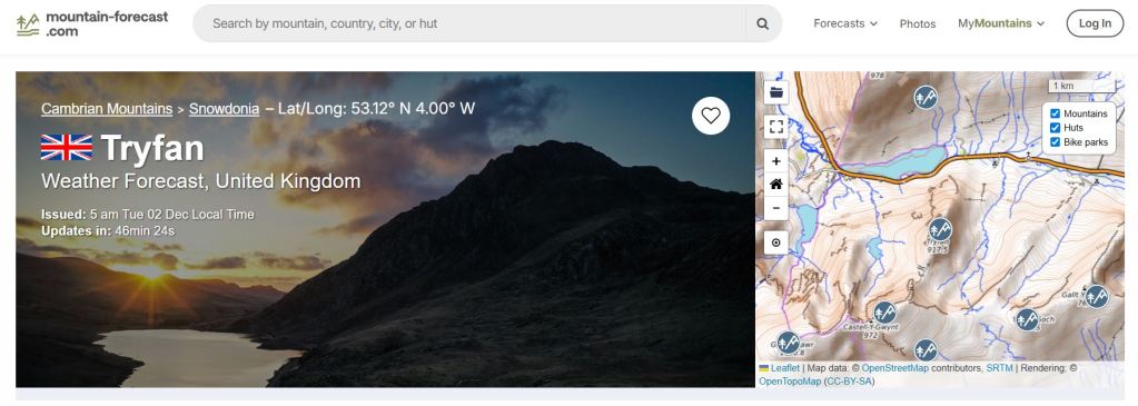
In addition to my three top tips I thought I’d just mention Mountain Forecast. It’s a freemium app that gives information about mountains from all over the world, including all of Eryri and the bigger mountains in the Clwydian Range. You can pay to get more advanced hour by hour information.
It is designed for hikers and mountaineers and comes from the technically advanced Meteo 365 brand, so it gives all of the information you need like cloud base, wind speed and rain etc as we’ve explored in the above methods. It looks great and it’s really easy to use… however…
The more time I spend in the mountains the more I realise it can be way off, especially with cloud base predictions which I find most vital as I hate claggy summits – I want to see the views! The Mountain Forecast App uses an AI learning model, so my hunch is that it can only get better. I still keep the app on my phone and I always use it in addition to the above methods – often to see if it’s right or not compared to the Met Office. I stopped paying for the premium service last year.
Remember – none of them get it right every time, so always prepare for the worst case scenario if you do decide to head out into the mountains. They can be extremely dangerous, i always err on the side of caution and just go somewhere else if the mountains are looking potentially miserable – I don’t enjoy horizontal rain and zero views!
When is the ‘Best’ Time to Visit Eryri for Great Weather?
Since the weather is always unpredictable, it helps to understand the odds. While Wales is known for its green hills (thanks to plenty of rain!), there are definitely periods that offer a better chance of comfortable, clear conditions and long daylight hours.
The Best Months to visit Eryri: Late Spring to Early Autumn (May, June, September)
- June (The Statistical Best): Statistically, June is often the driest month in Snowdonia and offers exceptionally long daylight hours. You have the best chance of clear summits and comfortable temperatures without the intense heat or peak school holiday crowds.
- May: Days are long, temperatures are mild, and you miss the main summer tourist crush. It’s perfect for tackling longer routes like the Carneddau or Glyders while enjoying the spring colours.
- September: The summer crowds thin out significantly, but the weather can often remain surprisingly warm and settled. The autumn colours begin to appear, offering some of the most dramatic mountain scenery of the year.
No matter the time of year you choose, your safety is determined by the forecast you check on the day.
I hope you found this post useful, do take a look at some of my Eryri Walking Guides
Leave a Reply