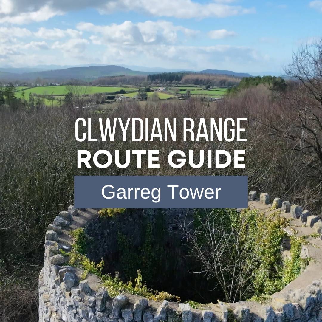
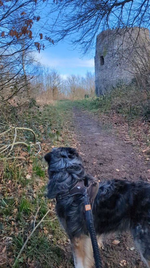
Garreg Tower has an interesting backstory, including a Victorian-era interpretation of it being a Roman Pharos, a word meaning lighthouse. On this walk you’ll also get to visit Maen Achwyfan, a 10th Century wheelstone. So much history in one short walk under an hour!
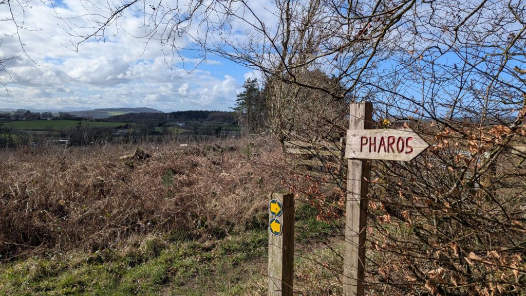
Apparently it’s not a pharos – it’s actually more likely to be a 17th century watch tower and part of a bigger chain of towers all along the North Wales Coast. If you like walks that make you start googling to find out more I think this is perfect. I’ve plotted a 1hr circular route which goes past it and through some pretty woodland which will be full of bluebells in spring.
How long does it take to walk up to Garreg Tower?
Less than 30 minutes if you just want to get to the tower, but I’ve mapped out a lovely circular route up to Garreg Tower you can try which is linked below and that takes around an hour – a lovely short walk with a bit of history.
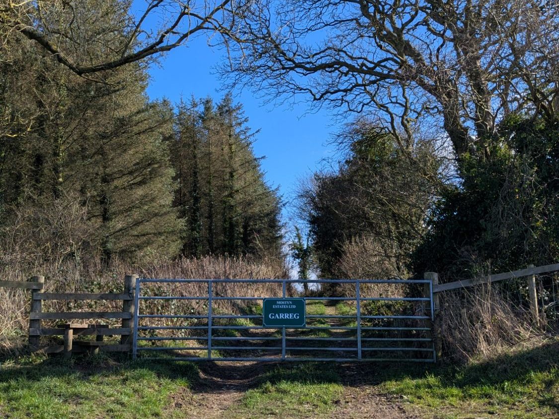
Where to park to walk up to Garreg Tower
There is room for a few cars around the junction near Maen Achwyfan and also room for a car at the entrance to the Garreg Woods owned by Mostyn Estates. Just use common sense and don’t block any gates.
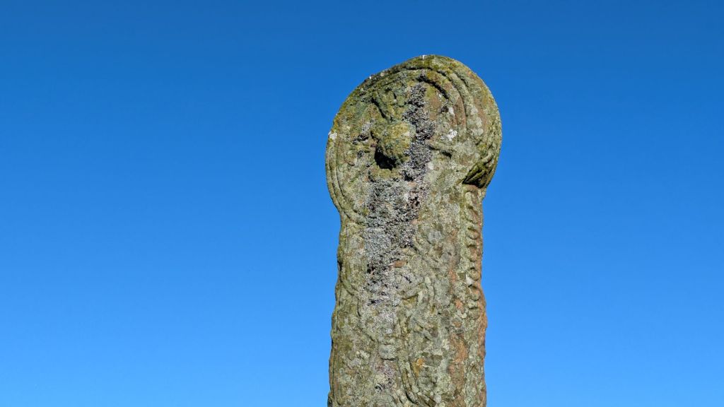
Maen Achwyfan is one of the largest complete carved crosses of its kind in Wales, standing around 3 metres tall and dating back to the 10th century. Its scale and intricate interlacing designs make it stand out, it still sits exactly where it was originally placed which is quite unusual for these crosses. Be sure to visit it before or after the walk up to Garreg Tower.
Garreg Tower Circular Walk – OS Maps

The History of Garreg Tower, Whitford
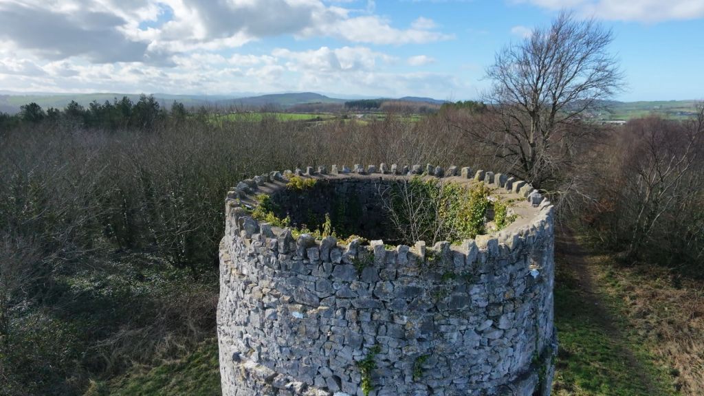
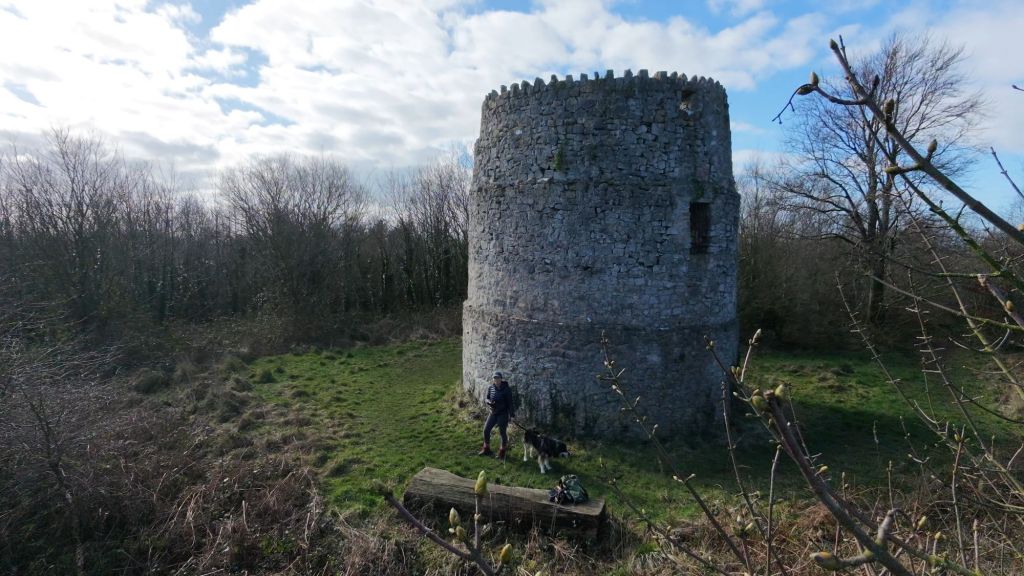
Garreg Tower stands on the highest point in the parish of Whitford in Flintshire, overlooking the Dee Estuary and surrounding farmland.
For a long time it was described locally as a Roman pharos or lighthouse. That interpretation was popular in the 18th and 19th centuries, largely because of its position and solid stone form. It even appeared that way on some early descriptions and estate references.
However, modern research suggests it is far more likely to date from the early 17th century. The tower is generally understood to have been built by the Mostyn family as a watchtower or beacon rather than anything Roman.
Old estate maps add an interesting twist. A map from the early 1700s labels the structure as a windmill, and later charts refer to it as a maritime beacon. That tells us the building may have shifted purpose over time, or at least been interpreted differently depending on who was recording it.
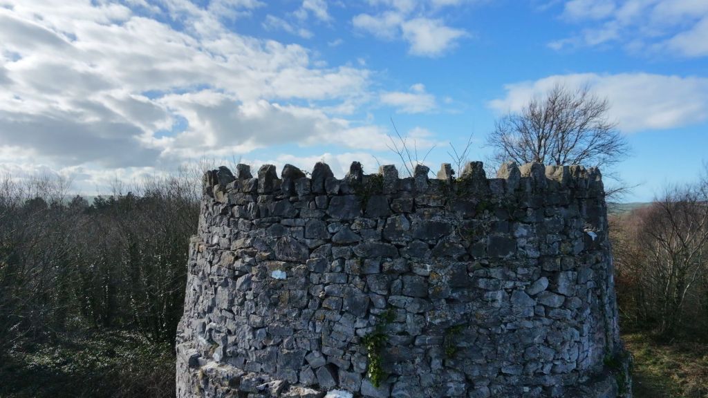
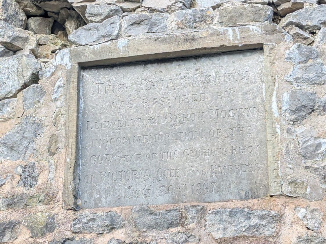
In 1897, the tower was restored by Baron Mostyn to mark Queen Victoria’s Diamond Jubilee. The Victorian restoration included an inscription that still references it as a “Roman pharos,” reflecting the thinking of the time, even though we now know there’s no archaeological evidence to support Roman origins.
Garreg Tower is often thought to have formed part of a wider coastal warning network along the North Wales shoreline. During the 16th and 17th centuries, the threat of piracy and foreign invasion, particularly from Spain and later privateers operating in the Irish Sea, led to the use of elevated lookout points and beacon sites.

From prominent headlands, signals could be passed inland or along the coast if suspicious ships were sighted. Towers or beacon sites at places such as Abergele and Deganwy suggest that this stretch of coast was strategically observed. Garreg Tower’s commanding position above the Dee Estuary fits well with the idea that it once played a role in this early warning system. I think this sounds like a legitimate reason for Garreg Tower to exist.
Today, the tower is listed and preserved as an important local landmark. It’s not open inside anymore. I have vague memories of going inside when I was a child, my mother thinks she remembers some steps around the side to get up the top (that would be 1947 +) . I’d love to know if you have any info on Garreg Tower or the other towers it’s connected to along the North Wales coast.
Find out more about Garreg Tower
- Mostyn Estate information on the tower and its 17th-century origins
https://www.mostynestates.co.uk/the-north-wales-coast-watchtowers-17th-century/ - Historical interpretation and discussion of the “Roman pharos” theory
https://www.mythslegendsodditiesnorth-east-wales.co.uk/pharos
Do you love history? You can find more walks with Welsh History here – Historical Walks in North Wales

Leave a Reply