
Moel Dywyll is a 1558ft high hill in the Clywdian Range, it means Dark or Black hill in Welsh. It’s north of Ruthin and East of Denbigh, a very beautiful part of North Wales that is well worth visiting with some excellent peaks to walk.
Moel Dywyll is the 3rd highest peak in the Clwydian Range and it’s a lovely walk, in this post I’ll explain where to park and share a few maps and pictures that should help with planning your walk.

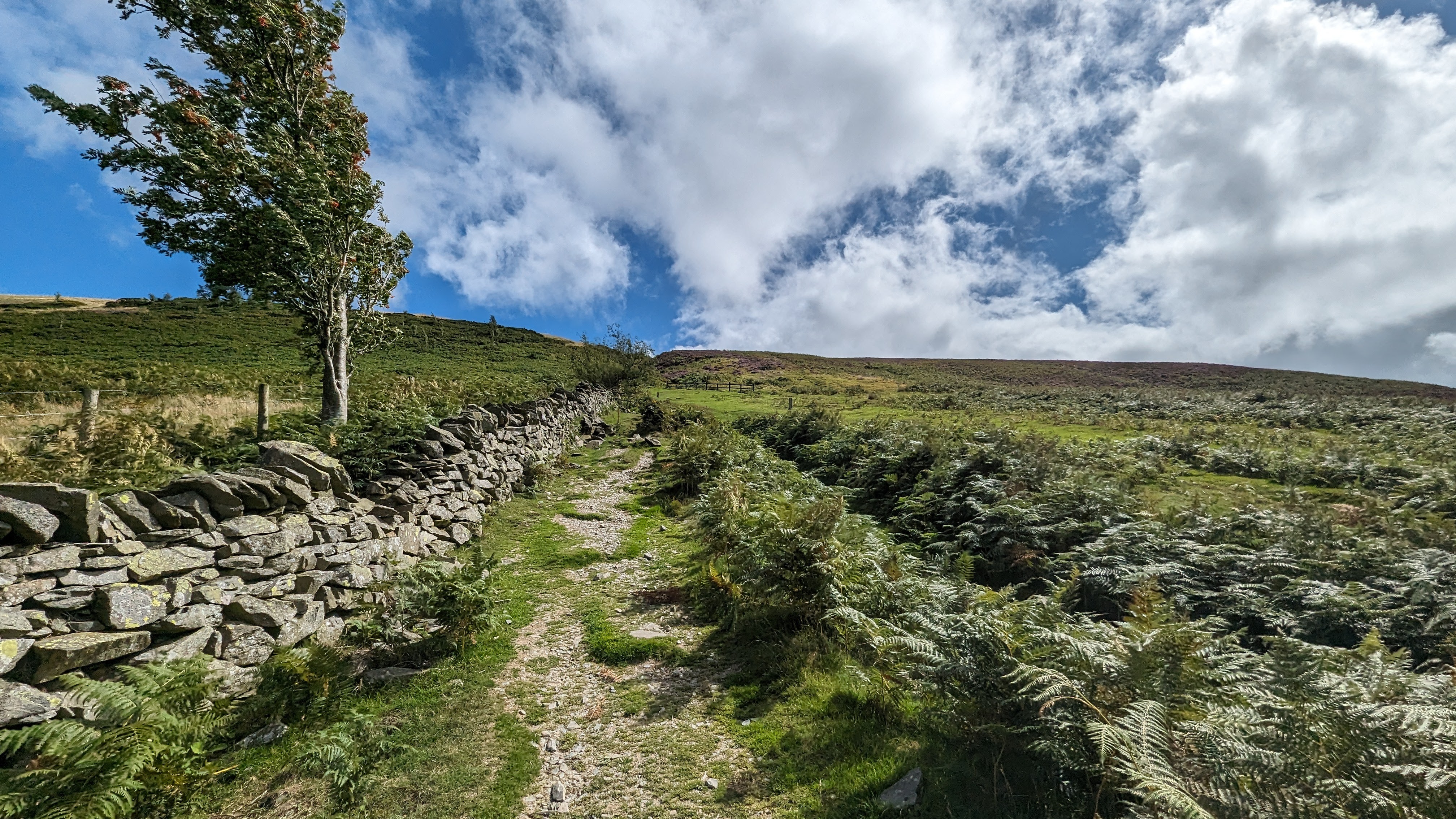
The only part of this walk that is tough is the very first climb up, but it’s short and you just need to take it at your own pace.
Where do you park to walk up Moel Dywyll and do you have to pay?

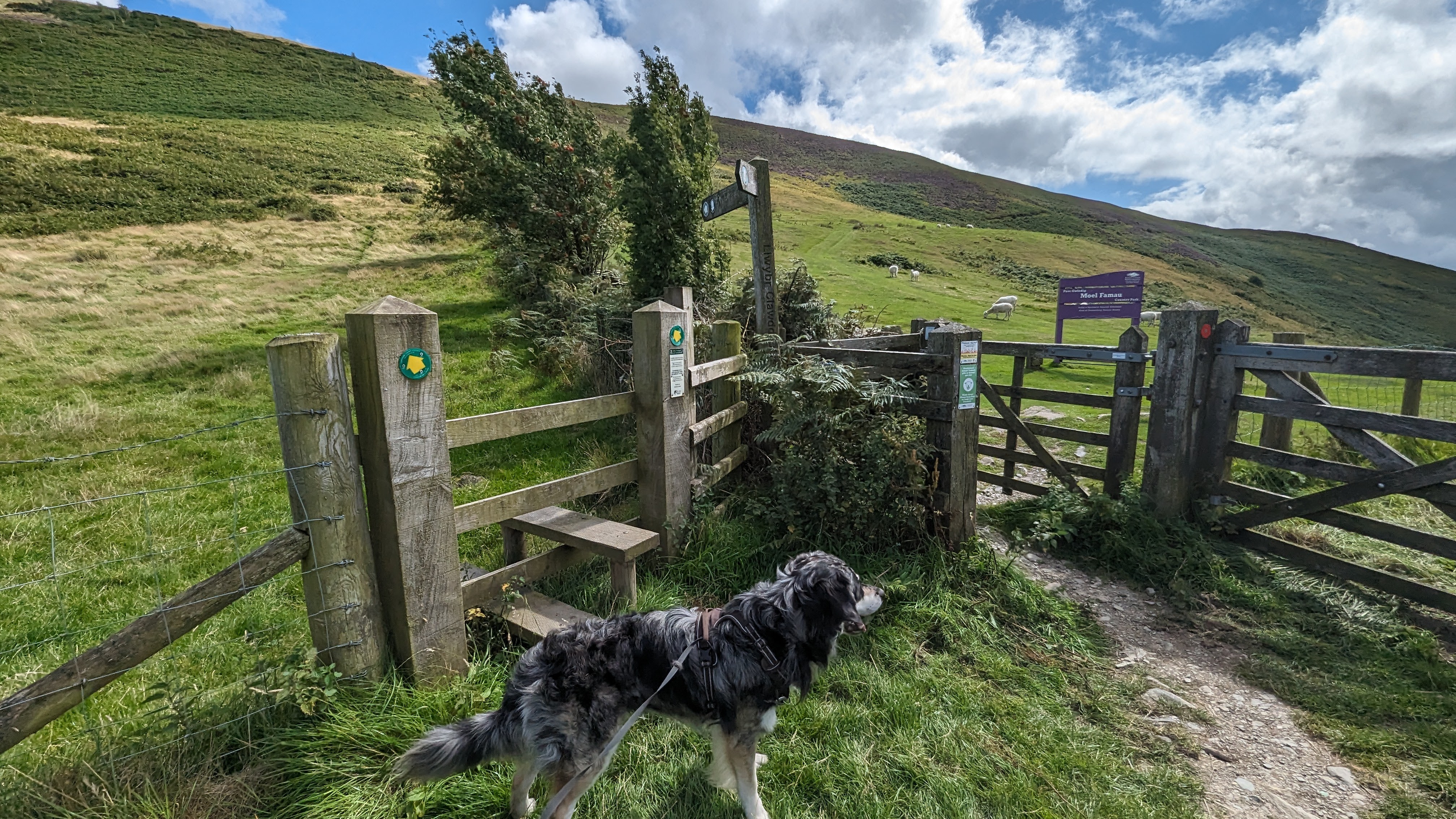
In this post, I will take you on a (non-circular) walk to Moel Dywyll starting from the conveniently located Car park on the B5429. This Car park is the same one used for the quick route up Moel Arthur. Alternatively, you can access this section of the Clwydian Range from the Moel Famau car park further South, although keep in mind that parking fees apply there! The car park at the base of Moel Arthur is entirely free and can comfortably accommodate up to 12 cars ( a guess!).
How long does it take to walk up Moel Dywyll
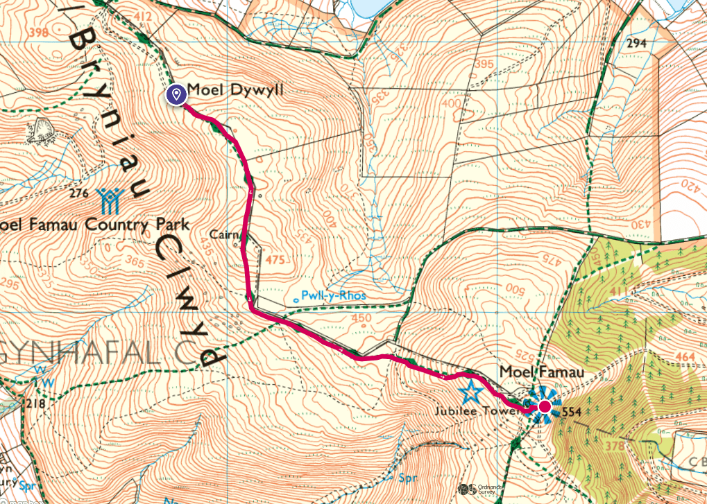
The walk from the car park to Moel Dywyll takes around 2hrs there and back, that’s at a fairly leaisurly pace. The first section is steep as you can see on the map contours from the car park, after that it undulates fairly gently.
We didn’t have time to go all the way to Moel Famau on this occassion, if you’re in a similar situation and debating whether to press on further just remember that you would have slightly more height to gain as Moel Famau is the highest peak in the Clywydian Range. You can see the summit of Moel Famau almost the entire length of this walk.

Can you do a Circular Walk up Moel Dywyll?
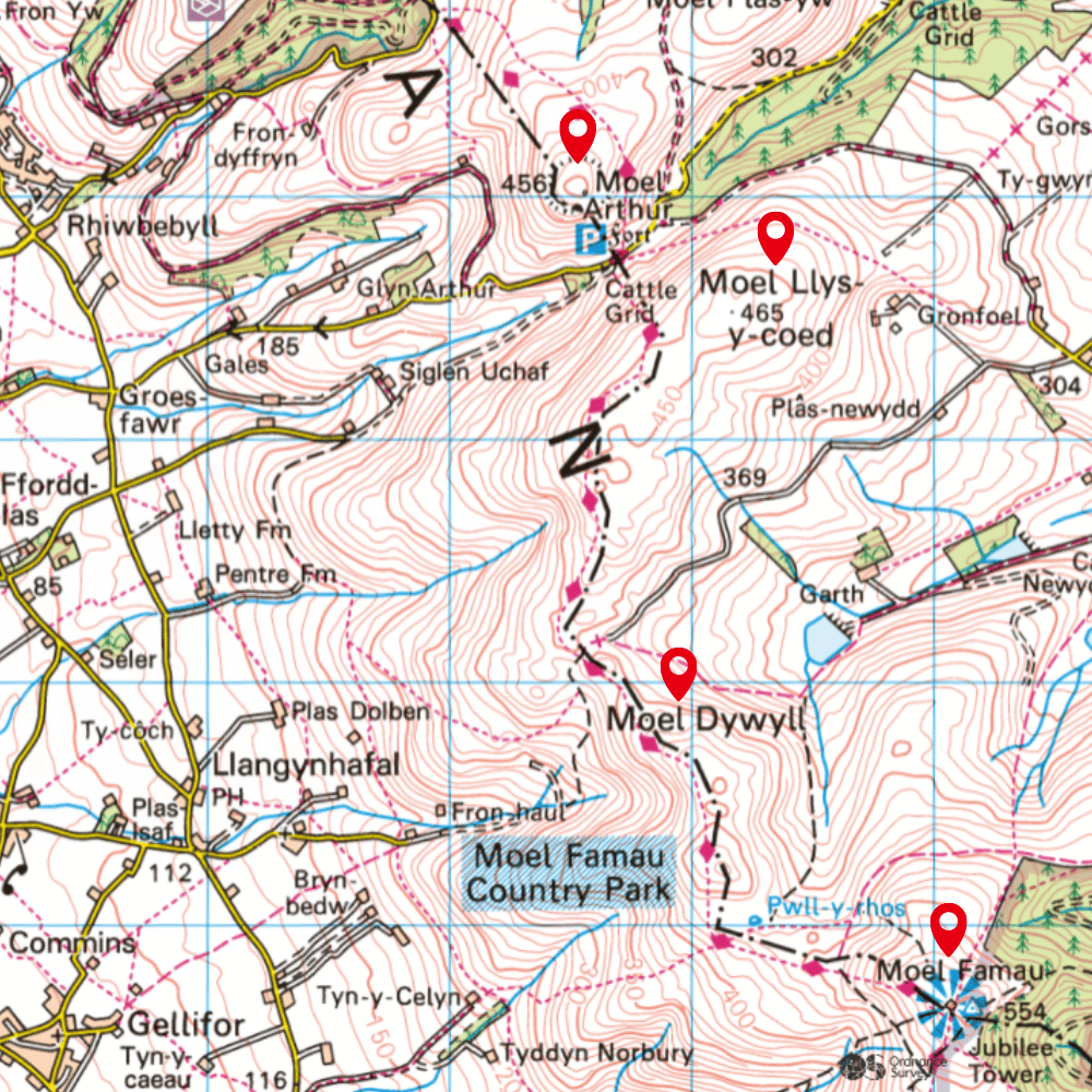
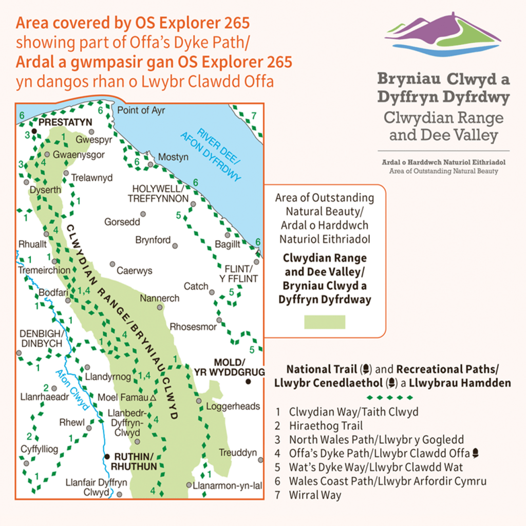
I am yet to walk a circular route up to Moel Dywyll from this parking spot. On my OS map it looks like there are a few options. This is the map I am using (both on and offline)
I wouldn’t want to suggest any circular routes until I have tried them myself in case they are not useable paths anymore (I have experienced this many times – it’s very frustrating!).


You can see Moel Famau’s Jubilee Tower behind me. There is a Cairn marking the top of Moel Dywyll, you need to come slightly off the main path to the left and climb over a fence to get to it but they have added a wooden section so you are not clambering over barbed wire!

We walked the same route there and back and found it an equally beautiful (albeit very windy) walk in both directions!

Is Moel Dywyll a worthwhile walk?

Yes, it’s a great length at 2hrs (there and back from the Moel Arthur Car Park) and it’s very easy! The path is wide and obvious (you can see it down below, we veered off to get to the summit cairn). The views from this hillside walk are breathtaking, with sweeping views of the surrounding hills and distant mountain ranges on a clear day. I think it is one of those walks that would be nice to return to in different seasons, especially when there’s a little snow on the ground, although you might want a 4×4 to get to the car park as the approach road is narrow, steep in places and high up.
Leave a Reply