
The Marchlyn Loop – One of the best walks in Eryri!
Elidir Fawr (aka Electric Mountain), Elidir Fach, Mynydd Perfedd and Carnedd y Filiast make up the Marchlyn Mawr Loop or Marchlyn Horseshoe, this lovely circular walk is great in either direction with the most amazing views right in the heart of Eryri Snowdonia. There are usually no issues with finding a parking space and in my experience you will often have these hills to yourself. Many of the walkers you will meet at the top of Elidir Fawr will have come from the more popular Ogwen Valley side.
At the time of writing I have walked this route 5 times, on 4 I have had spectacular weather and the other I could hardly see my hand in front of my face due to the clag and had to use my navigation skills (If you’re a bit rusty on map reading and using a compass I would thoroughly recommend Max Adventures Navigation Courses, Marty is ex-army and a member of Ogwen Valley Search & Rescue and knows his stuff! – Navigation Courses in Snowdonia, North Wales )
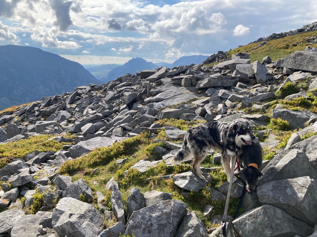
The photos of the Marchlyn Loop included are from all 5 of the walks, so hopefully I will capture the unbelievable beauty of this route, you do need to see it for yourself though!
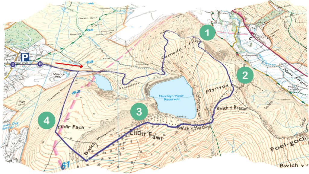
Marchlyn Loop Route Map
Get the route on OS Maps – Marchlyn Loop OS Map Route .

Marchlyn Loop OS Route
I have created an OS Route which you can find here – Walk / Hike: Marchlyn Loop – Carnedd y Filiast, Mynydd Perfedd, Elidir Fawr, Elidir Fach Marchlyn Loop OS Map Route .
In my opinion the route is not difficult as there are clear paths all of the way except for the descent which could be more challenging in low visibility (when doing it clockwise). I wouldn’t bother doing this route if you don’t have a chance of getting the views, that’s generally my opinion of most walks up mountains – I need the reward of those magnificent views!
Where to Park for the Marchlyn Mawr Loop

I set my sat nav to head to Tal Y Waen, Deiniolen, Caernarfon LL55 3NA. If you use Marchlyn Mawr as a setting it may add another 20 minutes as it thinks you’re going all the way to the resevoir.
Unfortunately there’s a gate which means you have to park and walk around 1.2 miles up the road to start.
How long does it take to walk the Marchlyn Circular?
It takes me around 4hrs walking at average adult speed, I’m fairly fit so be sure to give yourself plenty of time and check light levels, you never know what might slow you down so leave plenty of time.
Marchlyn Mawr Loop Weather

Just because it’s summer doesn’t mean you’ll get the views! You can find the up to date weather forecast for Elidir Fawr which is the highest peak at the Mountain Forecast website. This forecast gives you the weather at the elevation of the mountain and is usually pretty accurate in my experience. Rather than just looking at what the weather in Deiniolen (the village at the bottom) Click here for a more accurate Marchlyn Mawr Weather forecast – Elidir Fawr Weather Forecast
Starting the Route, Clockwise
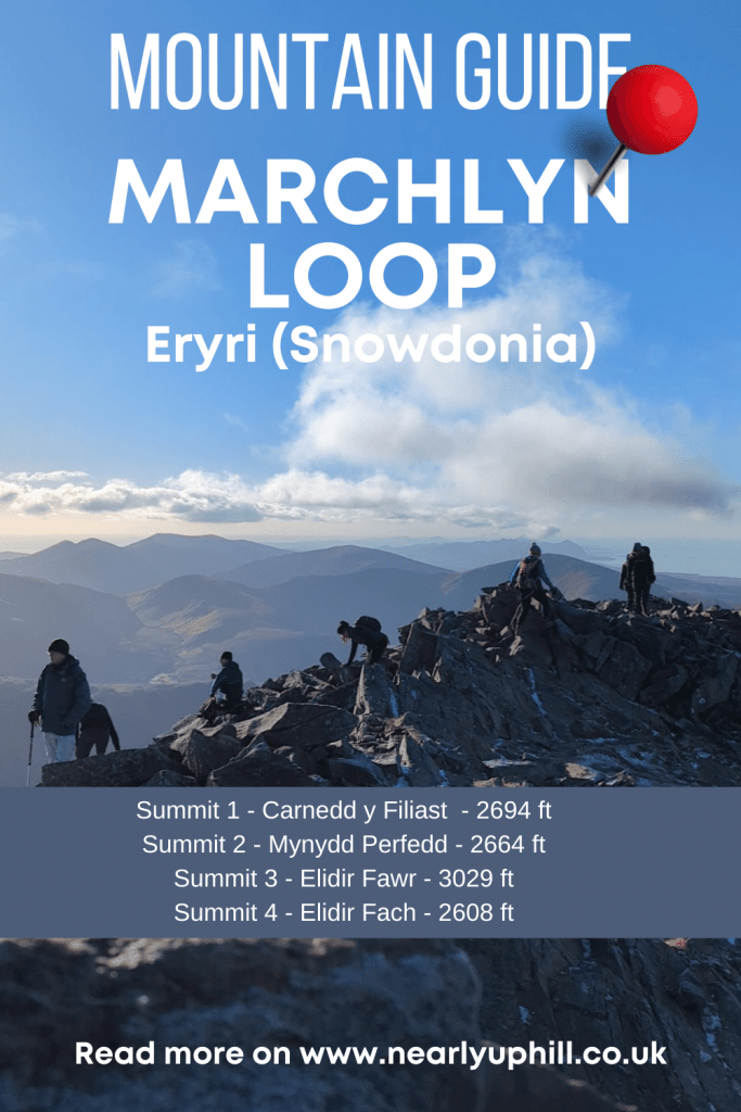
Summit 1 – Carnedd y Filiast
Summit 2 – Mynydd Perfedd
Summit 3 – Elidir Fawr
Summit 4 – Elidir Fach
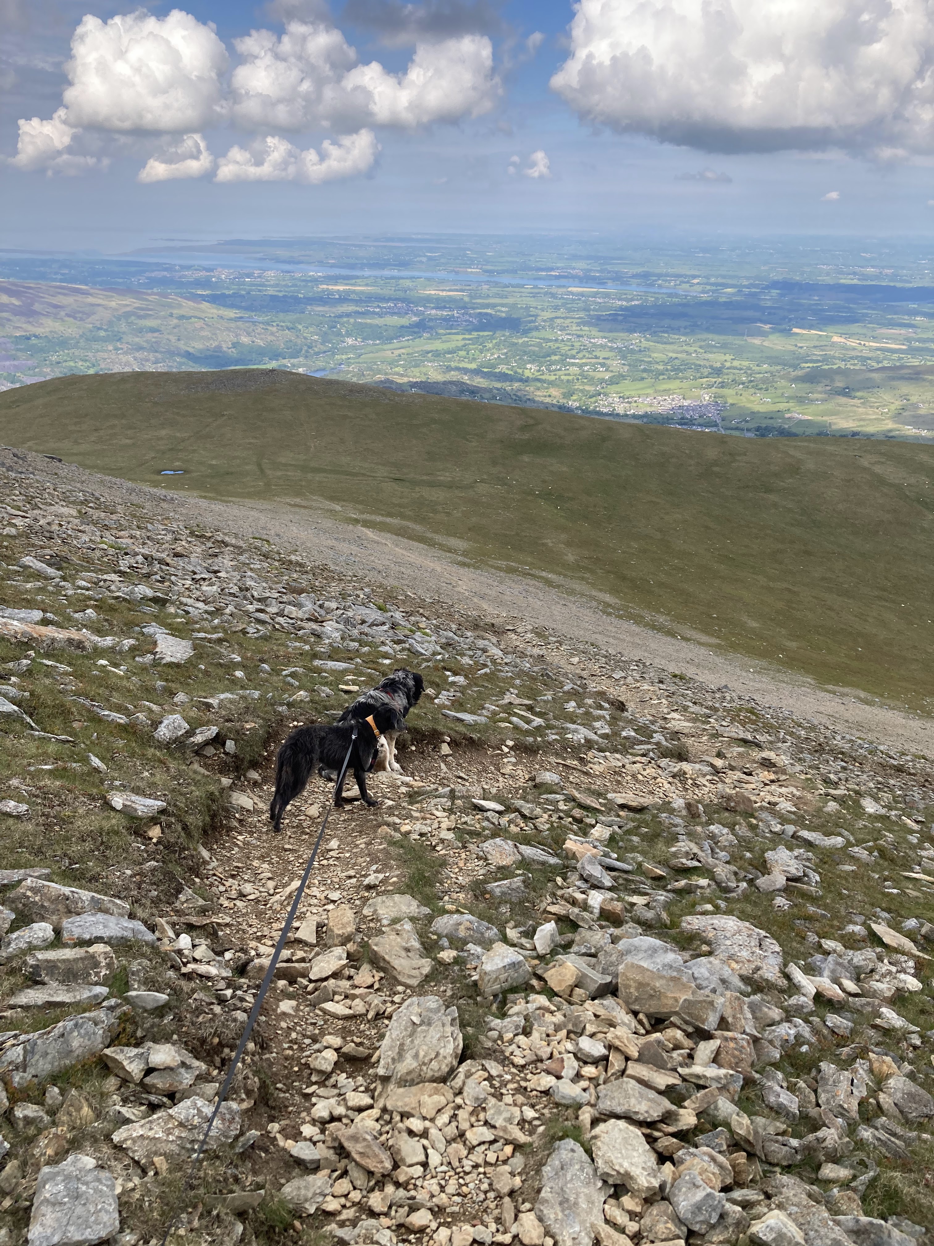
There is a fairly lengthy amount of road up to the resevoir to cover before you get to the start of the footpath. In this post I will share the route going clockwise, starting with Carnedd y Filiast and ending with Elidir Fach. There is a style on the left hand side after around 10 to 15 minutes of walking which says Carnedd y Filiast. This is a short cut, if it’s particularly muddy you can remain on the road, it wont take much longer to get to the first style which marks the start of the climb up Carnedd y Filiast.

Carnedd y Filiast – Summit 1 of the Marchlyn Loop
Carnedd y Filiast
Height – 2694 feet / 821 metres
Mountain Range – Carneddau
English Meaning – Cairn of the Greyhound Bitch (I can’t find a direct translation but I found this on UK Climbing)

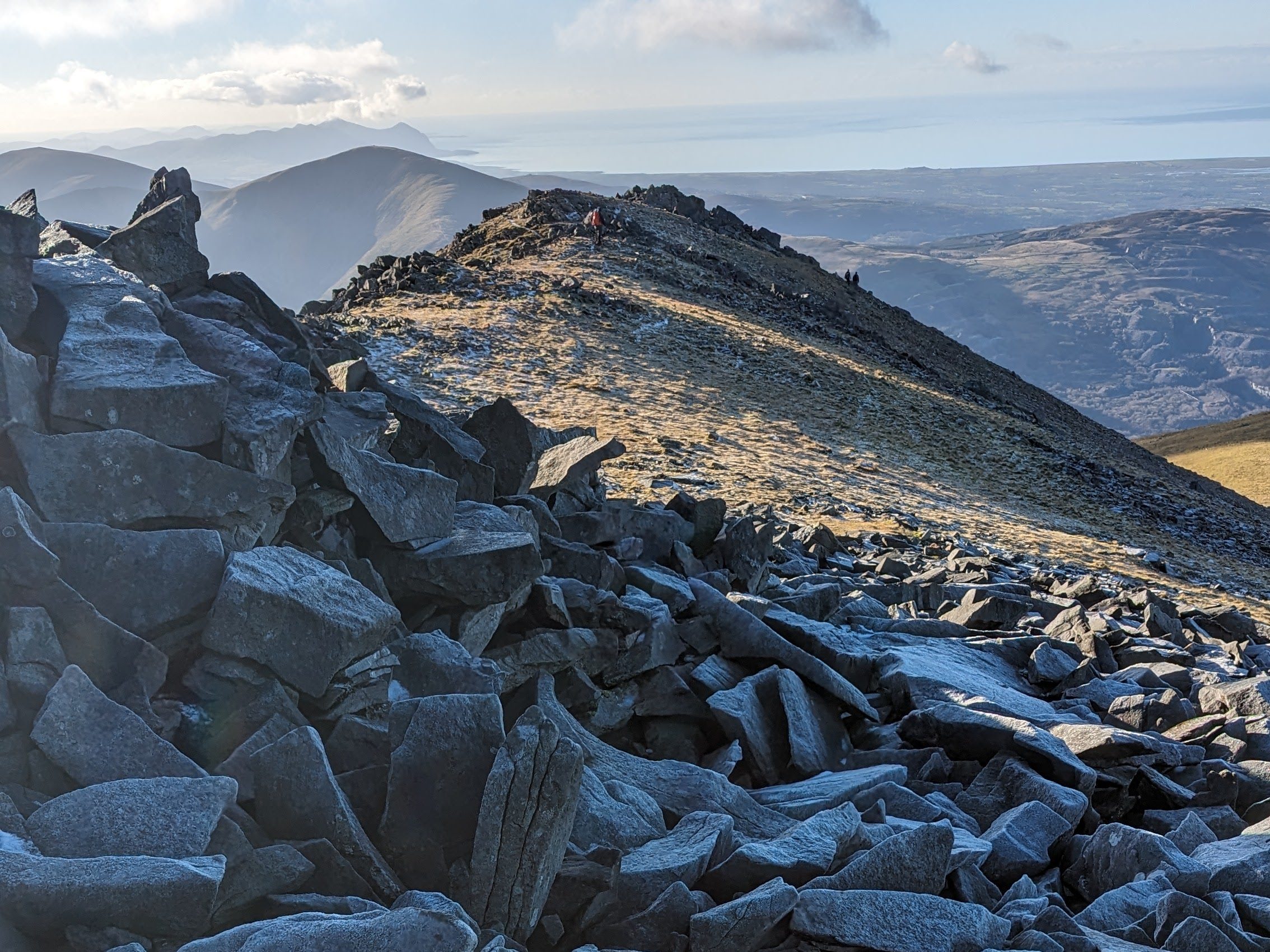
As you gain height you can see your target, Carnedd y Filiast to the right hand side. On the map it shows a smaller summit with a cairn to the left, you can include this if you have time, but I usually just head straight to the summit of Carnedd y Filiast.
You will reach a col / plateau and get a glimpse of some amazing views ahead before heading up towards the summit on a (thankfully) zig zag path.

Once you get to the top the summit will be to your right, you can either scramble over some rocks to get up to it or walk around the left hand side and turn back to view the shelter at the summit.
Mynydd Perfedd – Summit 2 of the Marchlyn Loop
Mynydd Perfedd
Height – 2664 feet / 812 metres
Mountain Range – Glyderau
English Meaning – Middle Mountain
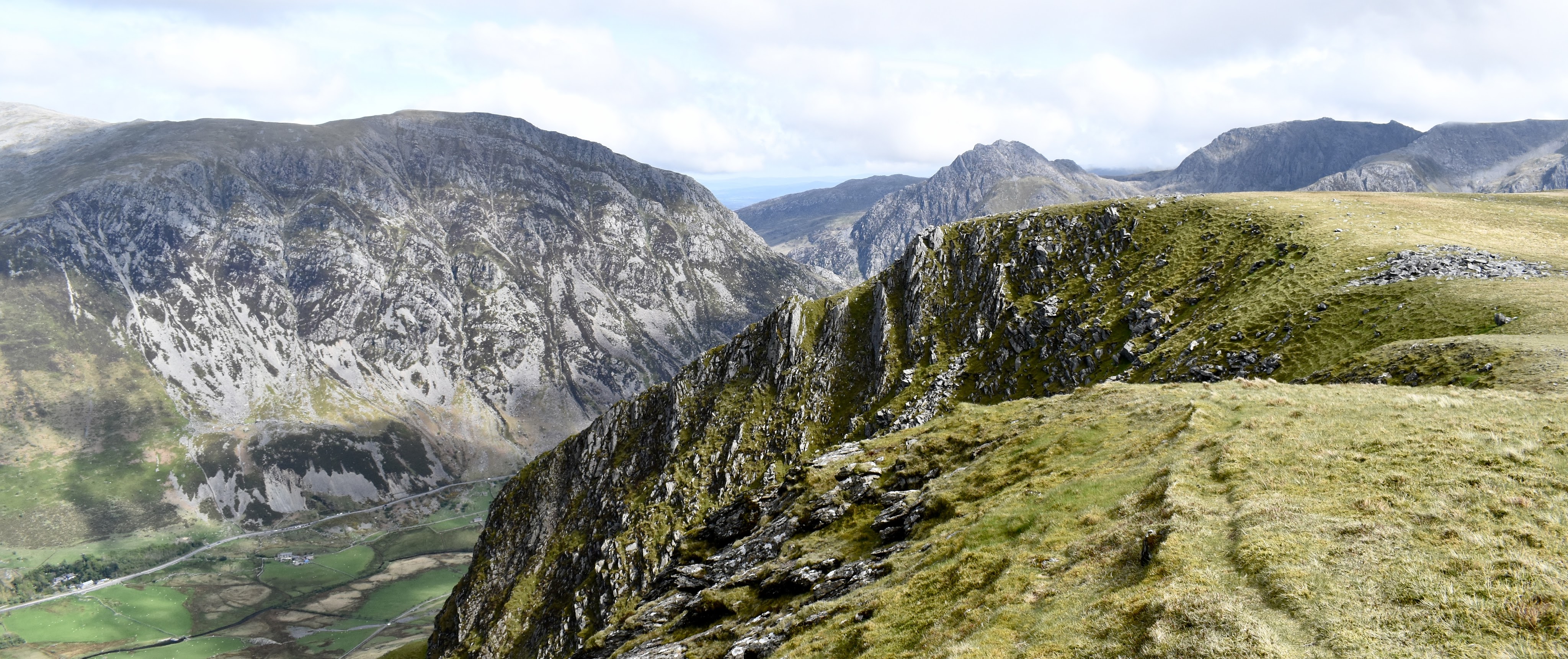
The next summit is actually lower by a few feet than the last so it’s a nice stroll along while you take in the breathtaking views of the Carneddau and Glyderau. It’s straight forward enough to find the path if you have good visibility as you can see the stone wind shelter in the distance. There’s a style over a stone wall and a clear path on the ground from that point. However you might want to walk nearer the edge if visibility is good and take in those amazing views.


Elidir Fawr – Summit 3 of the Marchlyn Loop
Elidir Fawr
Height – 3029 feet / 924 metres
Mountain Range – Glyderau
English Meaning – Either named after Prince Elidir Mwynfawr (About 560, he invaded Gwynedd to push his wife’s claim to the throne) OR Elidir could be a corruption of Leitir (Old Irish), meaning Hillside – Big Hillside

Once you leave the stone shelter of Mynydd Perfedd you need to head down towards a post and wire fence with a ladder style on your way towards the summit of the largest of the 4 peaks on the Marchlyn Mawr Horseshoe – Elidir Fawr, also known as Electric Mountain (see more on why it’s called this at the end of this post)
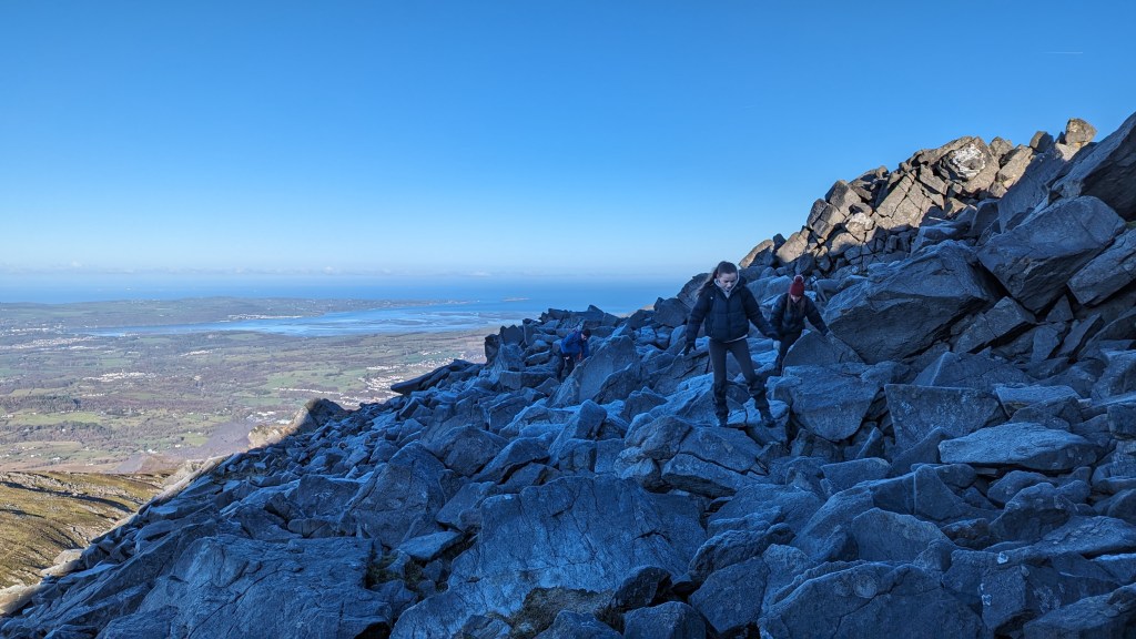
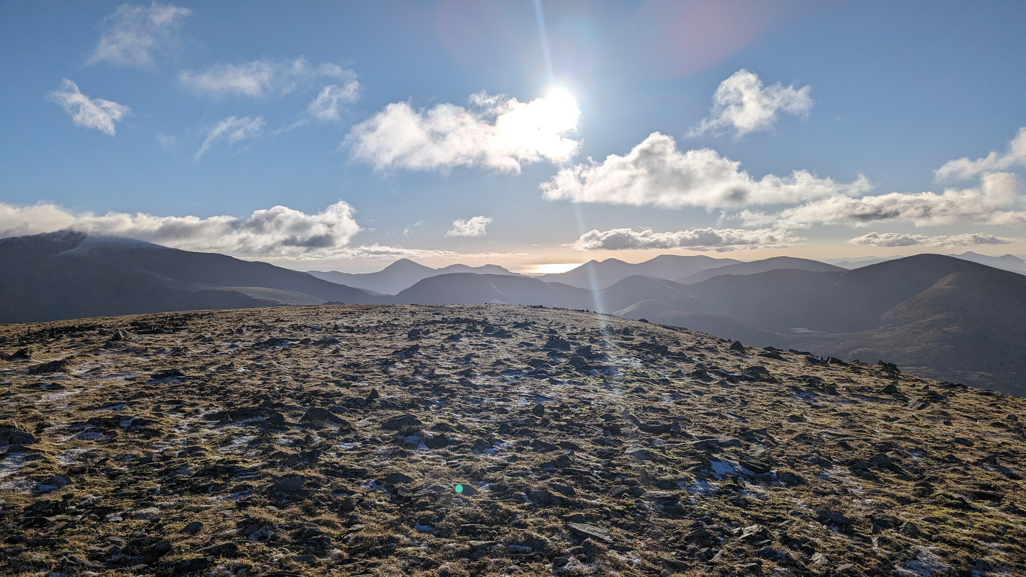
Elidir Fawr is over 3000 feet but having climbed over 2600 feet already and had quite a break from the strenuous uphill walking to reach Carnedd y Filiast you should find the ascent less challenging. That being said it is still fairly steep!

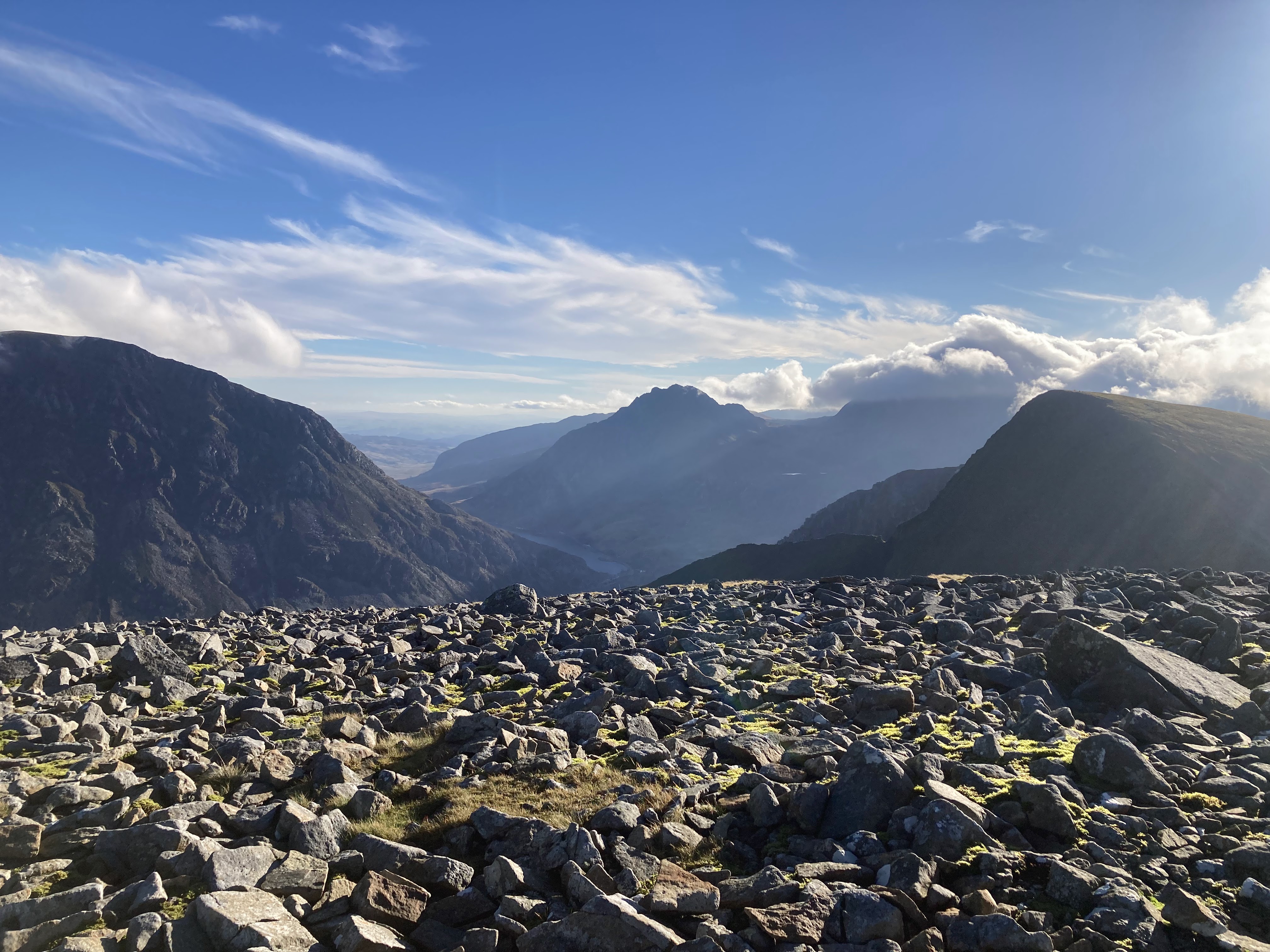
There is a path all the way up with vertiginous views of the Marchlyn Mawr Reservoir to you right and to the left stunning views of the flanks of Foel Goch and the Snowdon Massif given a clear day. Towards the summit of Elidir Fawr you will find the path gets a little more tricky to pick out amongst the rocks, as long as you are heading up it will be hard to miss the stone shelter which marks the summit.

Elidir Fach – Summit 4 of the Marchlyn Loop
Elidir Fach
Height – 2608 feet / 795 metres
Mountain Range – Glyderau
English Meaning – Small Hillside
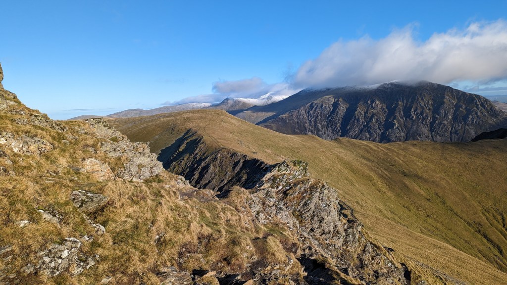
After you have enjoyed a cup of hot coffee or a celebratory swig from your hip flask then it’s time for the descent down to Elidir Fach. As you descend from Elidir Fawr you have a few choices of path. There’s a couple of lower diagonal paths if you head to the right of the ridge, these are both fairly tricky scree paths.
My preference having done both is to walk along the top of the ridge of Elidir Fawr for around 5 to 10 minutes until a clear path comes into view on your right (ignoring the diagonal paths that start right from the summit). Its still fairly unpleasant, slippery scree but there’s less to navigate plus you can see the fence which is clear on your map from this path and easily locate the summit of Elidir Fawr even in low visibility doing it this way. There is no exposure on the ridge just some rocks to clamber over, so use your own judgement depending on the conditions here.
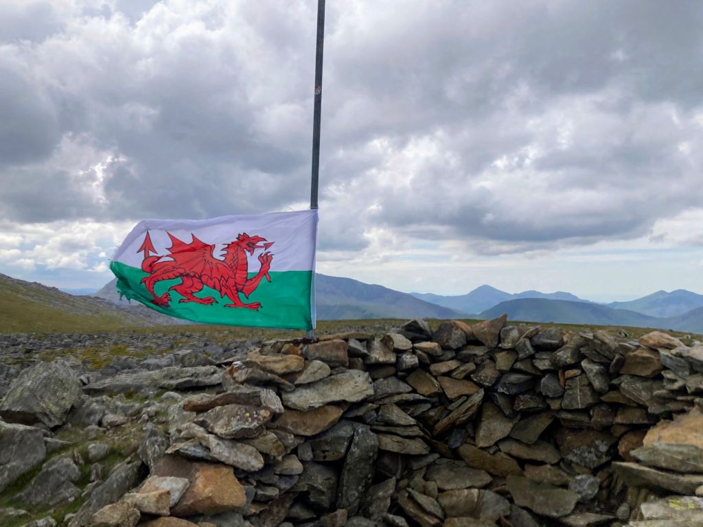
This lower summit with amazing views of the coast often has a Welsh flag flying, I was lucky to bump into the chap who replaces it after it’s been battered by the harsh weather up there. He does it entirely voluntarily he’s @type1_adventurer on Instagram if you want to say hello.
After the summit of Elidir Fach you will just have the last leg back to the Marchlyn Bach Reservoir. There is a faint path all the way but its fairly easy to drift off it, just make sure you,re not too far over to the right hand side edge, and bare left as you come to the steeper part of the descent. In good visibility you will find it really easy.
What is Electric Mountain in Snowdonia? – Elidir Fawr
Before you walk this route you might want to gen up on the amazing secret that lies within Elidir Fawr – it’s pretty amazing stuff. From your walk around the Marchlyn Loop you will be blissfully unaware that on the inside of this mountain is a huge Pumped Storage Hydro Electric Station – the mountain was carved out and you can fit St Paul’s Cathedral Inside.
This is what the mountain Elidir Fawr looks like from the Llanberis side. It really does look like the kind of thing a James Bond Villian would emerge from!
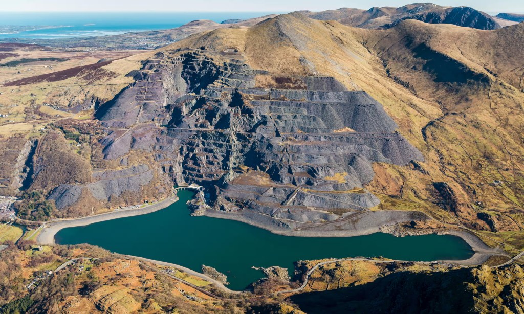
Electric Mountain is a pumped-storage hydroelectric station. From the outside, the installation consists of Elidir Fawr and two placid, slate-bottomed lakes: Marchlyn Mawr, high on the flank of the mountain, and Llyn Peris, nestled in the valley between Elidir Fawr and Yr Wyddfa. The 500 metres or so of altitude difference between the two lakes allows them to serve as upper and lower reservoirs, connected by a vertical shaft inside the mountain.
When an operator opens the valves at the top, water from Marchlyn Mawr flows in, falls straight down on to the turbines of six generators lined up in the cavern in the mountain – big enough to comfortably house St Paul’s Cathedral, it’s familiarly known as “the concert hall” – and then out to Llyn Peris. At full flow, enough water to fill a 25-metre swimming pool passes through the turbines every second (appropriately enough, the tour guide described this as “1.5m cups of tea”), but even at this rate, the artificial waterfall inside the mountain can generate electricity continuously for six hours before Marchlyn Mawr is depleted. Dinorwig dramatically increases the reliability of the UK electrical grid.
It was built as the local slate quarrying industry was in decline, and the workers on the project included retrained former miners. When Marchlyn Mawr and Llyn Peris were turned into reservoirs, the arctic char living in the lakes were relocated. (This seemed like a lot of effort to go to for some fish – arctic char are widespread and commercially fished across northern Canada – until I learned that they are locally endangered in the UK, since only a few small populations had managed to hang on since the end of the last ice age in a handful of Welsh lakes.) And it’s no accident that Electric Mountain is all but hidden; the entire power station and its facilities were designed to blend into the scenic landscape. There are no marching rows of electricity pylons, since the transmission lines are buried underground.
Guardian – Deb Chacra
Nearby Summits (distance from Elidir Fawr)
Y Fronllwyd (721 m)1.9 km
Y Garn (Glyderau) (947 m)2.6 km
Glyder Fawr (999 m)4.5 km
Carnedd Dafydd (1044 m)5.1 km
Foel Meirch (800 m)5.3 km
Castell y Gwynt (972 m)5.3 km
Tryfan (915 m)5.5 km
Moel Cynghorion (674 m)5.7 km
Pin It to your Pinterest Board so you can find the route later!
Leave a Reply