
How was Snowdonia Formed?
What geological processes shaped the beautiful landscape of Snowdonia, particularly the awe-inspiring rocky mountains of the Ogwen Valley ?
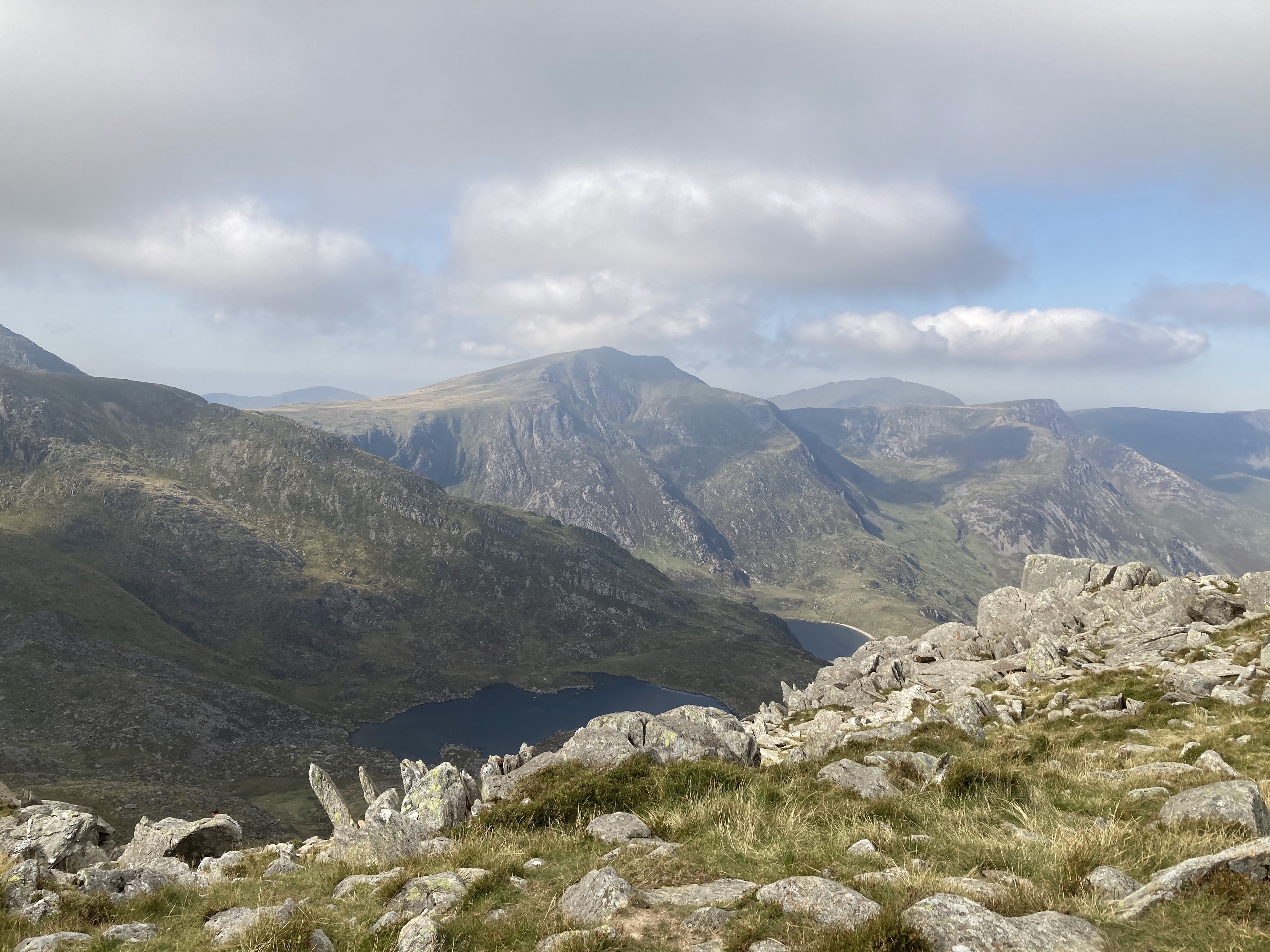
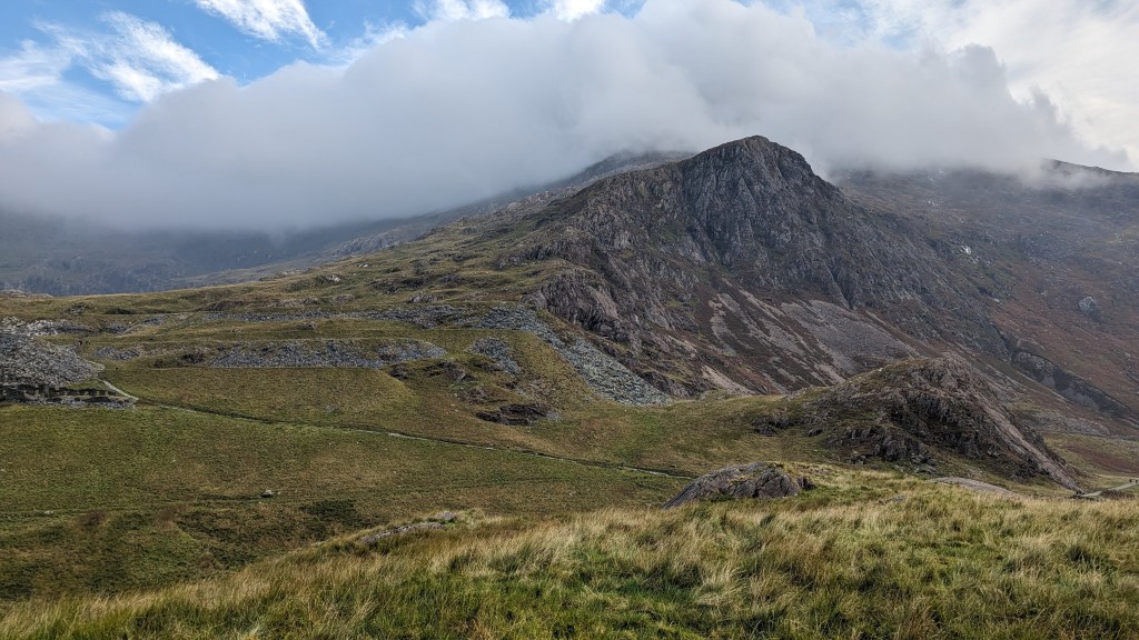
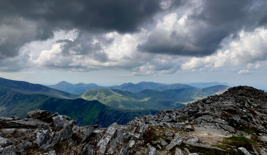
I can’t believe there’s anyone that’s ever seen Tryfan, Castell y Gwynt or walked up between Glyder Fach and Glyder Fawr and not wondered how on earth the massive rugged rocks got there and what made them so spiky and jagged.
I absolutely love the jagged rocky landscape of Eryri (Snowdonia) and I’m guessing you are in awe too! If you want to know why the Glyderau look like piles of rocks from outer space then read on. (Spoiler: they didn’t drop out of space!) It gets more scientific as you scroll down I promise… but I’ve tried to make sure all the geology of Snowdonia I’ve researched is easy to understand and I’ve shared a big list of further reading at the end of the post.

How did the Glyderau form, what makes it so rocky and jagged?
I have walked up to the summits of the Glyderau many times and decided that it was about time I found out how Castell y Gwynt, the unbelievable Bristly Ridge and the whole of Eryri was formed and why it feels so unique and jagged.

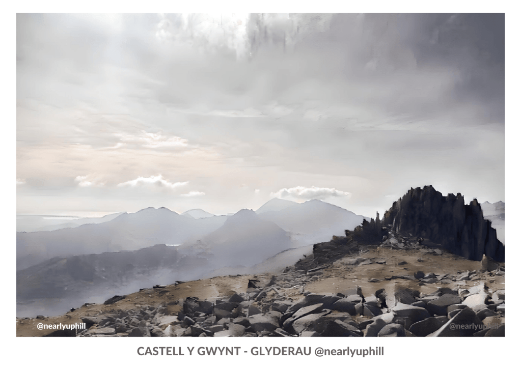
Glyder Fawr (distant peak) and Castell y Gwynt from the top of Glyder Fach which is quite literally another big heap of stones, but not as spiky as Castell y Gwynt. My friends in the rocks show the scale of these huge boulders! (They did both make it to the top)
Disclaimer – I’m not a geologist so my information relies heavily on internet research, I’ll add links to credit all the sources I’ve found at the end. So why are the rocks on the top of the Glyderau so distinctive and more to the point why are they so different to the likes of Pen y Fan and Moel Famau?
How did the mountains in Snowdonia form in the first place and how long ago?

I don’t want to be another person who mumbles about glaciers without really understanding them… I want to know how these massive spiky rocks came to look like they do. It’s not just because of glaciers. They must have been shaped by other factors as well. Before we get into the knitty gritty of why Castell y Gwynt and other peaks in Snowdonia are so jagged we need to understand how the mountains of Snowdonia were formed.

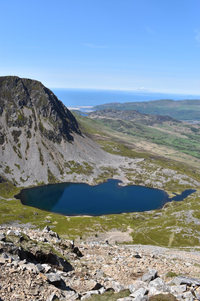
The formation of mountains in Snowdonia is a fascinating tale of geological processes that span millions of years. Snowdonia’s current form owes much to the last Ice Age around 18,000 years ago, when glaciers carved deep valleys, bowl-shaped hollows known as ‘cwms’, and pointed pyramidal peaks into the bedrock. These glaciers left an indelible mark on the landscape, shaping it into the stunning natural beauty we see today.
Learn a few of these terms to impress your friends the next time you’re on a walk in Snowdonia!
Orogeny: The Caledonian Orogeny, which took place around 490-390 million years ago during the Silurian and Devonian periods, played a significant role in shaping the landscape of Snowdonia. This was a mountain-building event caused by the collision of two tectonic plates, leading to the formation of the high peaks in the region.
Plate Tectonics: The ancient continent of Avalonia, where Snowdonia is located, collided with another ancient continent, Laurentia. This collision, part of the plate tectonics process, resulted in the uplift and formation of what we now know as Snowdonia / Eryri.

Volcanic Activity: Much of Snowdonia’s geology is characterized by volcanic rocks, evidence of intense volcanic activity during the Ordovician period. The eruptions led to the deposition of volcanic materials like rhyolite and tuff, which make up significant portions of the mountains, such as Yr Wydffa / Snowdon.
Sedimentation: Over millions of years, sedimentary rocks formed from the accumulation of sediments in seas and lakes. These sedimentary layers were later uplifted during orogenic events, creating the varied and layered appearance of many mountains in Snowdonia.
Uplift: This process has been significant in the formation of Snowdonia’s peaks. Uplift occurs when pressure from Earth’s mantle pushes the crust upwards. In Snowdonia, this uplift happened primarily during the Caledonian Orogeny.
Erosion and Weathering: Following their formation, the mountains of Snowdonia have been subject to millions of years of erosion and weathering, caused by wind, rain, ice (during ice ages), and other natural elements. This has led to the sculpting of the mountains into their current shapes, with features such as valleys carved by glaciers.
Isostasy: Snowdonia’s landscape continues to change due to isostatic adjustments. After the last Ice Age, the removal of large ice sheets led to the ‘rebound’ of the land, a process that is still occurring today, albeit very slowly.
These processes demonstrate how complex and dynamic Earth’s geology can be, with the stunning landscape of Snowdonia serving as a testament to these natural forces.
How are the jagged rocks of the Glyderau and Castell y Gwynt formed?

Castell y Gwynt and all the jagged rocks in Snowdonia were formed by FREEZE THAW WEATHERING!
What is freeze thaw weathering?
North Wales, particularly Eryri / Snowdonia National Park, is a prime example of a landscape shaped by the freeze-thaw process. Rocks that are already cracked by the pressure of tectonic forces (earth movements) are more easily broken down with the freeze-thaw process.
The rugged and jagged appearance of these mountains is a direct result of freeze-thaw weathering. You’ll see boulder fields, screes and lakes when freeze thaw has been in action.
When air temperatures drop below freezing, water expands and cracks open rocks and boulders. This breaking action is known as frost shattering or thermal fracturing. Repeated freeze-thaw cycles can have a dramatic impact on the landscape. It only happens in locations where it freezes at night but warms during the day. As the ice is warmed up it turns into water which seeps further into the craks made from the expansion… just teeny tiny amounts each year.

You can easily spot the impact of thermal fracturing when you see mountains adorned with boulders and talus slopes – heaps of shattered rocks. And check out those massive boulder fields in glacial valleys, created through frost shattering!
It’s fascinating how these processes shape and refine mountain landscapes over time.
So why does Eryri and especially the Glyderau and Castell y Gwynt have these rocky outcrops but other mountains in Wales don’t?
It’s all down to the type of rock… not all rocks are the same and if you’d have done GCSE Geology you’d know all about that (I didn’t!) So lets take a look at the different rocks of north and south Snowdonia Eryri. I’ve also added in a few other mountain ranges in Wales for comparison.
Rock formations of North and South Snowdonia

So how does that impact the look of the rocks on these mountains – why are some mountains smooth and some rocky and jagged?
In the north, around Snowdon (Yr Wyddfa), the area is characterized by rugged mountainous terrain, with peaks formed largely of volcanic rocks and intrusions from the Ordovician period. This includes rhyolites and dolerites, which contribute to the dramatic and craggy landscapes seen here.

On the other hand, the southern part of Snowdonia around Cadair Idris features a mix of sedimentary and volcanic rocks. Here, you can find Silurian mudstones and sandstones, along with some intrusive igneous bodies. The landscape tends to be slightly less rugged, with more rolling hills and valleys.
So both northern and southern Snowdonia share a common geological history, the subtle differences in rock types and the structure of the land lead to variations in their landscapes. Some rocky and some less so!
Rock Formation of The Glyderau or Northern Snowdonia/Eryri range
These mountains are primarily composed of igneous and metamorphic rocks from the Ordovician and Cambrian periods. These rocks are highly resistant to weathering but are susceptible to freeze-thaw cycles, leading to the jagged, rocky landscapes that characterize this range.
Mount Snowdon (Yr Wyddfa): The highest peak in Wales, Snowdon is primarily made up of rhyolites and tuffs – volcanic rocks formed from eruptions around 450 million years ago, during the Ordovician period.
Glyder Fawr and Glyder Fach: These peaks are part of the Glyderau range, characterized by rugged and jagged peaks. They’re formed from a mix of intrusive igneous rocks like dolerite and sedimentary rocks such as mudstone and sandstone.
Tryfan: One of the most famous mountains in Snowdonia, Tryfan is composed mainly of porphyritic rhyolite, a type of volcanic rock.
Carneddau Range: This includes Carnedd Llewelyn and Carnedd Dafydd, the second and third highest peaks in Wales. They’re made up of a variety of rock types including rhyolite, tuff, and slate.
The Ogwen Valley: This valley is home to the Idwal Slabs, popular among climbers. It’s composed of rhyolitic tuff, a type of volcanic rock.
Rock formations of Southern Snowdonia
Rock Formation Cader Idris: This mountain range is a popular spot for hikers and geologists alike. Its formation is primarily composed of volcanic and sedimentary rocks, including Ordovician shales and slates, with some areas of intrusive igneous dolerite.
Rock Formation Rhinog Fawr and Rhinog Fach: These peaks are characterized by rugged terrain and steep cliffs, formed from Cambrian rocks, mainly gritstones and mudstones.

Rock Formation Arenig Fawr and Arenig Fach: These mountains display a fascinating mix of Ordovician and Silurian rocks, including turbidites – sedimentary rocks formed by underwater avalanches.
Rock Formation of The Brecon Beacons
These hills are mainly composed of Old Red Sandstone, which gives the area a desert-like appearance due to the iron oxide in the rock. Although this rock can undergo freeze-thaw cycles, it is softer and less resistant than the rocks in the Glyderau, leading to smoother landscapes.

Rock Formation of The Clwydian Range
The Clwydian Range is primarily formed from Silurian age sandstones, mudstones, and siltstones. These sedimentary layers have been uplifted and slightly tilted to create the range of hills we see today. The alternate layers of different rock types have resulted in a stepped profile for these hills, as each rock type erodes at a different rate.
DID YOU KNOW? When you’re standing on rock in Snowdonia, it’s much older than any you can stand on in the Himalaya or Rockies!
Snowdonia (Eryri) Mountains, Wales, UK: Estimated to be about 500 million years old source
Rocky Mountains, North America: Estimated to be about 80 million years old source
Himalaya Mountains, Asia: About 70 million years old source
Extinction of the Dinosaurs: The event occurred approximately 66 million years ago, marking the end of the Cretaceous Period source
Andes Mountains, South America: About 25 million years old source
First Humans (Homo Sapiens): Homo sapiens, the first humans, appeared around 300,000 to 200,000 years ago source

Find out more about how Castell y Gwynt and Snowdonia was formed
Further reading… there’s so much more to learn! Way to much for one blog post…
- Geolsoc – Caledonian Orogeny
- Snowdonia National Park Authority – Geology
- Wikipedia – Geology of Snowdonia National Park
- British Geological Survey – Yr Wyddfa (Snowdon), North Wales
- Geological Society – Snowdon/Yr Wyddfa
- Cwm Idwal & Darwin’s Boulders ↩
- The Ogwen valley – a natural history – YouTube ↩
- Wales: British regional geology – BGS Application Server ↩
- Ordovician (Caradoc) marginal basin volcanism in Snowdonia ↩
- Geology | Snowdonia National Park ↩
- Snowdonia National Park: Eryri National Park ↩
- Previous Part II Mapping Projects ↩
- The Snowdonia Way by: Alex Kendall – 9781783624546 ↩
Leave a Reply