The Cwm Eigiau Horseshoe is a stunning circular walk located in the Carneddau range of Snowdonia, North Wales. This route takes in three peaks and inolves some fairly rugged paths, steep ascents and descents and just one little scramble between Pen Yr Helgi Du and Carnedd Llywelyn.
This route is in the heart of Eryri (Snowdonia National Park) with extensive views of the surrounding mountins and coastline in the distance. The closest town is Dolgarrog where you will find a very narrow and bendy road which goes up to the Llyn Eigiau Reservoir. There are a number of gates to open and close on this lane.
How long is the Cwm Eigiau Horseshoe Walk?
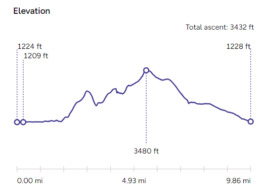
The route is just under 10 miles, 15.9 km. It took me and Ziggy my dog around 7 hours in total. We didn’t stop anywhere for too long but so for most people I would give yourself at least 8hrs of daylight to complete it. There’s a few ups and downs between each of the peaks – your total ascent is about 1000ft more than doing the PYG Track up Yr Wyddfa (the highest peak in Eryri) – so don’t underestimate this loop!
Download the OS Map of the Cwm Eigiau Horseshoe
I’ve created a map on OS Maps with the route I took.
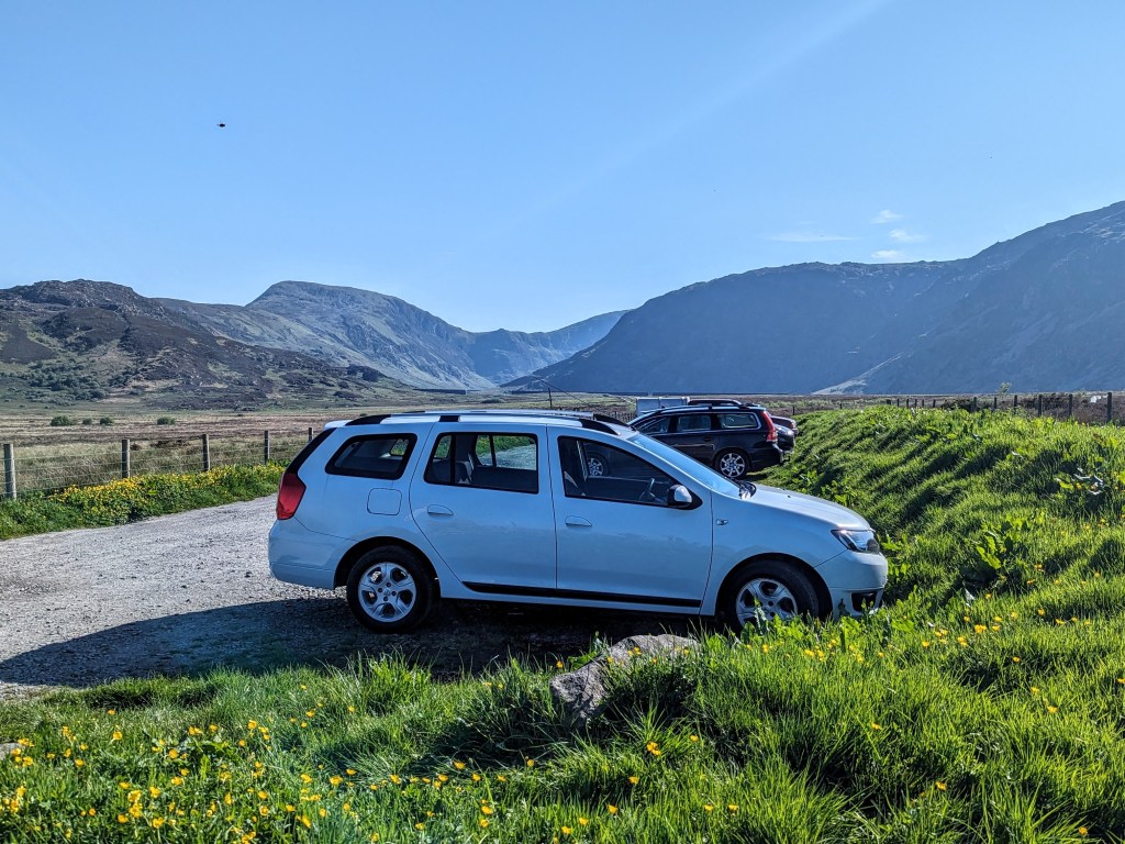
Parking at Llyn Egiau – There is parking for around 10-12 cars at the end of the road to Llyn Eigiau – so many routes start from this car park however I’ve never found an issue getting a parking spot (so far!)
How difficult is the Cwm Eigiau Horseshoe Walk?
The walk offers a mix of rugged paths, grass and heather slopes and some very steep ascents and descents, including a ridge descent.
Bwlch Erol Farchog taken from a walk in the Glyderau opposite in winter – it really is a beautiful section of this path!
There is just one small area where you need to scramble a little on Bwlch Erol Farchog. It’s not exposed (no cliff edges to worry about) and I managed it with my large, agile dog quite comfortably (it was a dry day. I passed a group of fairly elderly walkers on their way down it too, so I wouldn’t get too worried about it. I’d advise caution in icy conditions – I could see lots of crampon scrape marks on the rocks. Sadly I didn’t get a picture or video close up as I was too busy concentrating.
Is the Cwm Eigiau Loop suitable for Dogs?
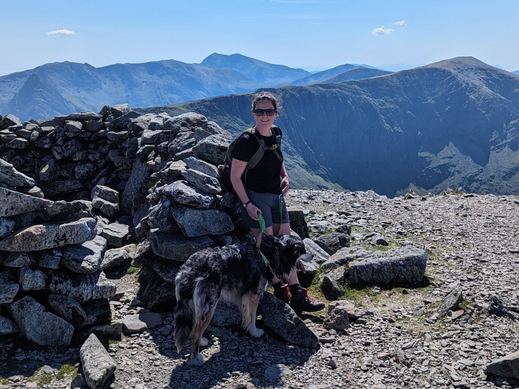
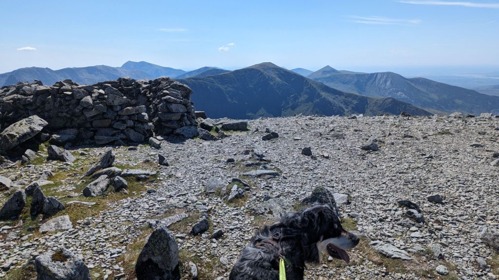
Carnedd Llywelyn Summit. The final summit of the Cwm Eigiau Horseshoe- Ziggy my coltriever relaxing at the top.
Yes, for most fairly fit dogs this is a great route. It’s 7 hours of walking and there is no water on the ground for them to drink once you get past the first summit. I took plenty of water as it was a hot day in May and there was nothing for Ziggy in terms of puddles or small ponds on top. Generally I take as much water for Ziggy as I do for myself – he’s on a lead so he’s not running around. If your dog is ok off the lead they may need more. It’s worth checking for water on the map, you can refill bottles then as well as letting your dog drink directly. You can read some practical tips on hiking with dogs in the mountains here – Hiking with Dogs in the Mountains
Cwm Eigiau Horseshoe Weather Conditions
Hopefully you’ll have beautiful clear and sunny conditions like I did at the summit of Carnedd Llywelyn – you can see Yr Wyddfa (the pointy one, directly behind)
I use MountainForecast.com to check the weather and the cloud base before my walks. It gives a report for the summit and the base – you should probably use Carnedd Llywelyn as the summit to check as it’s the highest of the 3 peaks – Carnedd Llywelyn Weather Forecast
The 3 Summits of the Cwm Eigiau Horseshoe
Pen Llithrig y Wrach
Height: 799 meters (2,621 feet)
Description: The name translates to “The Witch’s Slippery Head” in English, which hints at the challenging terrain. The summit provides panoramic views of the surrounding valleys and peaks, including a beautiful view down to Llyn Cowlyd reservoir.
Pen Yr Helgi Du
Height: 833 meters (2,733 feet)
Description: Translating to “Peak of the Black Hound,” Pen Yr Helgi Du is a prominent peak with steep, rocky slopes. The ascent from Bwlch y Tri Marchog is particularly notable for its rugged beauty and the dramatic ridge walk that follows.
Carnedd Llywelyn
Height: 1,064 meters (3,491 feet)
Description: As the second highest peak in Wales, Carnedd Llywelyn is a significant highlight of the walk. The summit offers expansive views across Snowdonia and on a clear day, you can see as far as the Isle of Man and the Lake District. The peak is named after Llywelyn ap Gruffudd, the last sovereign Prince of Wales.
Cwm Eigiau Loop Route – Step by Step Pictures and Videos
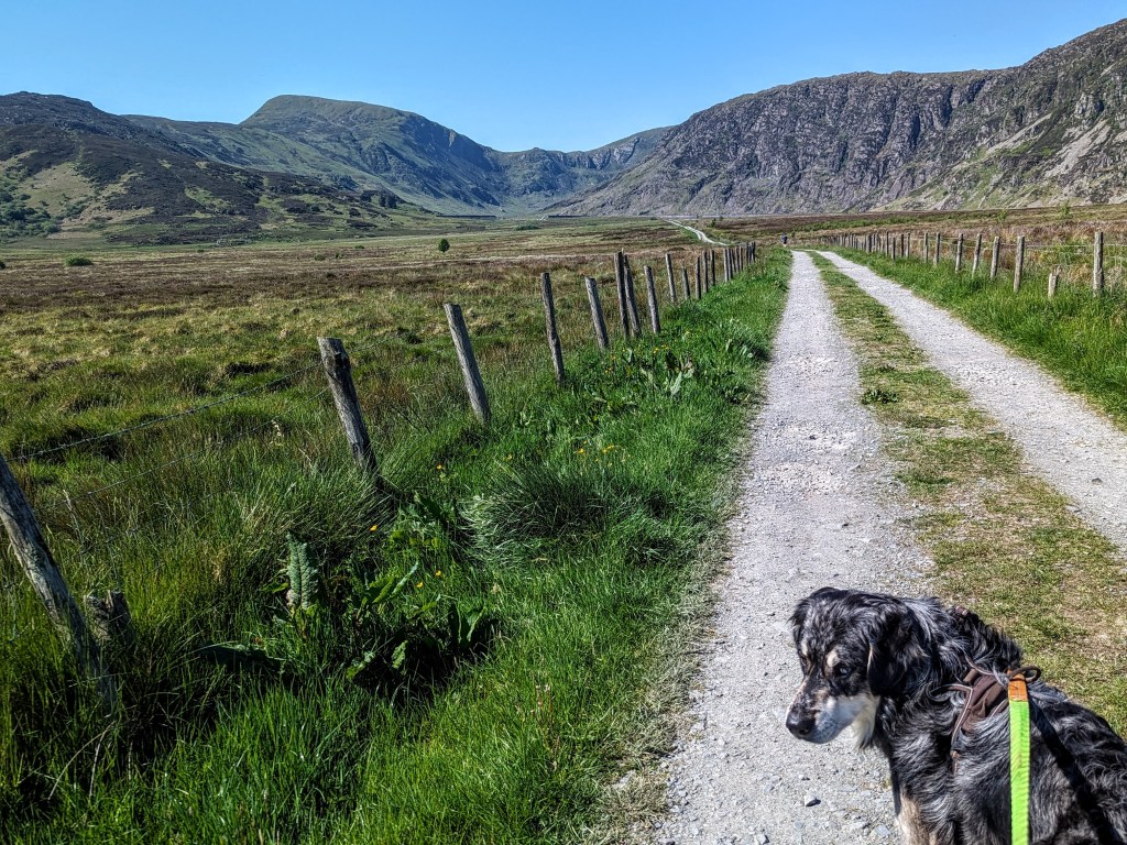
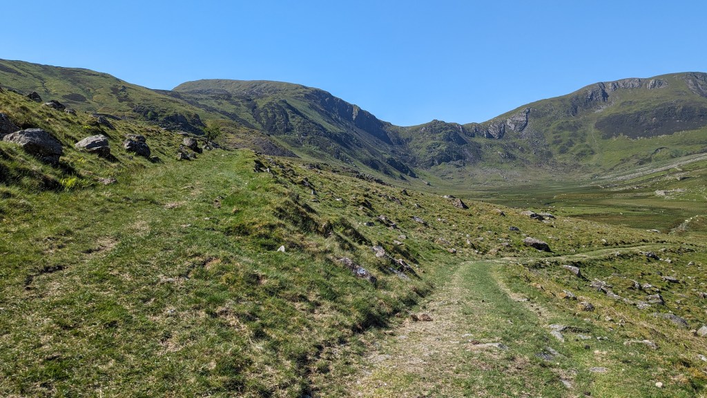
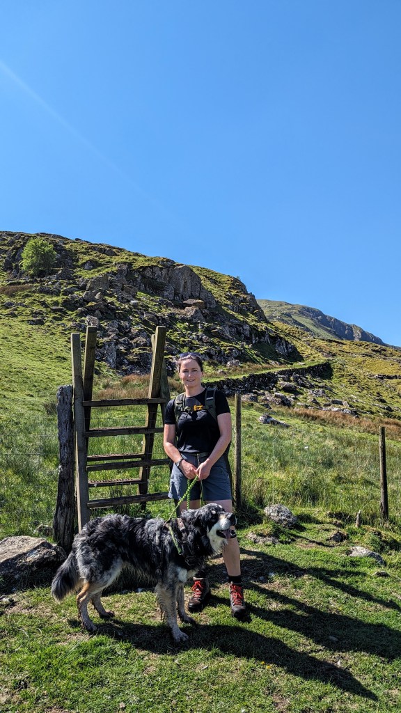
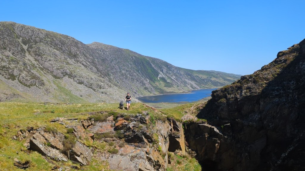
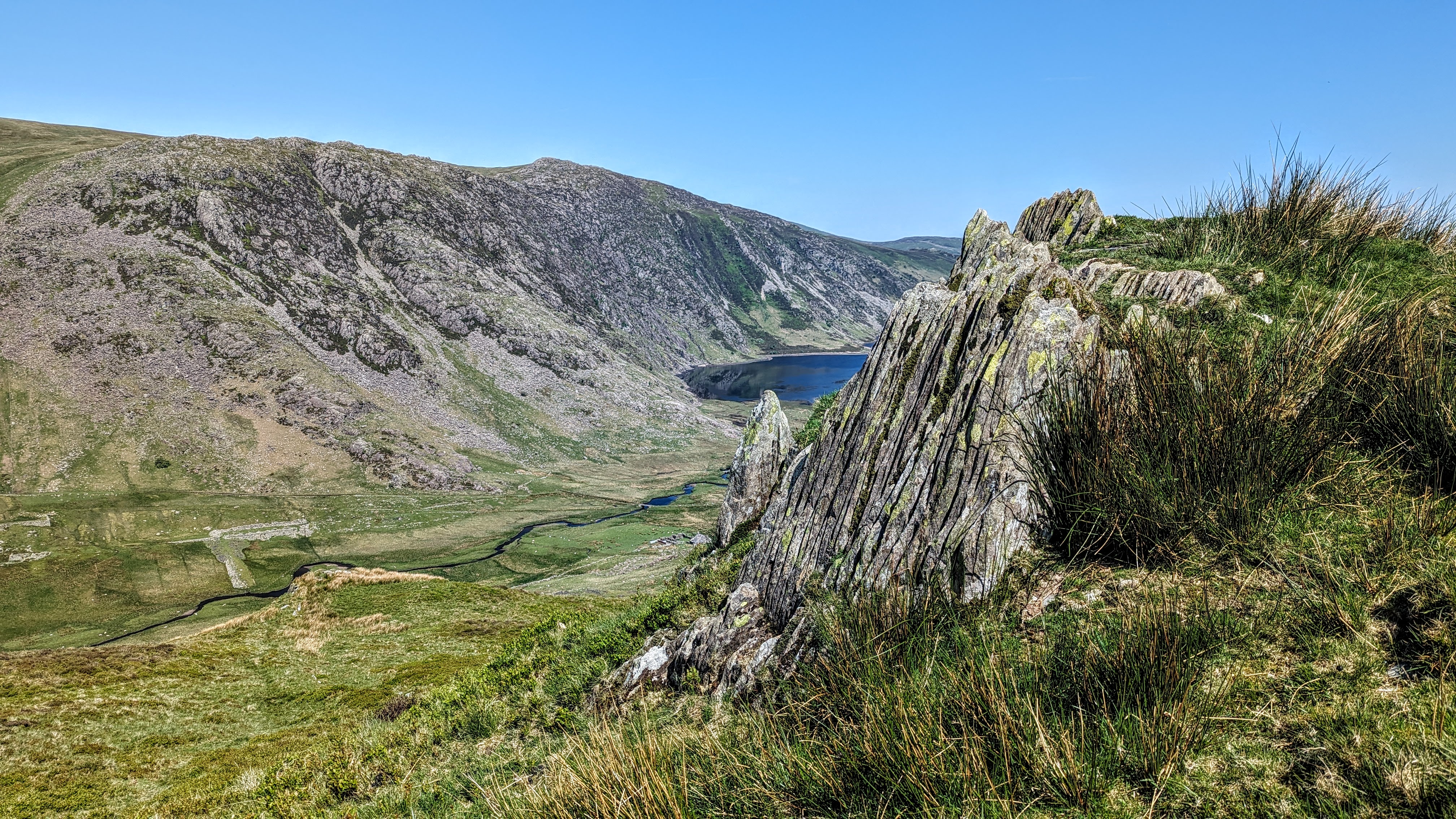
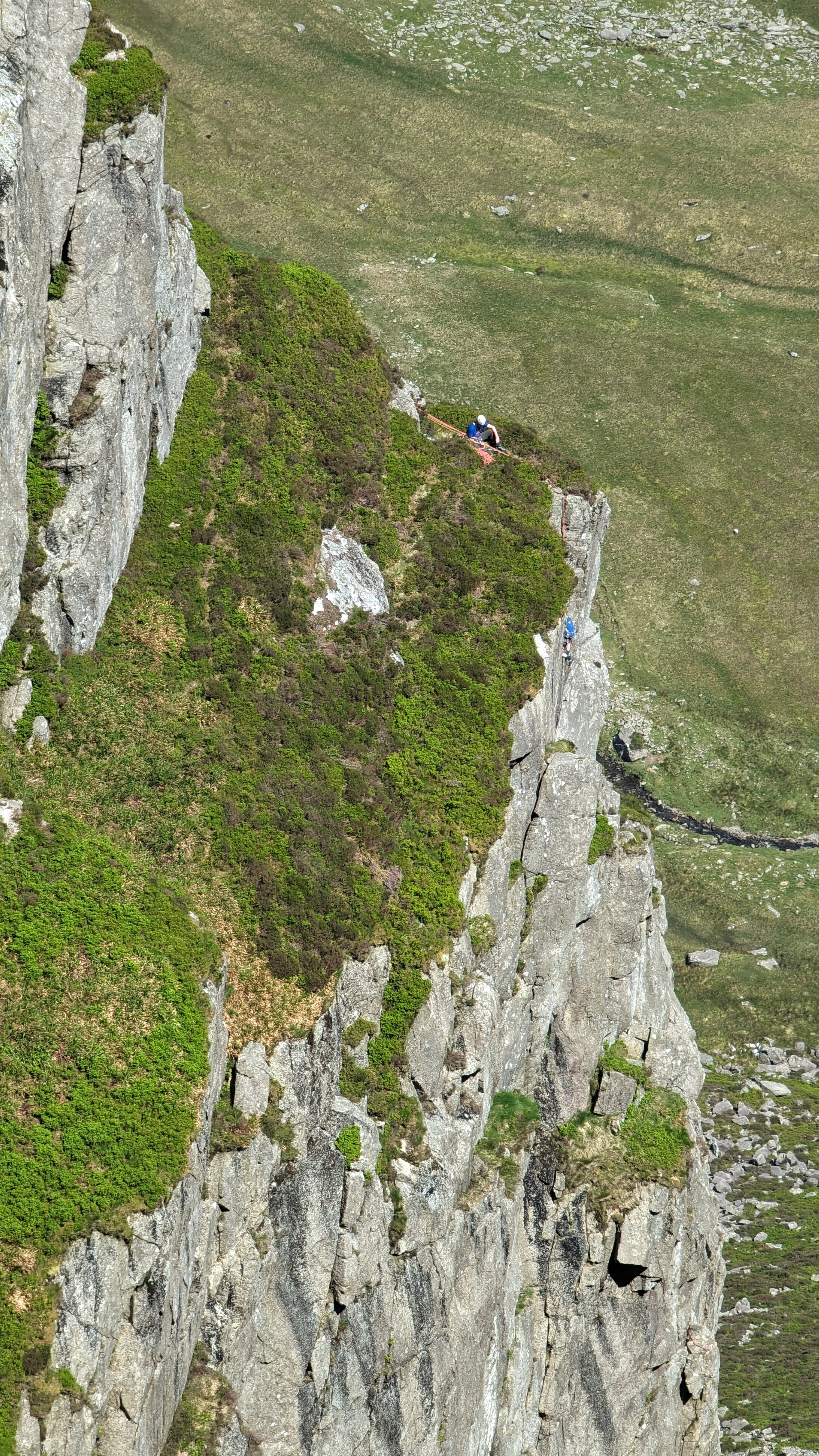
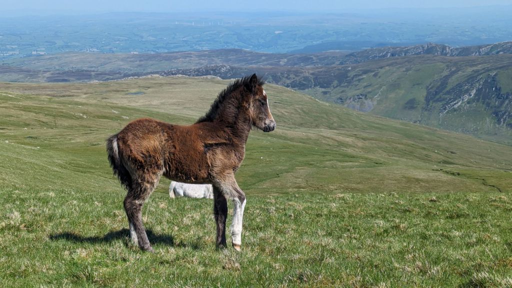
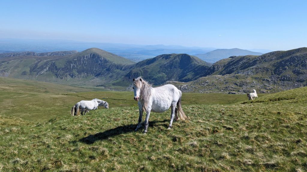
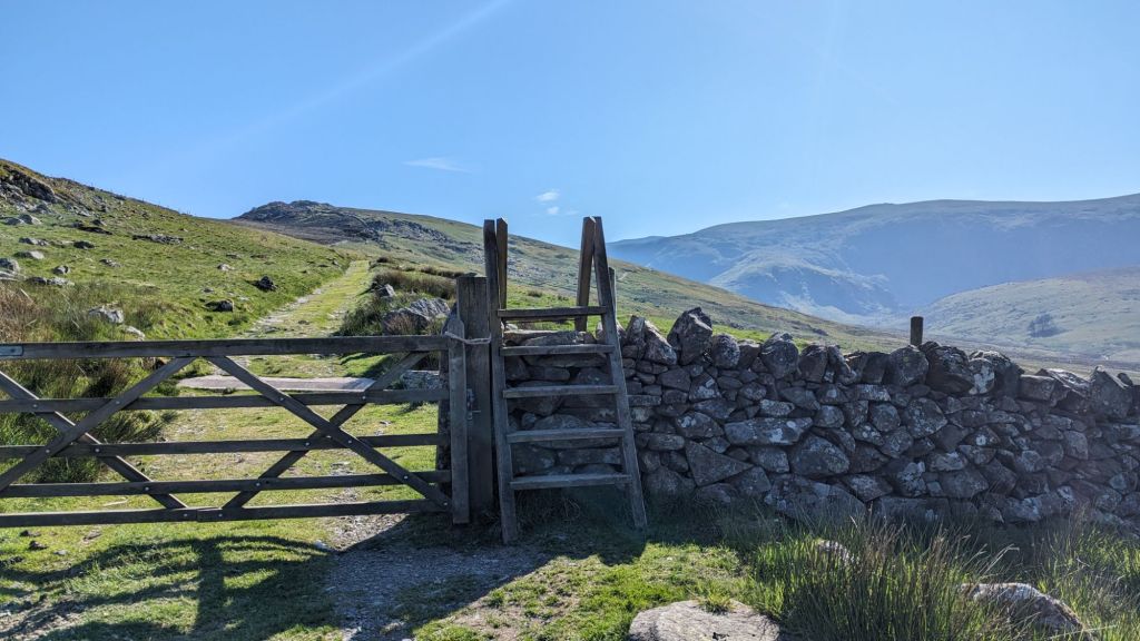
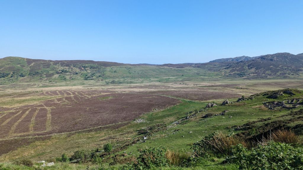
Walking down the track at the start of the Cwm Eigiau HorseshoeThis is the point where you start the ascent up Pen Llithrig Y Wrach, head up to the left. Just check your map to make sure you have the right turning point, it should be after the end of the lake.You’ll walk past old stone buildings, identifiable clearly on your map to help check you’re on the right path. Head over a ladder stile – you can then see the path that snakes around a rocky outcrop.You’ll suddenly spot this amazing quarry with a stream running through it, it’s quite staggering but take care – it would be easy to stumble into it on a low visability day.Ascending up the grassy slopes towards the summit Pen Llithrig Y Wrach with Llyn Eigiau still just visibleCarneddau Ponies on the Cwm Eigiau Horseshoe. I must have seen 30 of these beautiful wild Carneddau Ponies on this walk, including some cute little foals – you can just see a foal behind the grey mare here. They made sure me and Ziggy didn’t get too close!Llyn Cowlyd suddenly comes into view from the path up to Pen Llithrig Y Wrach, it’s full of Arctic Char apparently and it’s the deepest resevoir in North Wales.The view from the top of Pen Llithrig Y Wrach looking at the Glyderau in the distance and Pen Yr Helgi Du and Carnedd Llywelyn, the next two summits on this Cwm Eigiau loop Looking at Bwlch y Tri Marchog, with Pen yr Helgi Du is the next summit. You have to lose a little height here sadly but the views make up for it. Blwch is the welsh word for a pass, it means Pass (or Gap) of the Three NightsThe style at the lowest point of Blwch Y Tri MarchogLooking back at Cwm Eigiau and Llyn Eigiau from Bwlch Y Tri MarchogFfynon Llugwy Reservoir from Bwlch Eryl Farchog which translates as Pass (or Gap) of the Hunting KnightsAfter the brief scramble up from Bwlch Eryl Farchog, looking back at Pen Yr Helgi Du and Pen Llithrig Y Wrach – you can really see how your gaining and losing lots of height before you head up finally to the highest point of Carnedd Llywelyn.The views down to the valley below are spectacular as you look down the vertiginous slopes to your right as you ascend Carnedd LlywelynRock climbers on Craig y Ysfa – I didn’t fancy that route down myself!The summit of Carnedd Llywelyn, there’s a circular stone shelter to drink your coffee in if it’s a windy day
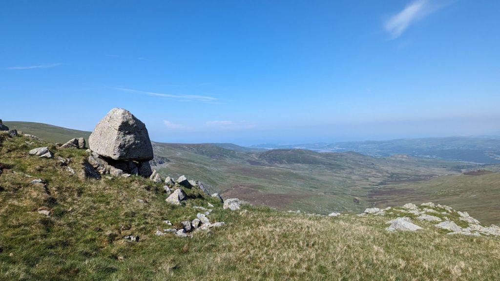
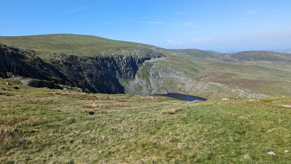
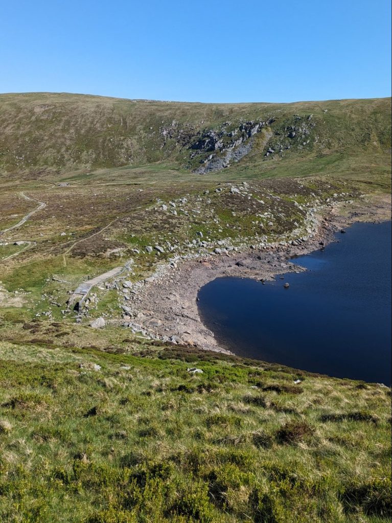
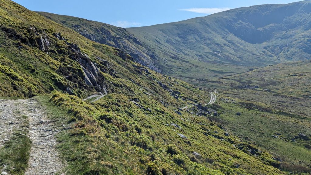
A little video of the summit of Carnedd Llywelyn Carneddau Foal on the descent down from Carnedd Llywelyn. The next section of the walk you need to descend down from the summit, it’s a little rocky at first then soon becomes a grassy slope. Keeping the ridge to your right as you head in the direction of Foel Fras. Before you get near to the next summit you will begin to take a diagonal route down. It’s worth having a proper look at the map to make sure you are heading in the right direction at this point. Carneddau ponies, it’s a treat to see such beautiful wild animals as you walk in the Carneddau. There is a bit of a path as you start descending down but don’t worry too much if you can’t find it on the ground, just make sure you are headed in the direction of Llyn Melynllyn Keep an eye out for this large boulder which is balancing precariously on a few smaller rocks. The descent from this point is pretty straightforward and you will pick up a path that goes between the two lakes, taking you to the left side of the lake. There’s steep cliffs around llyn Melynllyn so you wouldn’t want to go the right side!The lake you can see here is the higher one, the Dulyn Reservoir. If you have time it’s worth a little detour.Llyn Melynllyn, the path takes you round to the left of it, in between the two reservoirs. It’s a fairly easy descent, nothing too steep. From here you can also easily see the next section of the walk where you pick up an access track. It’s a steady march all the way back to the car along this track.The access track to Llyn Melynllyn and llyn Dulyn is a fair walk but you’re still in the shadow of the beautiful Carneddau, so it’s not too arduous. The track takes you around the bottom of Clogwynyreryr. As yoou make it round you will see the parking spot.The track to the resevoirs would make a good short walk too if you’re looking for a fairly easy route – I’ve done it myself on a sunny summer evening the reservoirs are both nice for a little paddle although I think swimming is prohibited.Just a short walk back to the car park from this point as you turn the last corner of this circular walk.
Let me know what you think of this route. I had glorious weather and views which made it a stunning walk. I’m already planning to return and do it the other way around soon.
Let me know in the comments if you’ve done this route before or if you have any questions about walking the Cwm Eigiau Horseshoe.
You can find me on Facebook and Instagram as Nearly Uphill!
[…] Route and Tips The Marchlyn Mawr Loop – amazing views of Ogwen Valley and the Carneddau Cwm Eigiau Horseshoe Moel Siabod Walk – The Best Circular Route, Parking and other FAQ’s for this Beautiful […]
I quite fancy this but the scramble is putting me off. Recently did the scramble up Moel Siabod which pushed me to my limits (due to my menaupasal vertigo!) but we were on a guided walk so felt in safe hands.
How does this scramble compare to Moel Siabod?
Grateful if you have time to reply.
Diolch
Ooh I’m looking forward to trying this route, thank you! Finding routes in this area with start points that don’t require me to leave home at 6am to get parking are my priority at this time of year!
I did it this weekend – bit of a hot one! But the wind on the tops was lovely and I had a paddle in the llyn near the end too. I did go wrong at one point – I didn’t have your route description saved and I wound up on the wrong side of a barbed wire fence so took a different line up the first mountain. It was very hard going! I extended the route slightly to make it to Foel Grach, just so I could add another summit to my list. For anyone else reading, on a hot and sunny July weekend, the carpark was almost full when I arrived at 8:30am. But I got back to my car at 1pm and there were more spaces then, so perhaps an afternoon hike is a safer bet? I don’t know where everyone was though, as I only saw a handful of people up there.
Loading…
Hilary
Interesting to hear the carpark was already nearly full at 8.30 – I might add in a little edit! Sounds like you had a good day though – it’s so easy to go wrong when the paths are not super clear!
[…] Carnedd Llywelyn (Llewelyn)Height – 3484 feet / 1064 metres Mountain Range – Carneddau English Meaning – Llywelyn’s Cairn – Llewelyn ap Gruffudd was the last sovereign prince of Wales before its conquest by Edward I of England.)Carneddau Traverse Cwm Eigiau Loop […]


Leave a Reply