
Which route is best for walking up Cader Idris?
In this post I’ve shared a route map, parking and some pics to help you find the way up via the Foxes Path easily. Scroll down if you’re not interested in the preamble!
Cader Idris, a mountain in Wales’ Snowdonia National Park, boasts ancient spiritual significance and exhilarating walks. Its highest peak reaches 893 metres (2,930 feet) above sea level, ensuring breathtaking panoramic views of the countryside and Cardigan Bay. I think the best route is up the Foxes Path and then a quick descent down the Pony Path, but there are many paths to choose from. This post will focus on the Foxes path up and Pony Path down.
Try and pick a clear day so you get to see just how spectacular these views are. I’ve done it a few times and sadly had some disappointing cloudy summits. See the end of the post for the classic trig point in the clouds shot!

Madman or Poet?
Legend has it that the Welsh giant, Idris, named the mountain his home and was, in fact, Britain’s first astronomer. According to lore, Idris slumbers atop the mountain, and those who spend the night on the summit may wake up a madman or a poet. This mountain is a family favourite and my nephew is even named Idris after it.
This video is fun, looking at the old legend of the King!
Cader Idris is recognised as a sacred site, offering peace and inspiration to the locals and tourists alike, making it a must-visit place for nature enthusiasts. I absolutely love it.
Parking for walking up Cader Idris – Ty Nant Car Park
There are a number of different paths to reach the summit. We walked up the Foxes path to the summit then down the pony path and back to the Ty Nant car park. Head to Dolgellau and then you can easily find the road to Ty Nant Car Park. There is an overflow carpark so you should always find a spot, even on busier days.

You start as if you are heading up the Pony Path it’s well signposted from the car park and a clear path.

The important bit is finding the point where you bear left and get onto the Foxes path. As you approach just keep an eye up to the left as the path is not that obvious to start with (well unless I’ve missed it on the times I’ve walked it!) You just need to be looking up at the top of Cader Idris (Penygadair) and heading to the left hand side of it, as you can see from the picture below.

Once you’re on the path it’s pretty clear and as you can see the summit (if weather is clear for you) then you definitely wont need to look at a map.

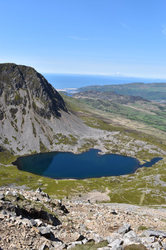
It’s well worth stopping for a picnic (or a swim) at Llyn y Gadair – one of the most perfect lakes in Snowdonia, bring your swimming gear as you’ll definitely want to jump in. My dog in the pic below is on a long lead as there are sheep everywhere and he likes to chase them.

It’s fairly clear which way to progress and you walk around the lake heading towards the scree. It looks a little daunting but it’s really not that tough, you just need to take it steady as the stoney path it very loose. You can either walk up the ridge or go up a path to the right which zig zags up across the scree and then rejoins the ridge path. You can see the path and the scree in the picture below – it is pretty steep but well worth it, just take it steady.

Once you’ve got up the scree/ridge then it’s not far to the top. There’s a little stone hut at the top, depending on how busy it is you should be able to get a nice pic by the trig point.
We chose to have a look around the summit at the different paths coming up as it was such a clear day and the trig was busy with about 29 people from the easier Pony Path which we used to get down and back to Ty Nant car park.
In the pic below you can see the route up the Fox’s path from the Minffordd path which starts on the other side.
This alternative Fox’s Path route up Cader Idris from Ty Nant is less common and more challenging than the Pony Path. It requires a good level of fitness, experience in mountain walking, and navigation skills. Always check the weather conditions before setting off and always carry appropriate clothing, footwear, and safety equipment. Better to carry more and not need it.
Can you walk up Cader Idris with a Dog?

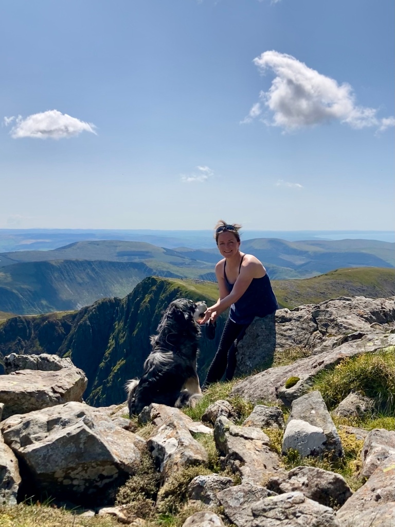
Yes, my dog has been up a few times and loved it. You must carry extra water for your dog as there is no water once you pass the lower level llyns (lakes) and if it’s a hot day they will definitely need it.
The terrain is fine for most dogs, the scree was easily climbed up by Ziggy my Collie / Golden cross, it’s loose stone and very steep on the scree section – you know your dog best, most will love it but if they’re getting on a bit I’d leave them with someone else instead. I left my little 12 year old terrier back home.
My dog is a sheep chaser so he has a long lead at all times as there are always sheep on this walk.

Is this Cader Idris Route ok for Kids?
Yes it’s a great walk for kids. Always make sure you know the weather forecast and have appropriate clothing, I’d never bother to take a small child up any mountain in really miserable weather, zero visability and constant rain is a definite no!
A few showers or cold weather are fine as long as you’re all wrapped up warm as the top of the mountains get really chilly even when it’s shorts and t-shirt weather at the bottom. You know your child’s capabilities best, you will need to allow adequate rest times and make room for lots of tempting and energising snacks in your back pack.
I walked up this route with my nephew when he was 7 and he loved the scrambly bit even though the top was cloudy – he’s a pretty tough kid though! Lots of people walk up the pony path with kids but I think it’s quite a slog of a walk with no lake to take in half way, I’d go Foxes Path every time!

Leave a Reply