

Gyrn & Moel Wnion Walk – Video Route Guide
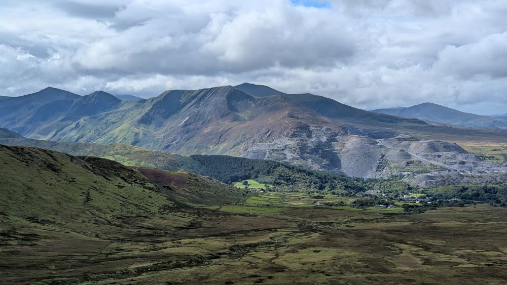
This is really one of the prettiest paths you can take up into the Carneddau. It starts from the village of Abergwyngregn, which if you’ve ever visited Aber Falls you’ll know really well. You will hike up to two summits, neither particularly well known or high – but the views are splendid from both and you’ll likely have the summits entirely to yourself.
How High is Gyrn?
Gyrn is 541.3 meters (1,776 feet)
How High is Moel Wnion?
Moel Wnion is 579.9 meters (1,903 feet)
So neither are quite big enough for my list of mountains over 2000ft in Eryri. but you do get to see quite a few of them on this walk.
This is not a walk up to Aber Falls… but you do get a beautiful view of them! (there are two!)
Route map for a walk up Moel Wnion via Gyrn

The footpath starts lower down in the village and often there are a few on road spaces. Do bear in mind though this is a tiny village! I’d steer clear on holidays and really sunny weather days when their will be crowds flocking to the waterfall car park and spilling over.
The start of the route is easy to find and the path is really clear until the point where you transistion from the low level Aber Falls Circular to the high path up into access land and the Carneddau. (get the OS Maps route link)

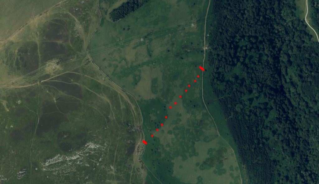
You’re far better off carrying on until you see a footpath heading up diaginally, quite a bit further on than the right of way path which starts at a gate just beyond a rectangular plantation of trees – it’s really obvious on the map and in real life when you see those trees. My red dots on the satellite map show which way I’d go if I did it again. The actual path meant wading through thistles and coming up against fences…
Have faith though as it’s so worth it when you get to that lovely access land!
Beware the Black Dotted Paths on OS Maps…
My initial route plan was to do a circular with far less of a ‘lollipop stick’ but unfrtunately one of the gates on the footpath was padlocked.

Black dashed lines represent physical paths on the ground that have been used by people but are not designated public rights of way, its legal status or right of access is not defined by the map. Green lines mean you have a legal right of way on the OS Maps App.
My intention was to carry on along this path to save doubling back. The red arrow shows my planned route but with a high stone wall and a locked gate I had to go back and find my way to the initial stile I had used to get off from the main diamond path and into the Carneddau. Note well that access land stops at this point – the chunky orange line indicates this!!! Don’t attempt to climb over any walls.

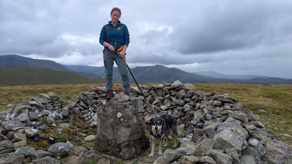
Moel Wnion is definitely worth a hike and from Abergwyngregn I think it’s one of the prettiest walks in North Wales up into the Carneddau.
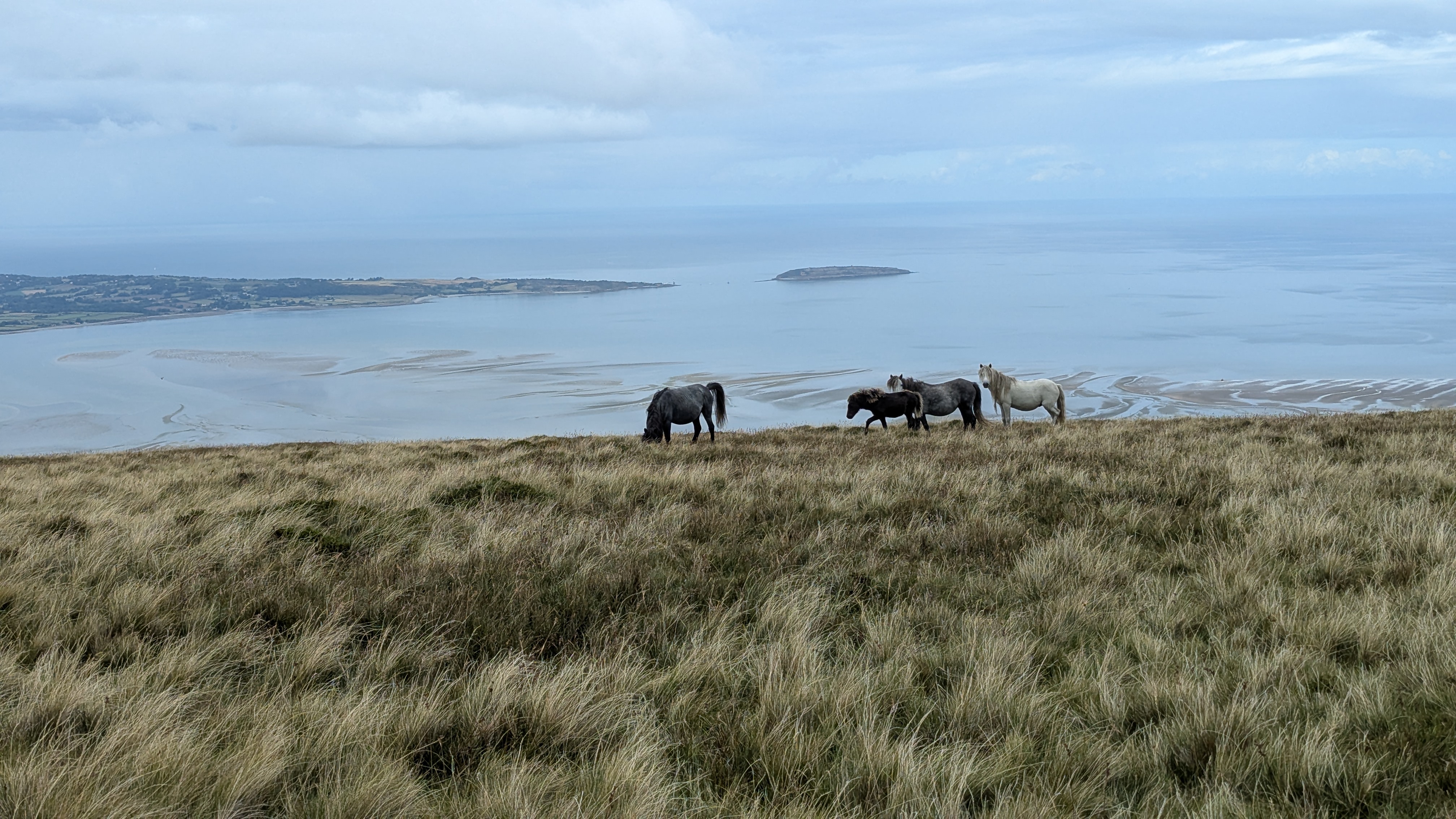
Be sure to look out for Carneddau Ponies – there are lots roaming around Moel Wnion.
Leave a Reply to Bera Bach from Abergwyngregyn: A Walk Above Aber Falls into the CarneddauCancel reply