
I absolutely love this short walk up Moel y Parc in North Wales. It’s the perfect gateway to the Bryniau Clwyd (Clwydian Range) with access to lots of routes if you want a days walking.
A great short walk in Bryniau Clwyd, North Wales, ideal for little legs or when you don’t have all day
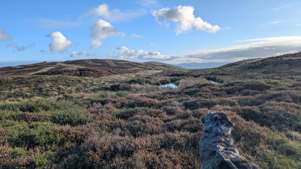
The beauty of this route is you can just be up and down Moel y Parc in an hour if you dont have much time, great for a sunset or sunrise walk. There are no really steep sections either, which makes it a nice leisurely walk. Within just a few minutes from parking you are already getting epic views and they only get better as you reach the top of Moel y Parc. On a good visibility day the whole of Eryri will be on show for you too.

Where do you park for Moel y Parc?
Parking and Route Options
You can start this circular route from either of the two parking areas listed below. If you prefer a shorter walk, the route can easily be adapted into a quick “out and back” from either spot.
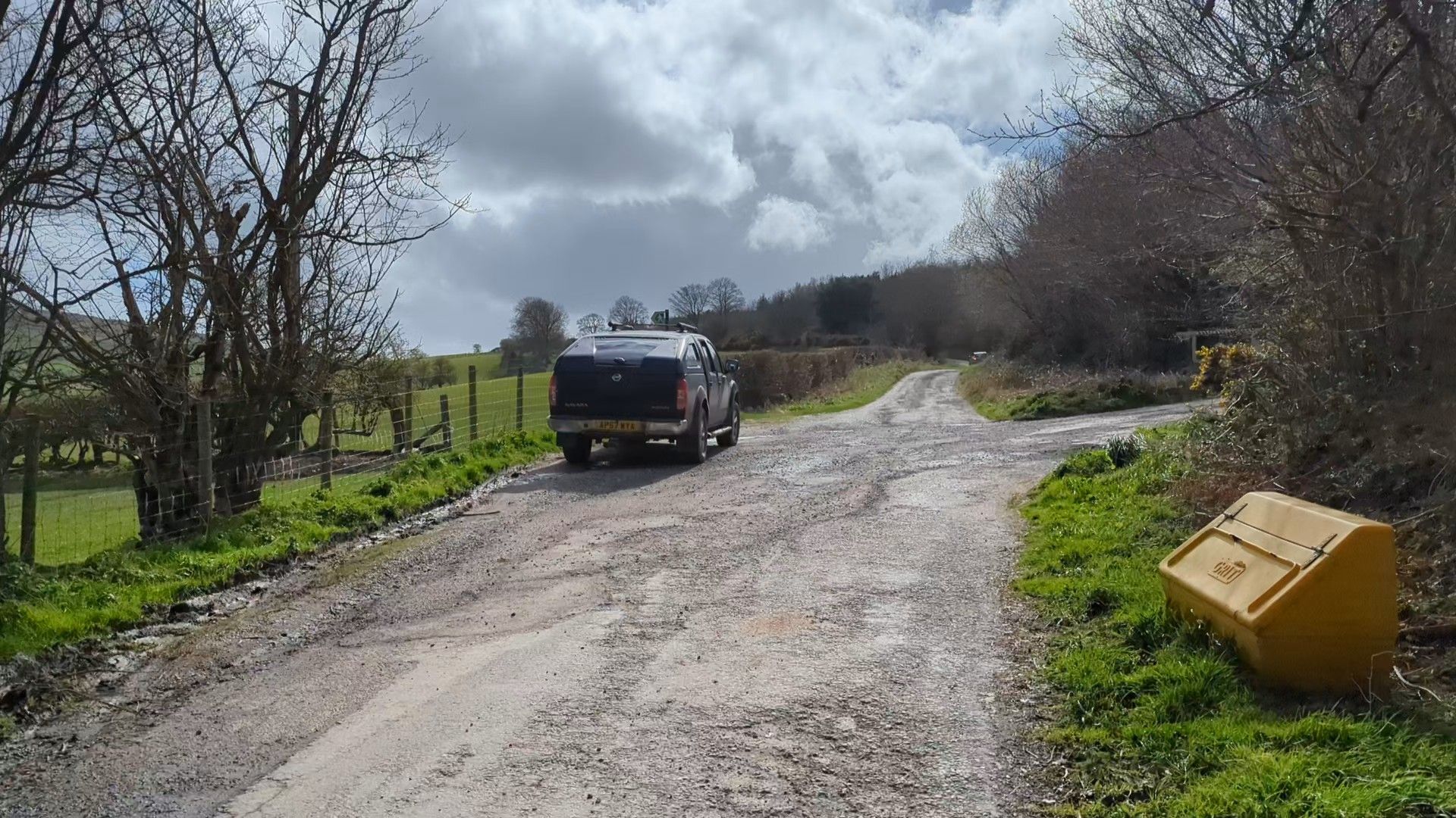
Both parking areas are accessed via the same steep road off the A541. Please take extra care during icy weather.
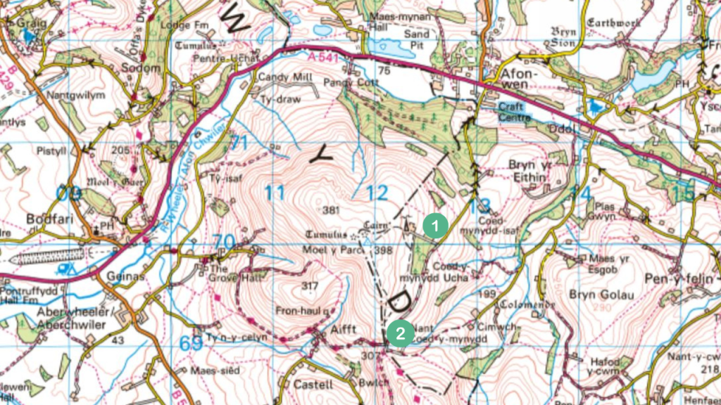
- Option 1: The Transmitter Layby Located directly opposite the entrance to the Transmitter Station. This is a small roadside pull-in with space for 4–5 cars. (open in Google Maps)
- Option 2: The Higher Parking Area Continue past the first spot onto a farm track. While accessible for most cars, this section has large puddles and potholes – drive slowly! This is a larger, unofficial but completely legal parking space with room for about 6 cars. (open in Google Maps)
Note: While these spaces are small, Moel y Parc is generally quiet, and you will likely find a spot without much trouble.
Are there stiles on the Moel y Parc walk?
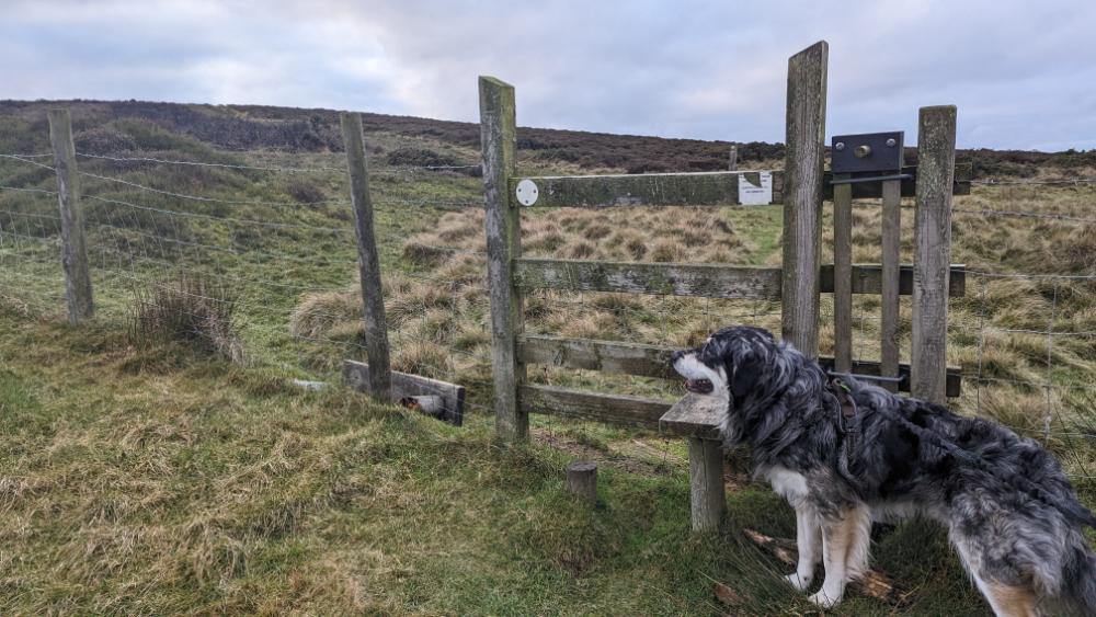
Yes, the route shown below has two stiles and a couple of swing gates. Both of the stiles have dog gates. There are sheep and sometimes cattle grazing in these hills, as well as nesting birds, it’s best to keep your dogs on a lead.
How high is Moel y Parc?
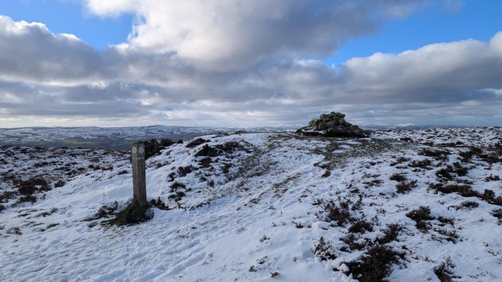
Moel y Parc is 398 m high (1306 Feet). However the trig pillar at the summit is sadly fenced off in a field. Instead you head to the obvious cairn which most people happily accept as the top. I bet a few trig baggers have hopped over the fence to pat the trig but its not within access land so it would be trespassing if you did that.

What is the mast on Moel y Parc for?
It’s primarily a TV mast but also now has 4G and 5G transmitters. If you’ve ever driven in North Wales you will most likely have seen the mast lit up red at night like a huge beacon. It always makes me feel I’m close to home when I spot it from the M56 or the A55.
The huge TV mast was built in the 1960’s. According to wikipedia Moel y Parc Mast is the tallest structure in Wales at 229 metres (751 ft) (not sure that’s true but it’s definitely one of the tallest!)
The Route to Moel y Parc Summit – step by step guide

This Moel y Parc walk starts with a gentle incline, making it one of the most accessible routes in the Clwydian Range.
From the parking area opposite the Moel y Parc transmitter station, follow the lane for a few minutes until you reach a stile on your left. Cross the stile and head through the trees; you’ll emerge into a grazing field with the iconic mast visible to your left.
Follow the fence line uphill until you reach the second stile. Once crossed, you are on open access land. While you can explore freely, I recommend staying on the well-trodden paths, the heather here is thick and can be quite scratchy on the legs!
After the stile, turn left onto the main path. Look for the small waymarker confirming you’re on the right track for the top. This section of the footpath is fairly wide and takes you through beautiful purple heather (in the summer) and leads you directly toward the top – it would be hard to go wrong.

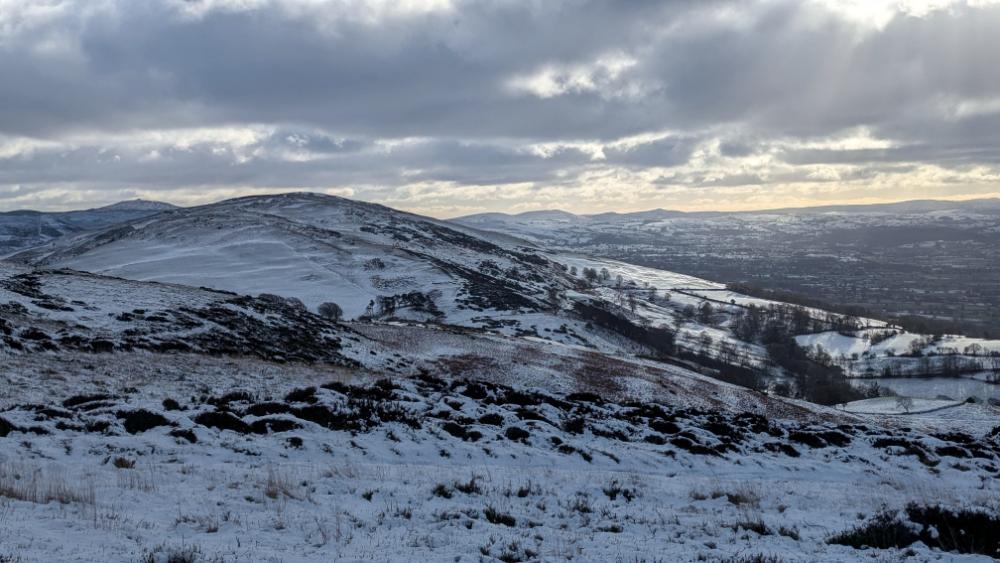
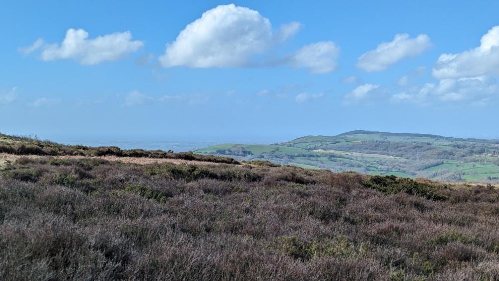
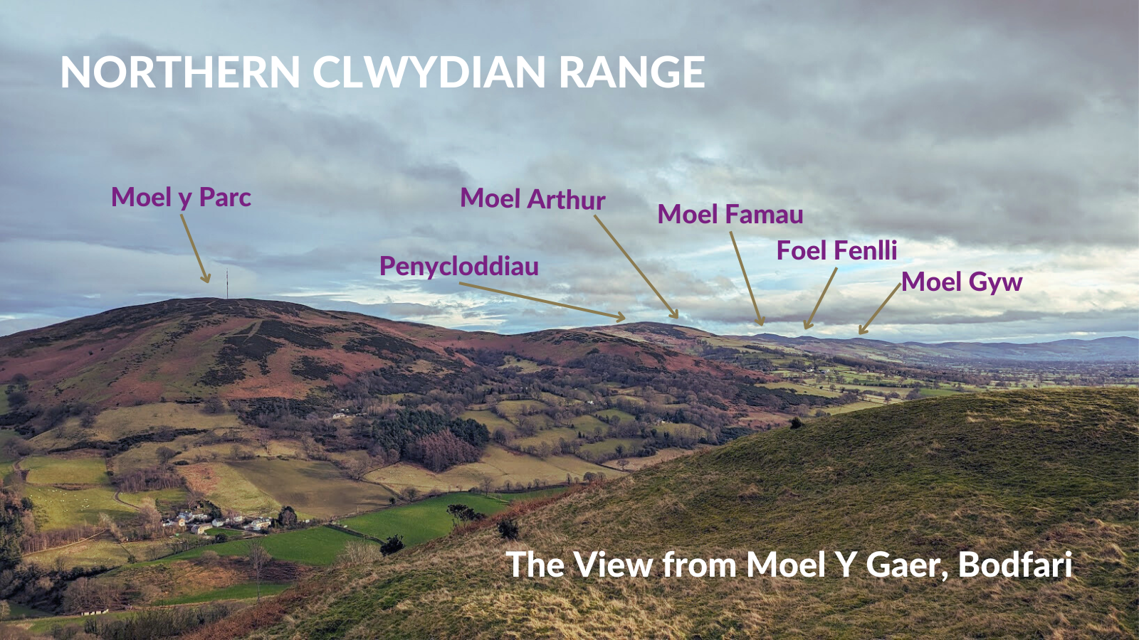
Be sure to look back! As you gain height, you’ll be rewarded with incredible panoramic views of North Wales and the North West of England. It is one of the best vantage points in the Clwydian Range and Dee Valley National Landscape in my opinion.
Reaching the Moel y Parc Cairn
Once you reach the summit area (remember the trig pillar is on private land) and you’ve taken in the spectacular views of the Vale of Clwyd, the North Wales Coast and Eryri, you’ll find plenty of options for extending your Clwydian Hills hike:

- Turn right to find a path leading to some interesting rocky outcrops perfect for hiding from the wind and having a snack.
- Head straight on to join a section of the famous Offa’s Dyke Path, which connects many of the Iron Age hillforts in the area.
- The Clwydian Range AONB is crisscrossed with fantastic footpaths. If you have the time, check your OS Map (Explorer 265) to find the perfect detour!

Completing the Circular Route
To keep this as a short circular walk, bear left at the top and follow the descending path and fence line toward the second parking spot. This also connects you to the Offa’s Dyke Path which wraps around the flanks of Moel y Parc.
From this 2nd parking spot, you can see paths branching off toward Penycloddiau Hillfort or the lower scenic tracks to Llangwyfan (you can find more details in my Penycloddiau Circular guide).
To finish this specific Moel y Parc loop, keep the mast on your left and follow the farm track back to your starting point.
Leave a Reply