Moel Siabod Walk – a guide with photos and route maps
In this post you will find an illustrated guide to walking up Moel Siabod including a video guide for the Daear Ddu Scramble, scroll down or CLICK HERE to avoid all the FAQ’s about this popular mountain in Snowdonia and go straight to the Moel Siabod route guide or click here to go direct to the Moel Siabod video guide.

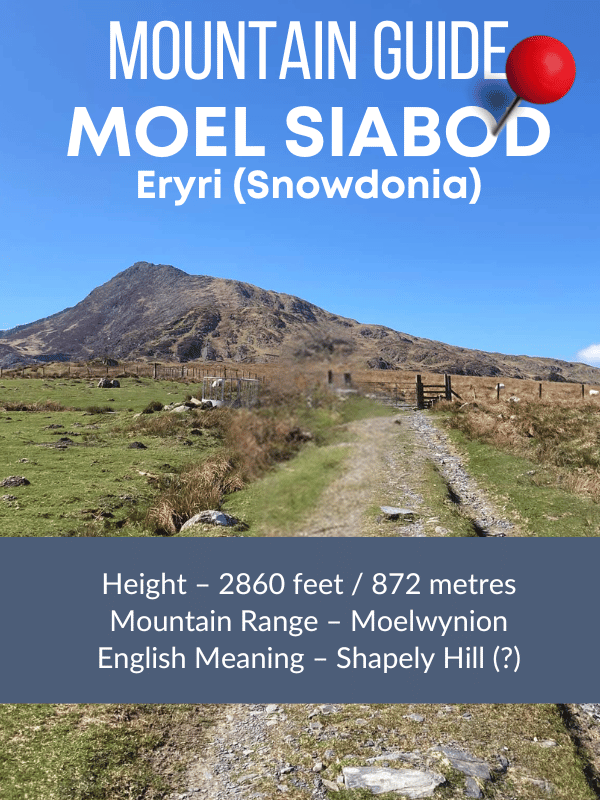
Moel Siabod is one of the most prominent mountains in Snowdonia and is the first big peak you will meet as you travel from Betws-y-Coed into this beautiful mountain range. It stands alone as it is actually part of the Moelwynion Mountain Range rather than one of the closer Carneddau or Glyderau.

Height – 2860 feet / 872 metres
Mountain Range – Moelwynion
English Meaning – Shapely Hill or Shabby Mountain
Moel Siabod Weather (updated at midnight every day)
If you’re looking for a great walk in North Wales with free parking then Moel Siabod should definitely be on your short list.
How do you pronounce Moel Siabod?
Moel Siabod is pronounced – MOIL SHA-BOD (don’t say mole see-ab-od please!!!)
How long does it take to walk up Moel Siabod
This circular route via the Daeaer Ddu Ridge takes from 4 to 5 hrs for most people. On the OS Maps Route – Moel Siabod Circular it states 4hrs but this doesn’t take into account stopping for snacks and rests.

How high is Moel Siabod?
The summit stands at an impressive 872 meters (2,861 feet) above sea level. This makes it the 22nd highest mountain in Snowdonia, it’s a popular destination for hikers and climbers but not as busy as the peaks around Yr Wyddfa or those accessed via the Ogwen Valley. I only saw a handful of people on both occassions I have walked up it in the last few years.

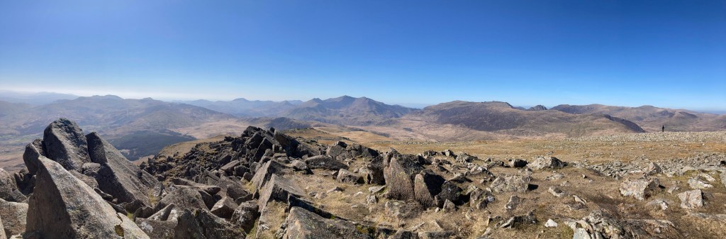
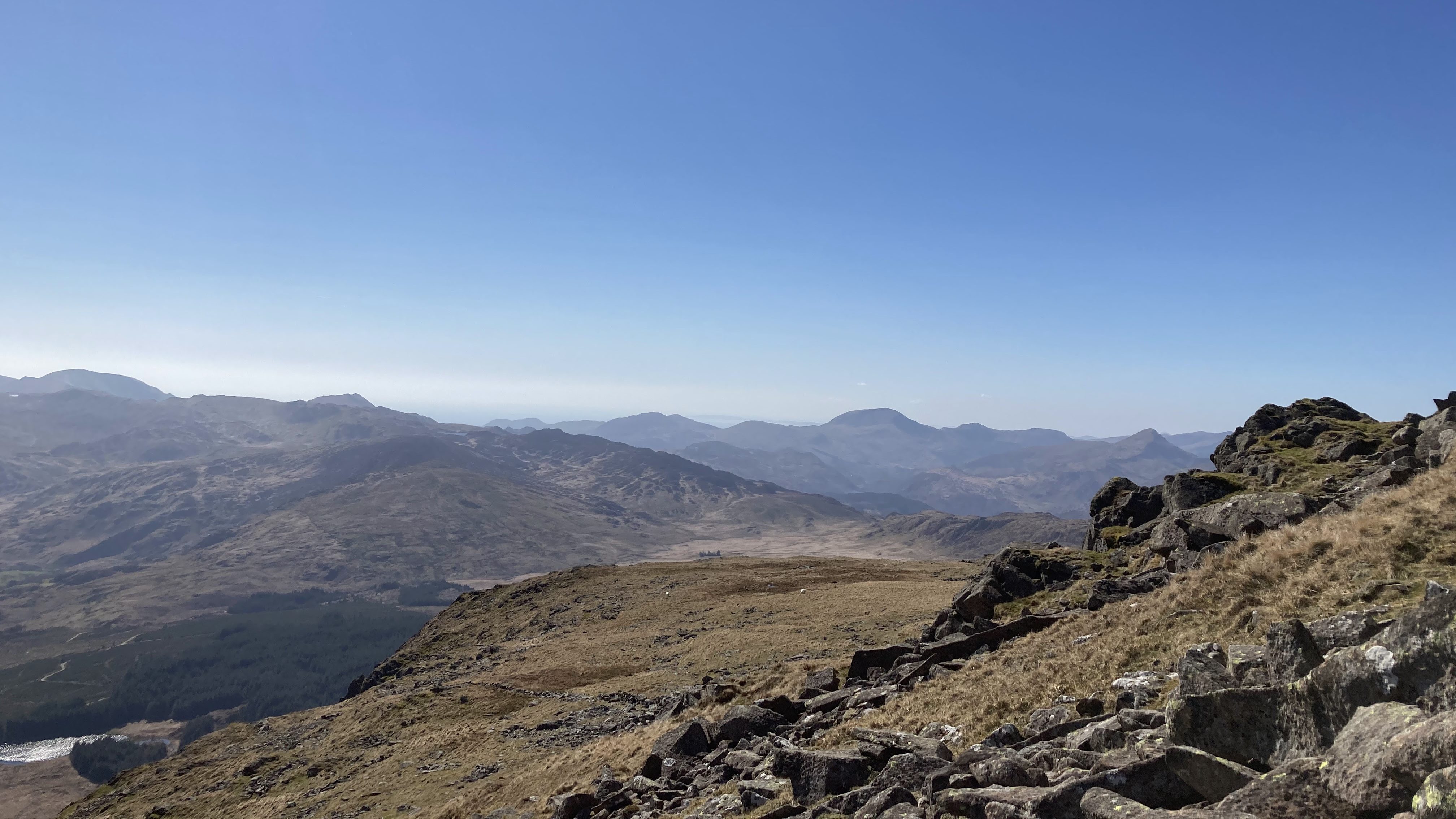
From the summit of Moel Siabod you will find stunning views of the surrounding mountains, including the famous peaks of Yr Wyddfa (Snowdon) and Tryfan which are so easy to pick out. On a clear day, you can see all the way to the coast.
Is Moel Siabod Hard?
No it’s not particularly difficult. HOWEVER! As with all mountain walking you will need a generally good level of fitness as the paths are steep in places and you should avoid it in poor weather conditions unless you have experience of navigating in zero visibility – aka you can use a compass and work out where you are (if you can’t do that then just go on a sunny day and make sure you have plenty of daylight for getting back down)
Is the Daear Ddu Ridge a Difficult Scramble?
It’s considered to be a grade 1 scramble which is the easiest, so it comes down to your experience scrambling. If you decide to go up the actual top of the ridge you will be scrambling, however you can avoid the scramble by taking the path that goes around the back of the ridge so this route is fine for taking dogs or for anyone who doesn’t fancy scrambling.
Daear ddu Ridge Video Guide
I recently rewalked the Daear Ddu Ridge and created a video giude with my honest experience of hiking up it with my dog Ziggy.
Moel Siabod Parking – where to park for the circular route
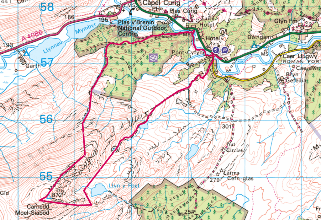
For the route described in this blog post park at Bryn Glo A5, Capel Curig, LL24 0DT (You can see this on the far right of the map below where the start and finish flags are). It’s easy to find with a big Bryn Glo sign and there are around 20 spaces so if you’re early you should be fine. The car park is FREE! (hooray)

If you’re unlucky and that car park is full you could adapt the route by parking in a layby near Plas y Brenin (see map above) and then walking to the path from there or parking at the car park in Capel Curig which also has a public loo, you will still be able to make the route circular it will just take you a little more time to get onto the path up Moel Siabod. Look out for the bridges on the A5 and at Plas y Brenin to get onto the route (shown in red)
What does Moel Siabod mean in English?
The name Moel Siabod is commonly said to translate to “shapely hill” and it certainly lives up to that name with its distinctive shape. However, this translation has been debunked by many who actually believe it’s more likely to be Shabby Mountain! (There’s nothing shabby about it – it’s a stunner!)
On wikipedia it says
The name Moel Siabod is wrongly translated as shapely hill, although William Williams in Observations on the Snowdon Mountains (1802) proposed that the name comes from siadod, meaning ‘bare hill, whose head or crown is covered in new-fallen snow’. J. Lloyd-Jones of Dublin University, in his Enwau Lleoedd Sir Gaernarfon 1928 (Cardiff), favours Middle English origin ‘shabbèd’, ‘shcabbèd’, ‘shabbid’, ‘sceabbed(e)’ (‘scabbed’ Modern English), therefore proposes a shabby, scabby, scarred mountain.
Moel Siabod Circular Route
You can find the OS Explorer Route Guide here – Moel Siabod Circular from Bryn Glo Car Park
You can check the Moel Siabod Weather including wind speed and cloud elevation here – Moel Siabod Weather Report

Start the walk from Bryn Glo Car Park, cross the road and turn right from the car park up the hill, taking a look at the spectacular river to your left. When you reach the bridge cross it and carry on along the track until you see a track heading up through the trees.
Keep walking on this track until you see a sign for a detour, this takes you around the farm and then back onto the track again.
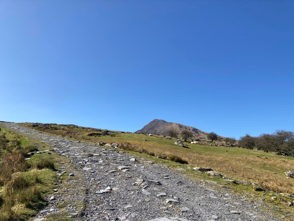
Keep walking up this track until it turns into a smaller path and you pass a lake to your left. You’ll go past some old stone buildings to your left, the remains of quarry mens cottages.

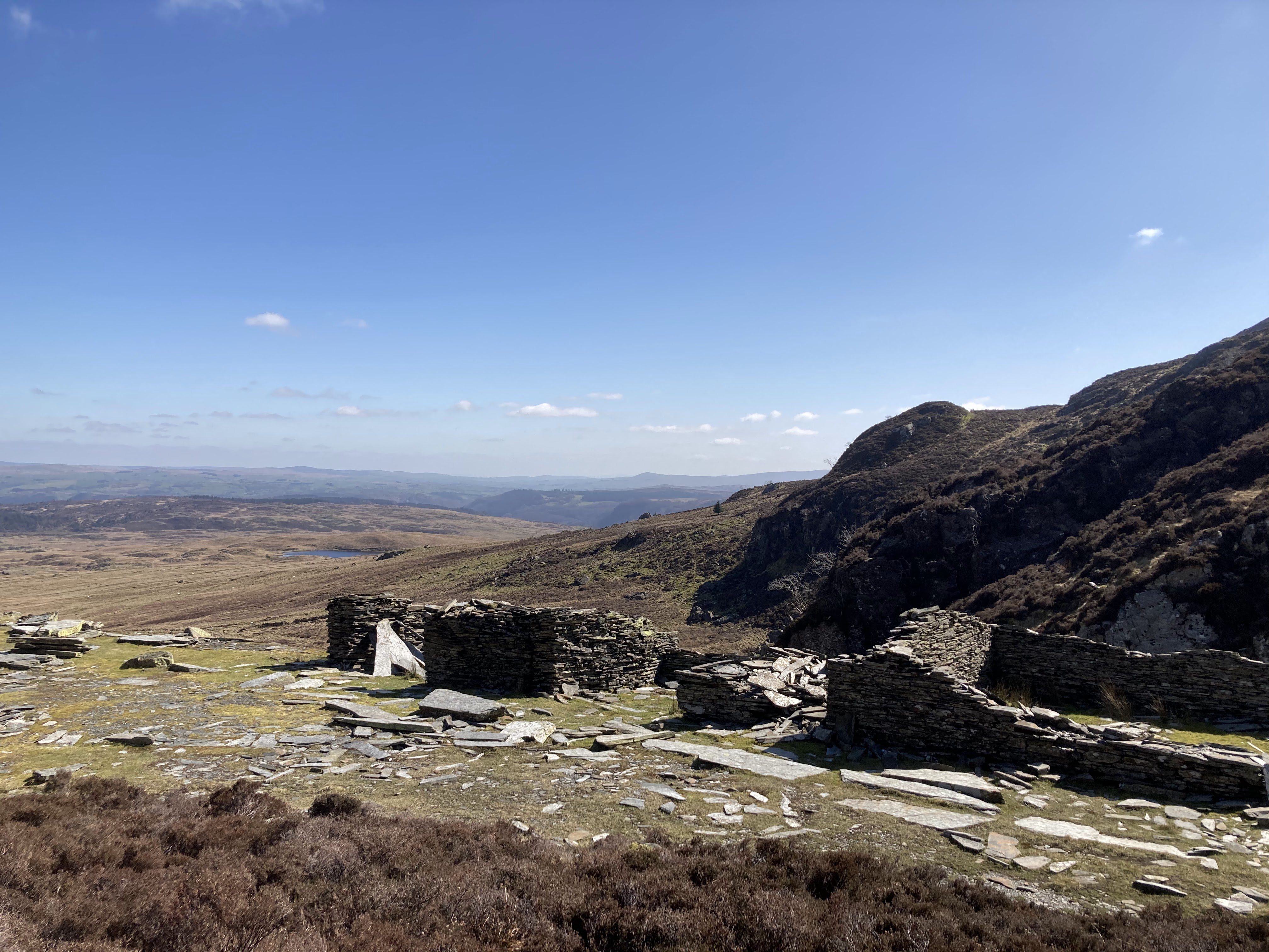
The path rises gently as you head up to an old quarry pit that now is filled with water and has attractive waterfalls filling it up.

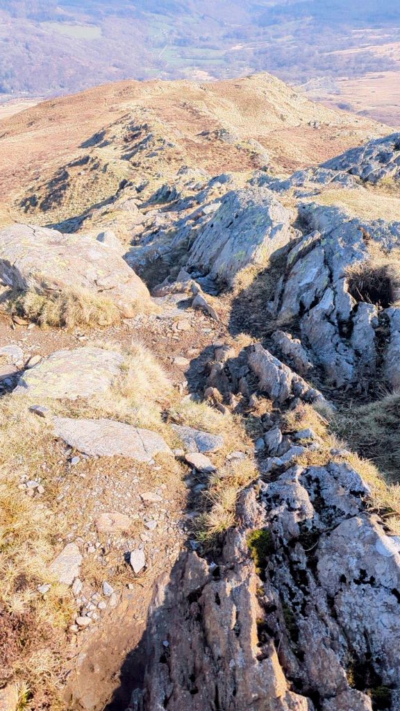
Keep on the path until you see Llyn y Foel ahead of you. The path is to the right of the lake and due to the boggy nature it disappears, keep the lake to your left and head towards the start of the Daear Ddu Ridge where a more obvious path can be seen.


At this point you can choose to take the easier path round the back to the left of the ridge or scramble more directly up the ridge. If you choose to scramble you can pick your route. There’s no need for scrambling if you take the path and at any point you can choose to scramble up a more direct route to the top. I’ve created a video guide for the Moel Siabod Scramble here.

Keep heading around and up on the easier path. When you see a fence you should walk up along it until you see a stile, climb over the stile and keep walking until you see the Trig Point on your right, it’s higher up in the rocky area.

To the left is a stone circular shelter, it can get wild on the top so it’s a nice refuge out of the wind until you start your descent.
You want to walk along from the Trig (away from the direction you have arrived) keep the drop down to Llyn y Foel on your right. At this point there is also another option to ascend back down more directly to the car park avoiding the river walk but it is a much steeper ascent. Click here to see this alternative descent.

After a few minutes of walking you will start to see a path heading diagonally down the slope to your left side. It’s a clear gravelly path that takes you very straightforwardly down to the woods at the foot of Moel Siabod.


The red arrow shows the path off Moel Siabod you have come down from and into Coed Bryn-engan. I’ve added two red crosses on the map to show the other bridges you can use if you wish to head to Llynau Mymbr for a dip or have a look around Capel Curig – there’s a fairly new outdoors shop called Joe Browns which has public loos at the back of it.


You will reach a tarmac track, turn right and head along keeping the river to your left right up until you reach the bridge which you first came across.

The walk back to the car is very attractive and on a summers day would be perfect for a quick dip in the river.
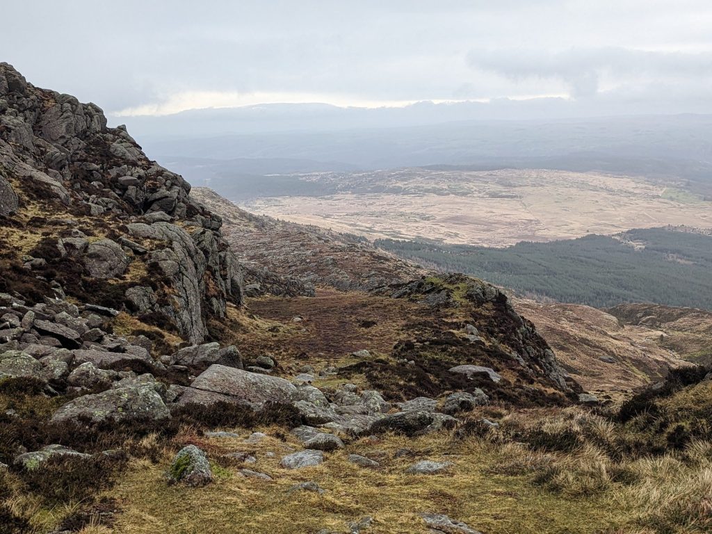
Alternative Quicker Descent Down Moel Siabod

This route is quicker than the route oulined above but the path down is steeper and has a little scree in places. If you’re looking for the easiest way down then go with the route above rather than this more direct route. As you can see from these pics below it is a little steep – I thought it was more enjoyable than the easier route.
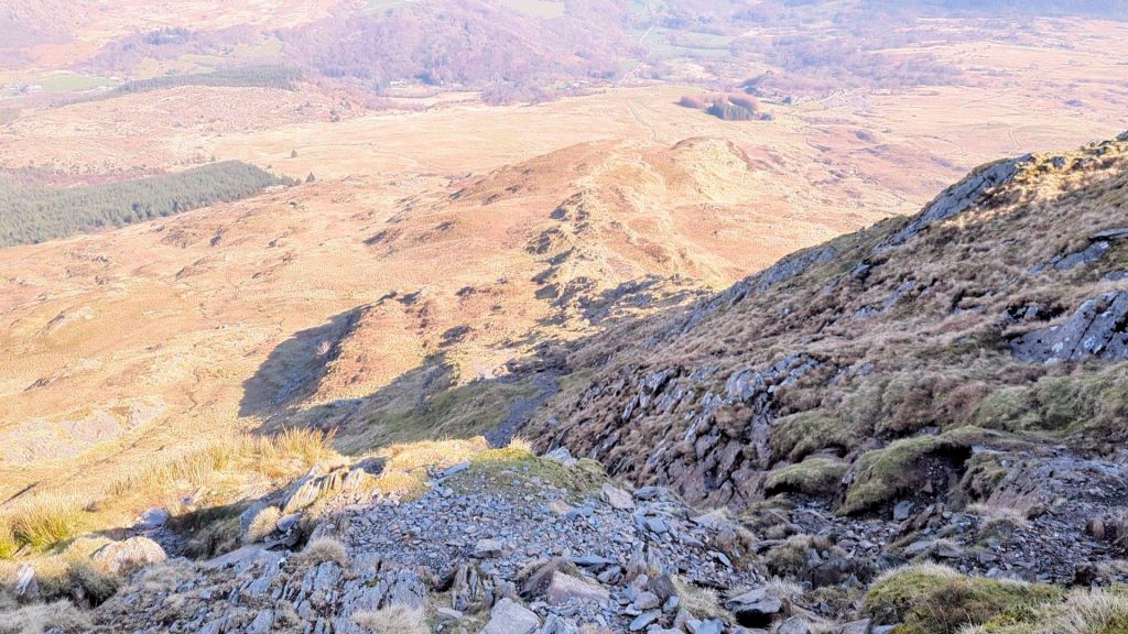


It’s not a difficult route down Moel Siabod and the path is easy to find, it’s just steep and can be slidy on a wet day as there are both grassy and rocky sections. It is more direct and cuts out quite a bit of time. Let me know in the comments if you have any questions and be sure to watch my Daear Ddu Scramble Video guide if you are planning this walk and want to decide on which route to take.
Follow me on Instagram @nearlyuphill for more inspiration for your next great walk in North Wales! (or beyond – I do get further afield sometimes!)
Leave a Reply to Seven Mountains To Walk in North Wales instead of SnowdonCancel reply