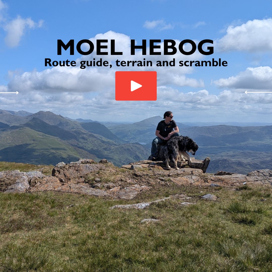
Moel Hebog – a stunning walk in North Wales
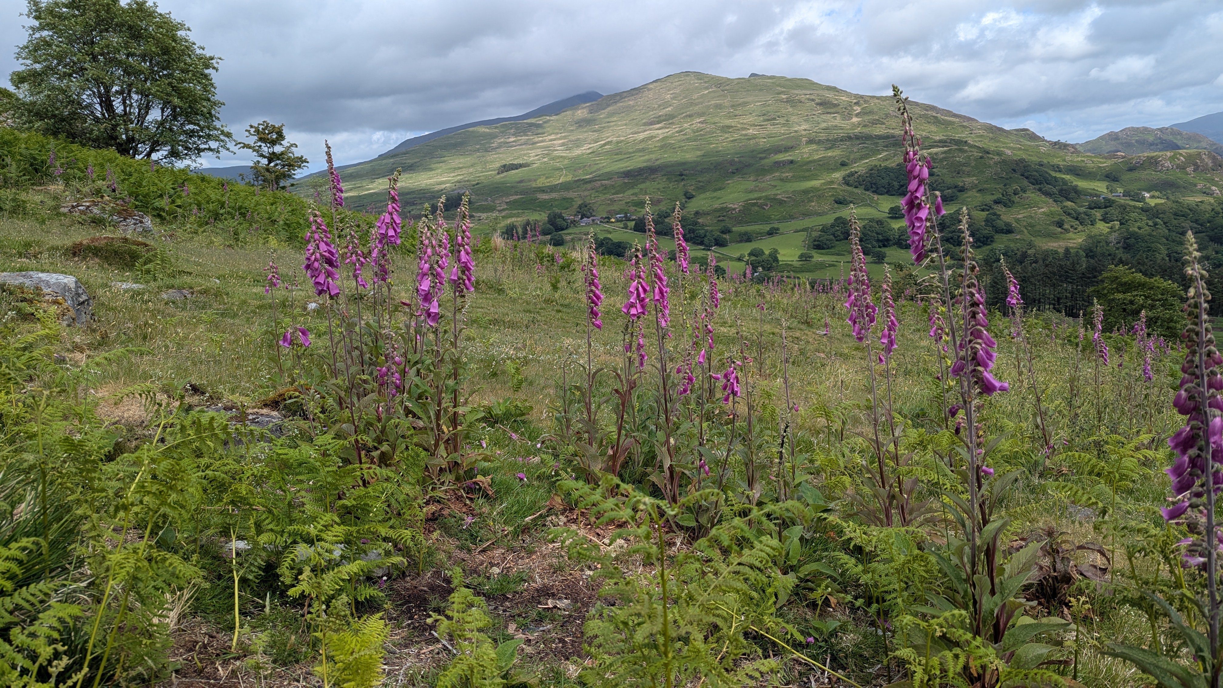
Moel Hebog is a beautiful mountain in Eryri (Snowdonia) National Park. In Welsh Moel Hebog means “bare hill of the hawk”. I didn’t see any hawks but I did see a few buzzards and heard a woodpecker. It’s a beautiful walk and in spring I’d challenge you to find anywhere there are more pretty purple foxgloves growing, they’re stunning!
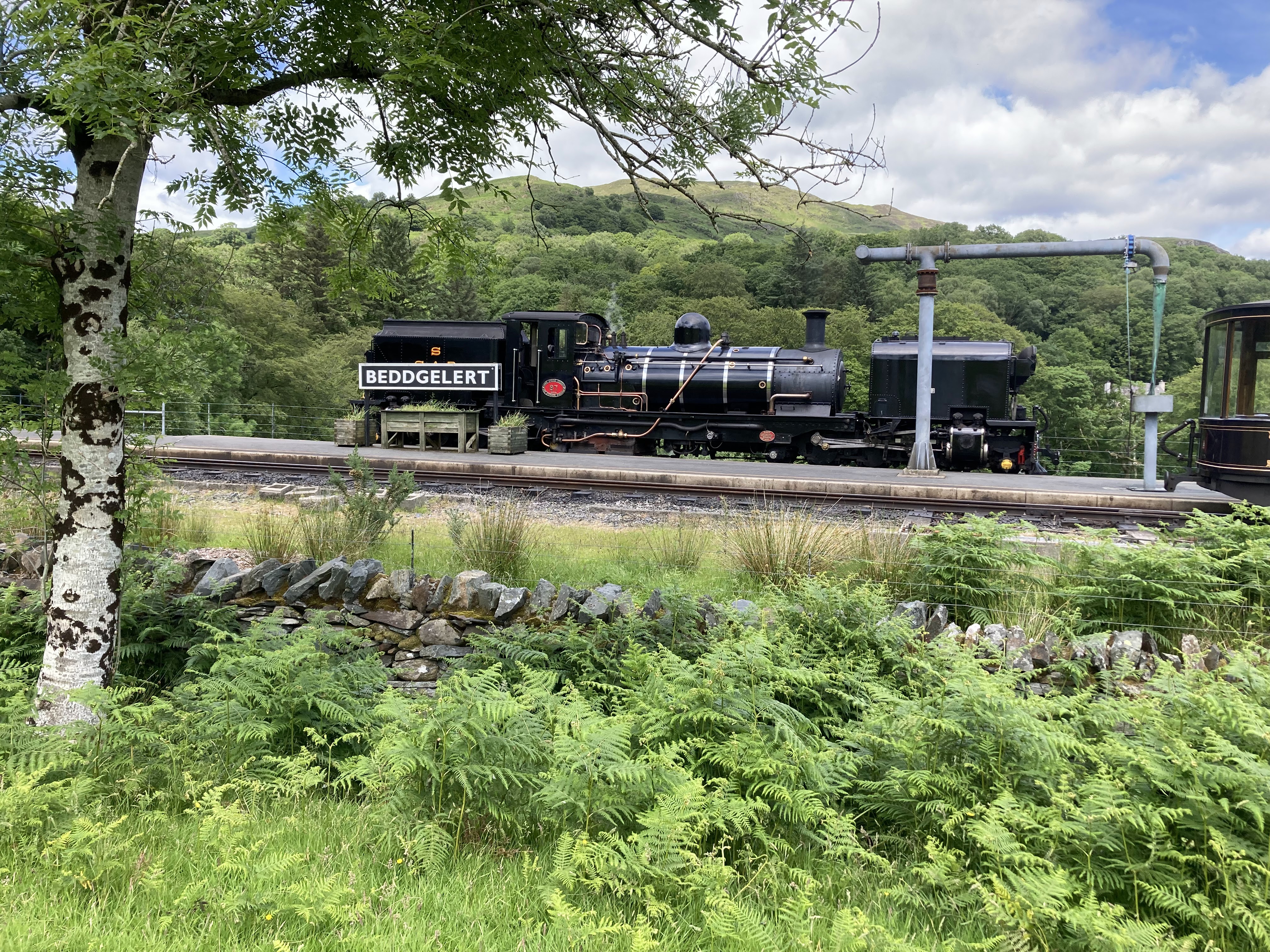
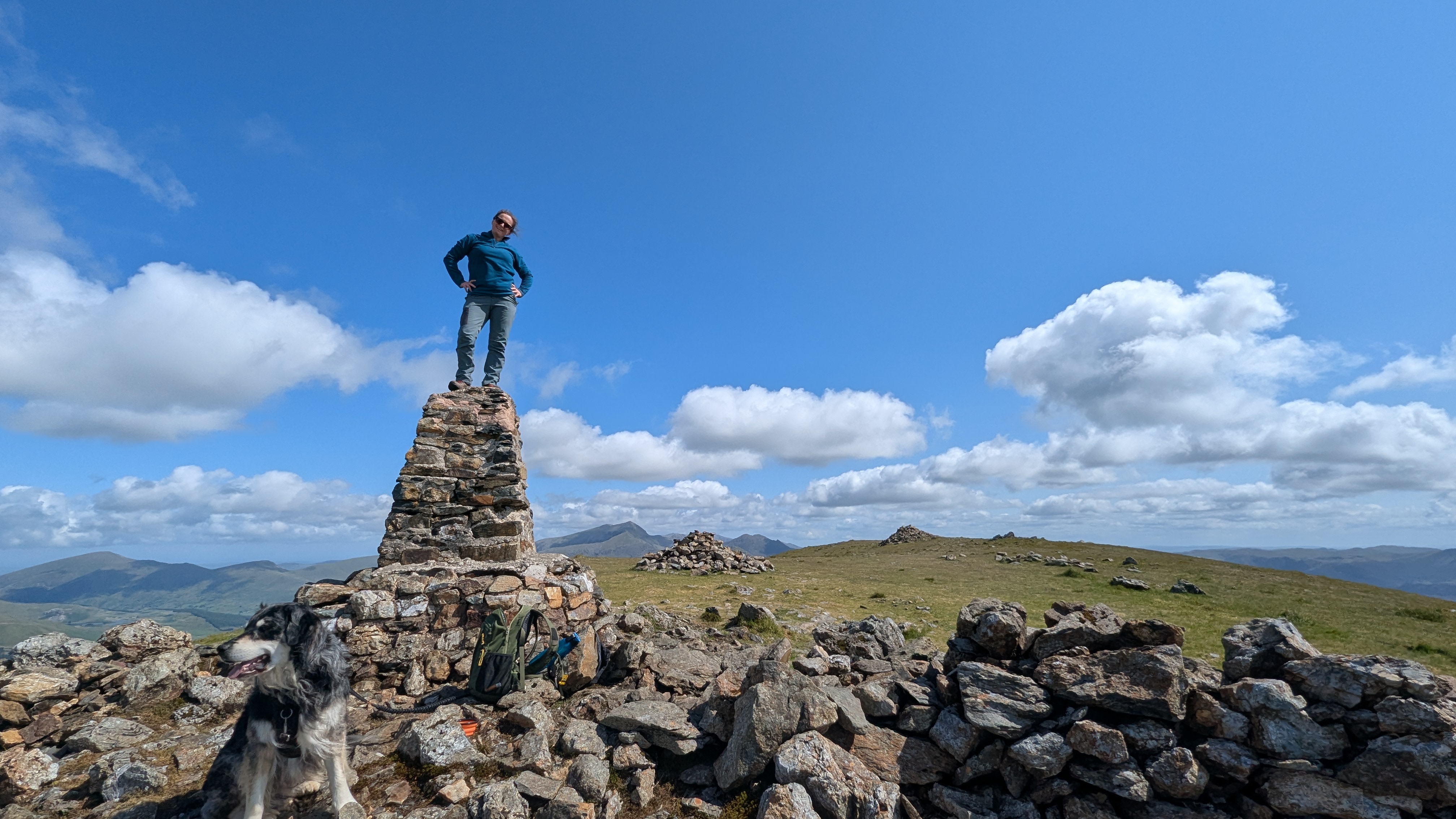
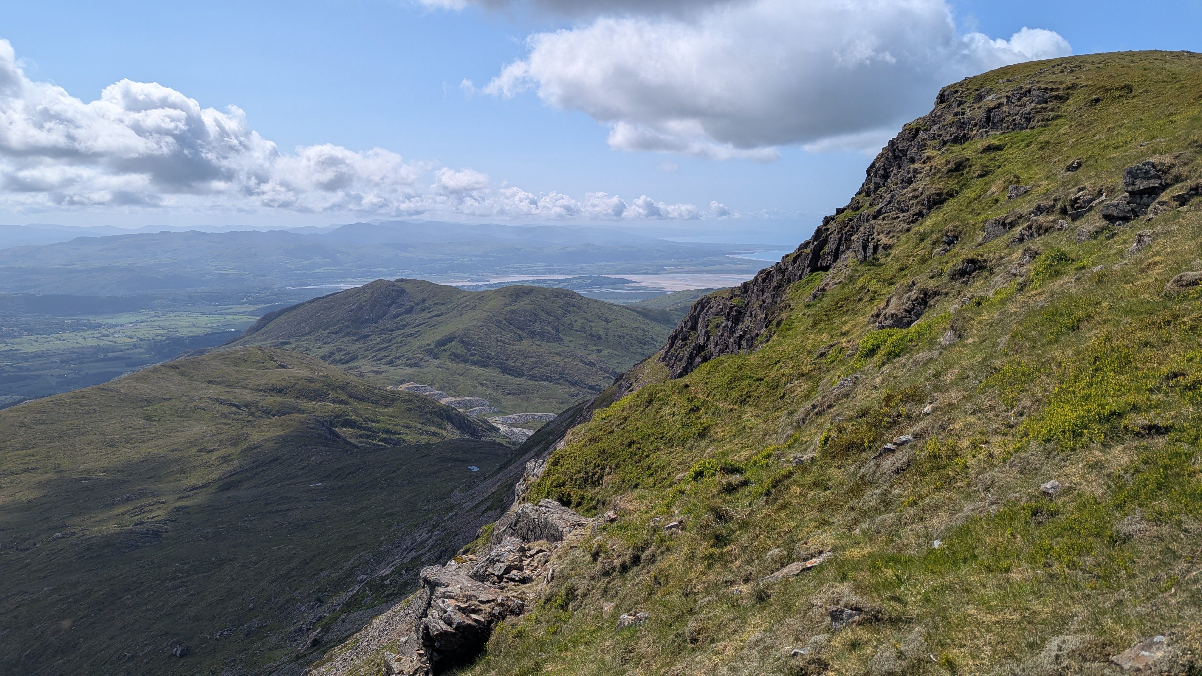
There’s a lovely weather-beaten Trig Pillar at the summit and the views of Eryri are spectacular. As you walk up you’ll see the Nantlle Ridge, Yr Wyddfa, Cnicht and many more. An added bonus is the occasional (and slightly haunting) sound of trains tooting on the Ffestiniog Railway. It’s the world’s oldest narrow gauge railway.
The Moel Hebog route in this post is a straightforward out and back starting in Beddgelert, you can find the OS Map Route below.
How high is Moel Hebog?
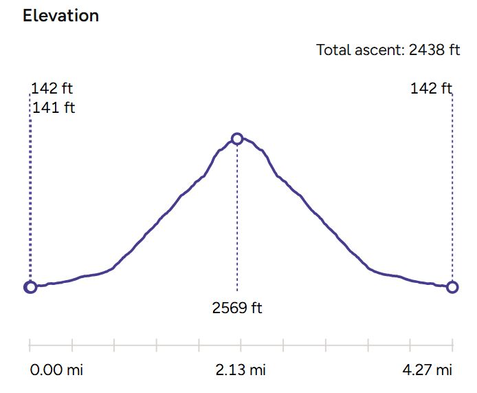
Moel Hebog is 783 meters (2,569 feet) above sea level, the total ascent if you walk from Beddgelert is 2438 ft.
Is Moel Hebog a scramble?
The walk up Moel Hebog involves some very steep sections, with rocky, loose terrain, and some very light scrambling. I wouldn’t really call Moel Hebog a scramble though, you may need your hands very occasionally on the steep section up to the summit. You’ll need a good level of fitness. If you are inexperienced in navigation, save this route for a clear day.
Where do you park to walk up Moel Hebog?
The most common starting point for walking up Moel Hebog is from Beddgelert. There is a fairly large pay-and-display car park in the village centre.
Moel Hebog Route Map
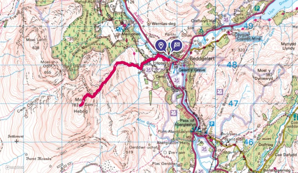
I’ve plotted the route I took up Moel Hebog on OS Maps. If you’re a premium member, you can see the topographic mapping up to 1:12500. It’s a larger scale than a standard paper map. This is really useful when navigating.
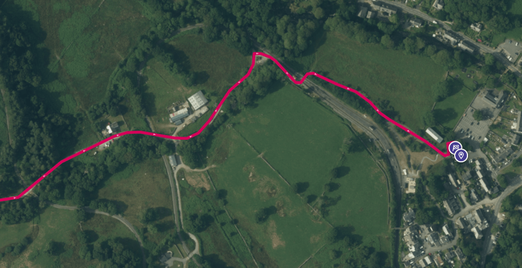
If you are parked in the public car park, take a footpath off to the right and then under the train tracks on an underpass, this then takes you to a farm track which leads up to the start of the walk up Hebog. There is a sign on the gate to show you the point at which you turn off the track and start heading up Hebog.

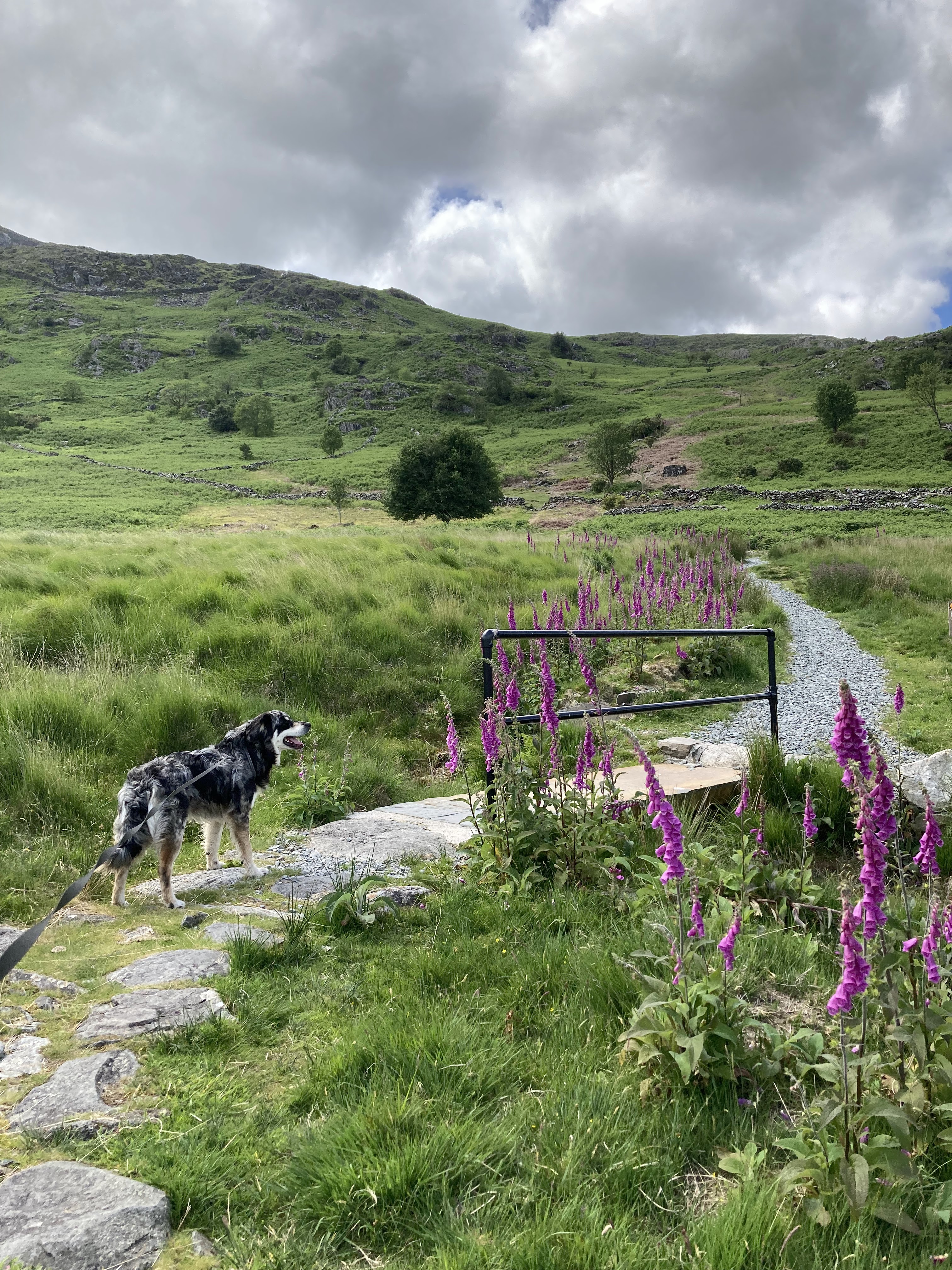
If you have good visibility the path is very clear on the ground. After the path forks up to the left you have clear sight of the summit. Pass through a swing gate and then continue on the path on the left side of the mountain up a zig zag path. The path is all scree with just a few sections that may require using your hands. I wouldn’t really call this a scramble, it’s just very lose rock. Watch my video to see all the terrain on the walk up Moel Hebog.


Leave a Reply to AlittlebitoutoffocusCancel reply