
This is one I’ve been itching to try for ages, and now it’s tried and tested by me. In this post I’ll be talking about the short bit of scrambling up to the summit of Pen yr Ole Wen using the Cambrian Way Path.
I’ll also share details of the route I took off the summit of Carnedd Dafydd via an unofficial route that isn’t on OS Maps but, in good dry conditions, makes a perfectly viable way to stitch together a nice 4‑hour loop taking in Pen yr Ole Wen and Carnedd Dafydd.
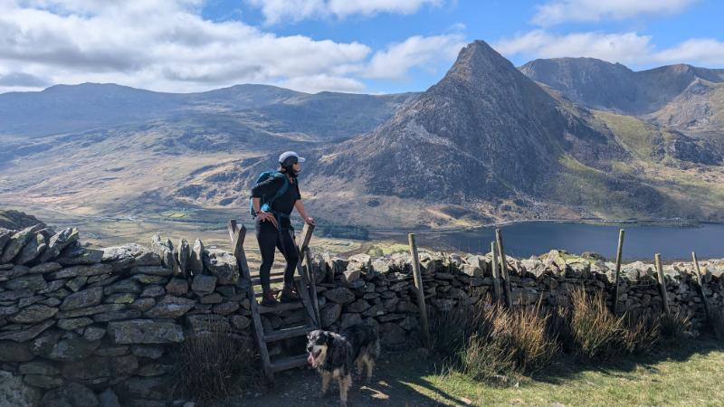
If you love the mountain Tryfan then this is an excellent route as the view is dominated by it the entire way around.
Watch the Video Guide
Jump straight to the route description here – Step by Step Guide Cwm Lloer Circular

FYI: Carnedd Dafydd is the 4th highest mountain in Wales and England – it’s quite a bit bigger than Scafell Pike so a real achievement on a short days hiking.
Of course if you have much longer you could carry on to Carnedd Llewelyn and Pen yr Helgi Du before dropping down back to the A5, but the route below gives you a shorter option of around 4hrs give or take.
For an even shorter option you can simply just walk up to Ffynnon Lloer – a great option for a route with young kids away from some of the more honeypot walks like Cwm Idwal.
Parking for Pen yr Ole Wen and Carnedd Dafydd Circular
There’s plenty of parking at the foot of Tryfan in a long layby – open it on Google Maps here – Parking for Pen yr Ole Wen.
NB. On sunny weekends and holidays assume you’ll need to be parked by 8am, or use the bus service / park and ride because everyone else will be heading up Tryfan and into the busier Glyderau. You, though, will be heading into the much quieter Carneddau and enjoying spectacular views of the Glyderau from the opposite side.
How tricky is the Cwm Lloer Ridge Scramble up to Pen yr Ole Wen?
Just because it’s a ‘green- diamond’ recreational route on the map don’t expect it to be easy. I’m experienced at scrambling and found the scramble up to Pen yr Ole Wen to be ok with my large dog Ziggy.
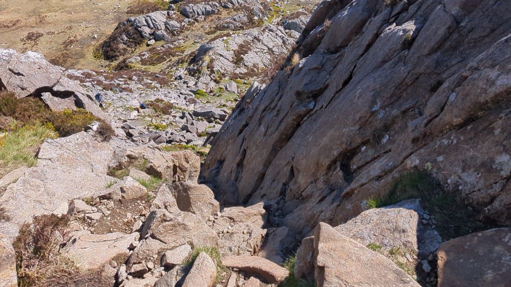
It was a sunny fairly windless day in May when i walked this route and at no point did I feel exposed to any precipitous drops. I personally would not take this route in low visibility/rainy conditions – but that’s because I mainly walk for the views. IF you have the right gear and experience it would be fine in snow / ice. There are plenty of evidence of crampon scrapes on the rocks. Just stay within your own limits.
The scramble is not very long (around 10 minutes of actual scrambling) and mostly just rock steps. At 5ft tall I was at full stretch in one section (red arrow)and it definitely felt like a good work out. The path was fairly easy to pick out if you have a little experience scrambling, but could be daunting for inexperienced hikers.

The Geology of Cwm Lloer
Cwm Lloer is shaped by Ice Age glaciers that carved out the cirque and left Ffynnon Lloer (the small lake) sitting in a bowl of tough Ordovician rock. If you want to understand how all this rock and ice shaped Eryri into the landscape we see now, you can read my geology post here: How Was Snowdonia Formed and Why Is It So Rocky & Jagged?
Step by Step Guide to the Cwm Lloer Circular
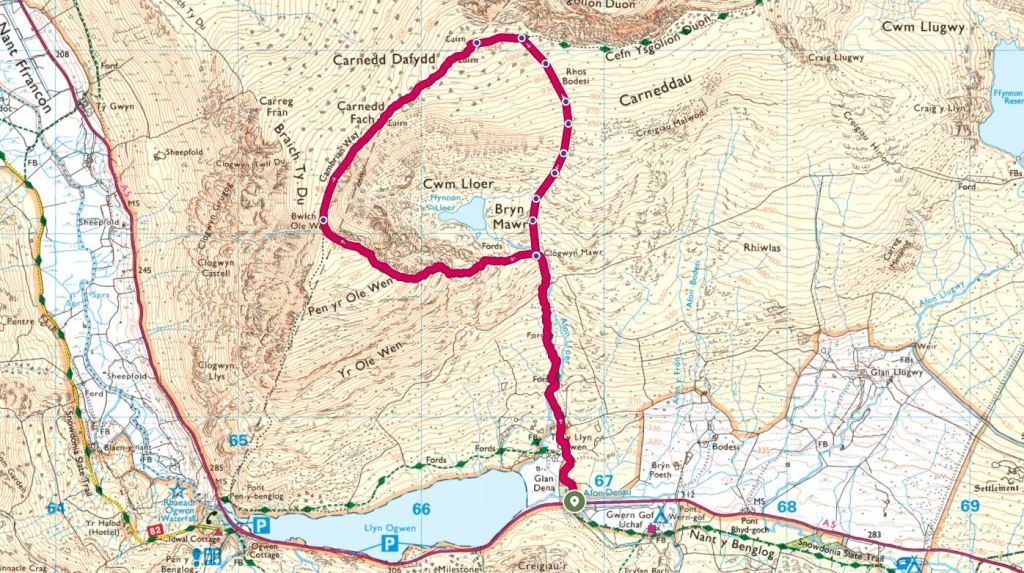
Once you’ve found a space to park on the A5 (hopefully as close to the start at Afon Lloer as possible to save too much road walking) you’ll see a footpath sign and need to head up the track past some accomodation and then through a swing gate onto the mountain.
Llyn Ogwen is to your left as you look up towards Cwm Lloer. Tryfan behind you offers amazing photo opportunities all the way around this route.
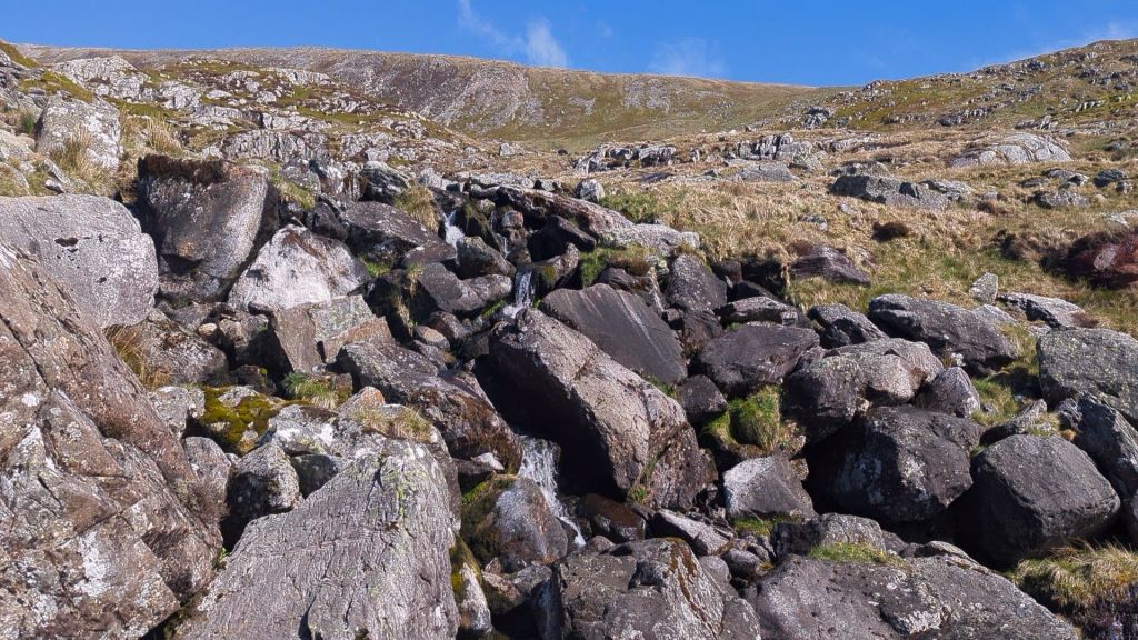
The walk up to Ffynon Lloer is stunning, the path criss crosses over the stream with some areas now with boulders to help cross over boggy areas. It’s a fun ascent with epic views of Ogwen Valley.
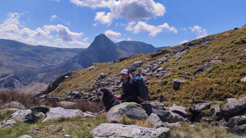
Once you have picked your way up the path next to the stream Afon Lloer you can either head to the small lake, Ffynnon Lloer up ahead or stick on the engineered path and head straight up to the ridge scramble I described in more detail above. (jump back to the scramble in more detail)
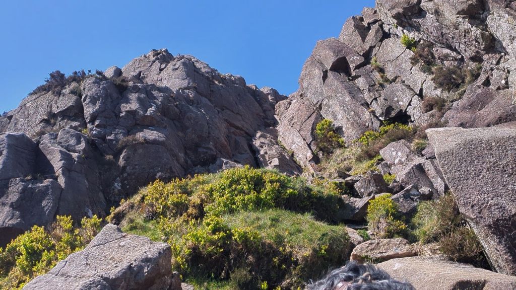
For experienced scramblers this route offers no paticular difficulties as it’s fairly easy to find the worn sections of path linking up rock steps.
After the scramble there’s a bit of a false summit and some amazing views of Ffynnon Lloer. If visibility is not good just make sure you are really aware of how close to the edge you are on these paths.

You’ll soon find yourself at the summit of Pen yr Ole Wen. The views are incredible but there’s not much protection from the wind, so I dropped down a little away from the path for a snack.

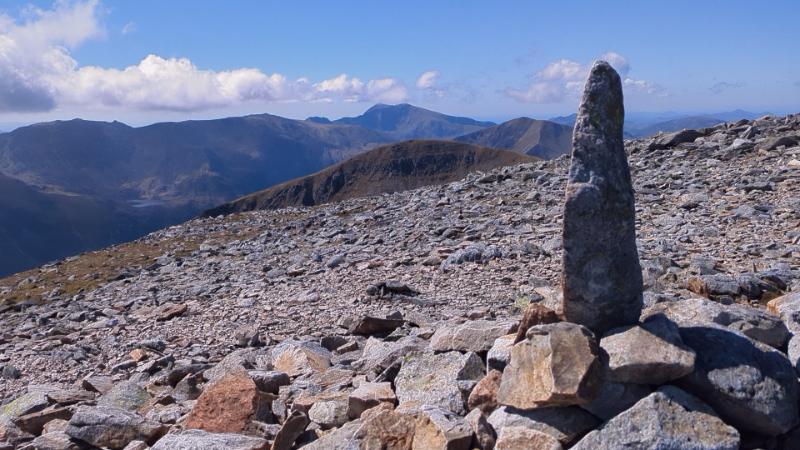
After the summit of Pen Yr Ole Wen, if you have good visibility it’s easy to see where you are headed next. Carnedd Dafydd is the second lump along the plateau like path you’ll walk between the two major Eryri summits.


The Route Down Carnedd Dafydd to the A5
It’s time to head back down to Afon Lloer now. There is no official path on the map but it’s actually not too difficult. Much of Eryri and the Carneddau is access land so it’s fine to go off the path as long as you follow the Countryside Code.
Start heading down by turning right after the summit of Carnedd Dafydd. You need to be aware of the steep cliffs around Cwm Lloer and avoid those of course. If visibility is low you need to know how to locate yourself and navigate.
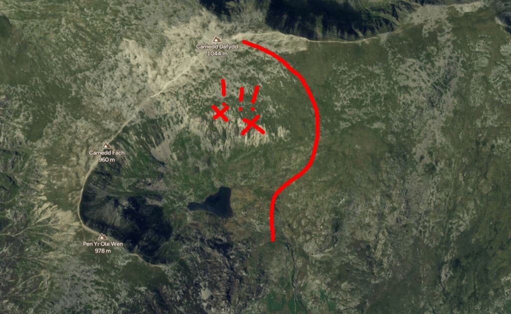
The going is grassy and as long as you steer away from any big drops down to your right it’s just a case of zig zagging down the mountain on rough grass. Take care in low visibility with this route as there is no path on the ground to follow so you could easily become disorientated.
NB – in wet weather descents down grass slopes are extremely slippy so extra care is needed.
I followed a stream down and only at the end as I neared the flatter section of the lake did it become a little boggy – in winter you might need gators.


Once you drop back to the stream it’s just a matter of crossing it. I’ve marked the spot I used on the OS map and it was straightforward with big, dry stepping stones. In winter the water can run much higher, so you may have to find somewhere different. Alternatively you can stay on the left‑hand side of Afon Lloer a little longer until you reach a safe place to cross further down. At the wall, there are ladder stiles on both sides of the stream.
After crossing you simply rejoin the path you came up on. Unless you’re in complete clag, the A5 is visible the whole way, so it’s an easy descent back to the road.
Enjoy the walk and let me know how you found it. As always check the weather before you go – I have some advice on which are the best apps to use and how to read them here – Best Apps For Checking Mountain Weather
Leave a Reply